Not all Loopers choose to travel the North Channel. For Captain Pat – it was a must. Now I can see why. For more about the North Channel, here is an excerpt from The Looper’s Guide:
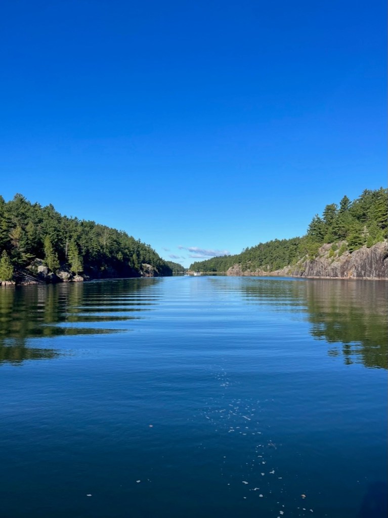
“The North Channel stretches about 130 miles from Little Current on the east to St. Joseph Island on the west. At best, the Channel is 20 miles wide and at some points very narrow. There are miles of exquisite cruising, with waters to the east being a little more sheltered and easier to navigate, and waters to the west being more remote with some tricky locations to navigate. East or west, the anchorages are beautiful and plentiful.
The area is popular – peak season is mid-June to mid-August. The best cruising and the best selection of anchorages can be found from August 15th through September 15th. (This is what we did!) The crowds are gone, the mosquitos are gone, the water is warm, and the weather conditions are almost predicable. The waters are so pristine, with better cruising. Where ever you go there are dozens of picturesque sheltered anchorages. The towns are also close enough at hand that provisioning is not a problem.”
We found all of the above to be true!
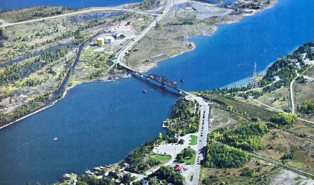
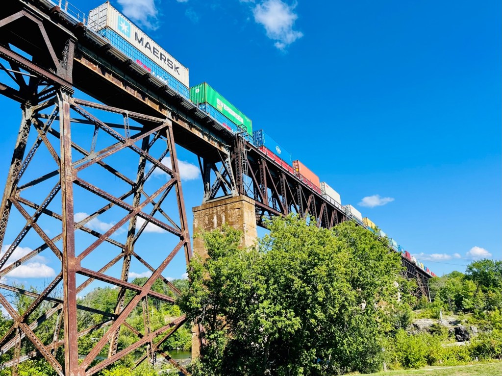
See top of map -the North Channel – You can take a cruise of the North Channel with the tour boats.
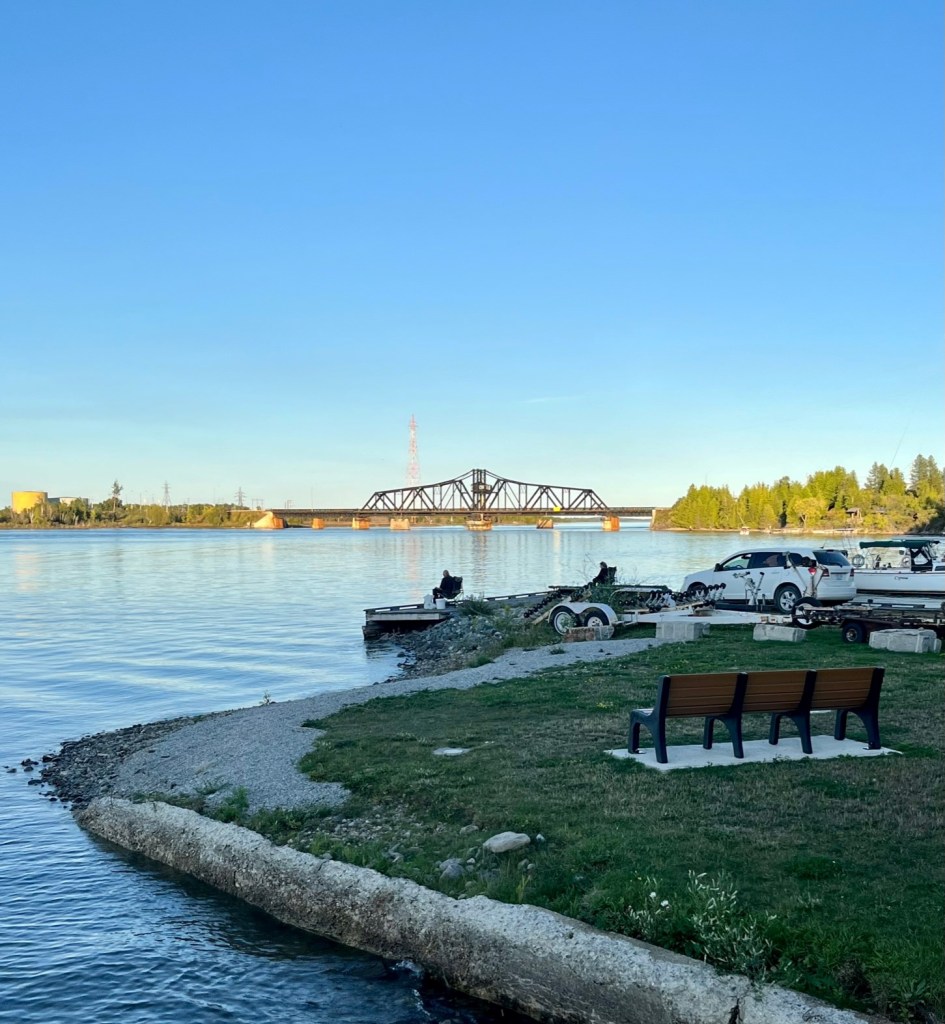
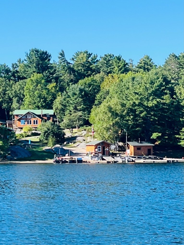
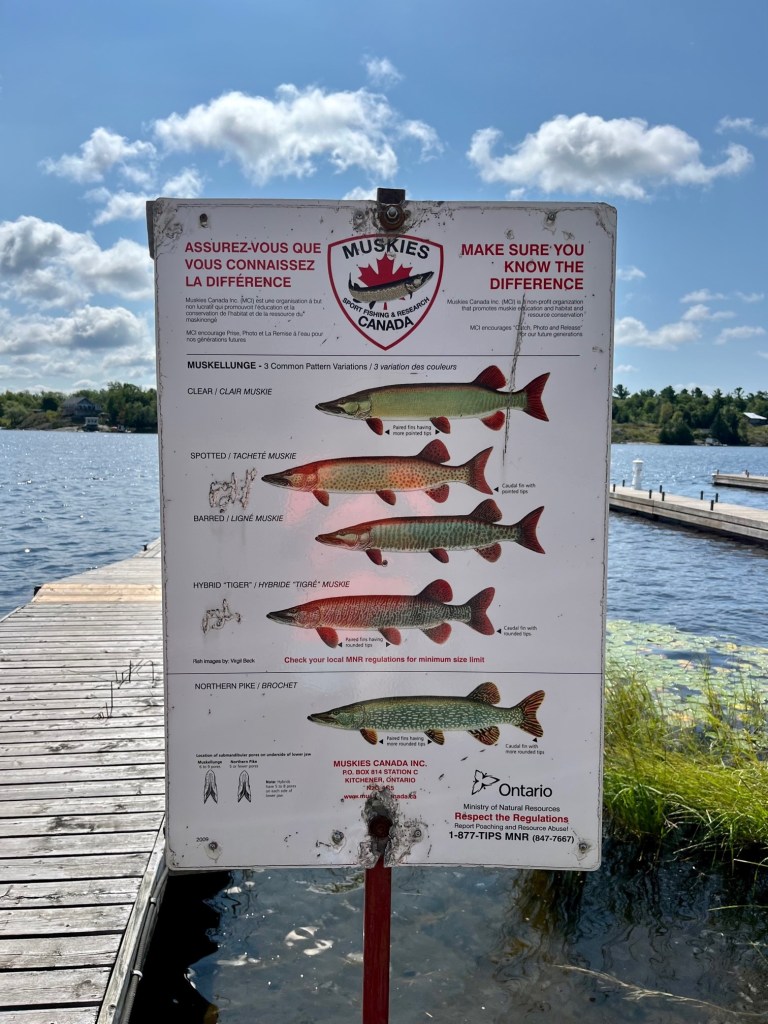
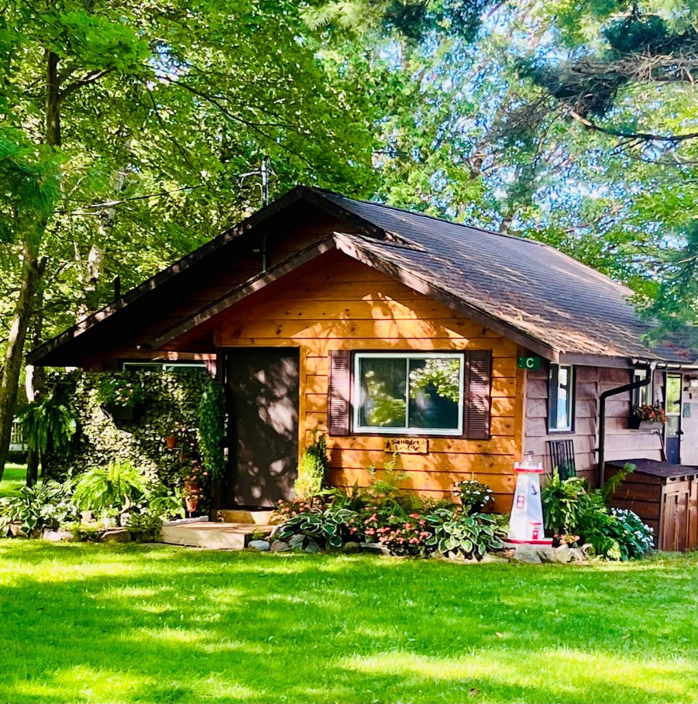
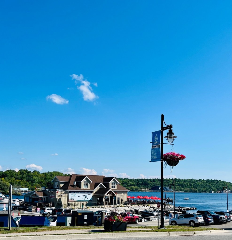
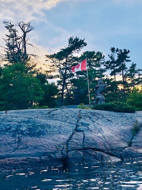
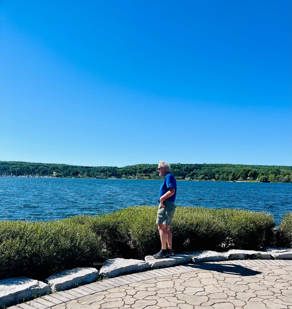
The Town of Little Current
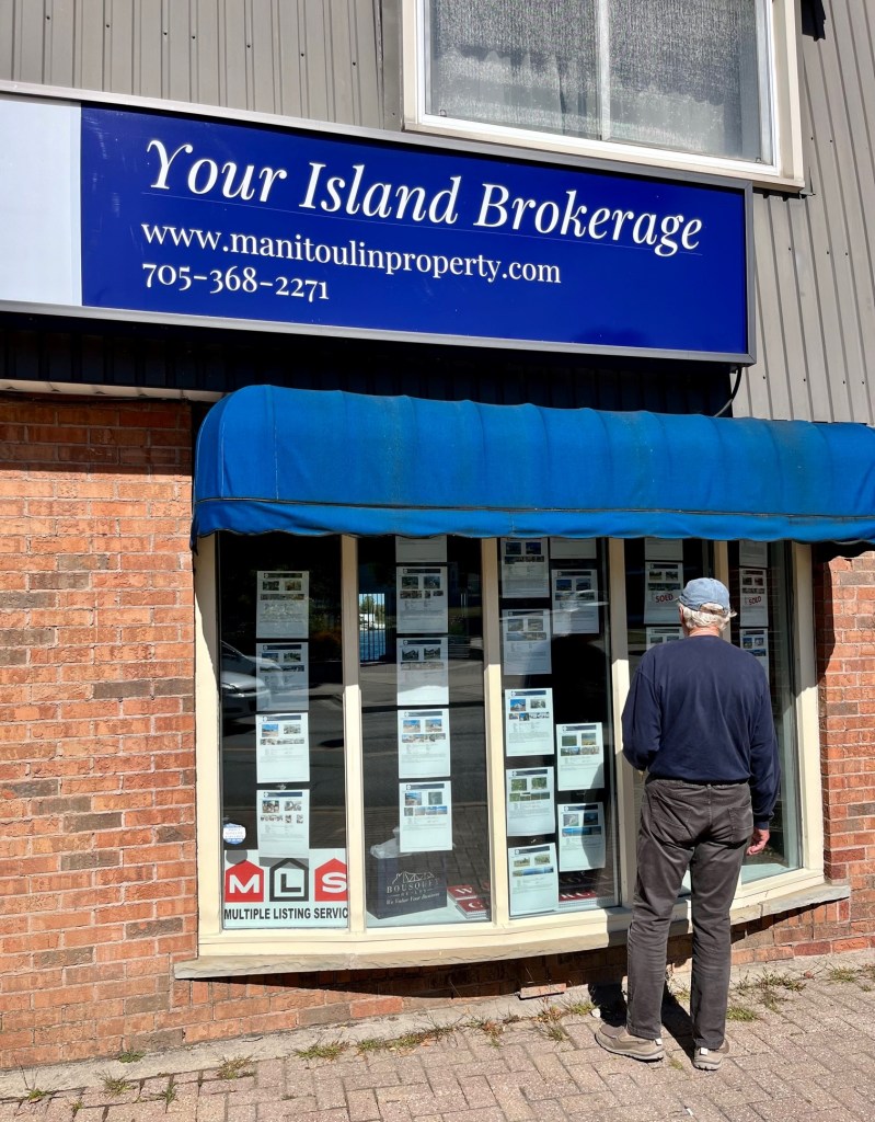
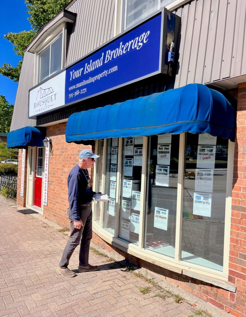
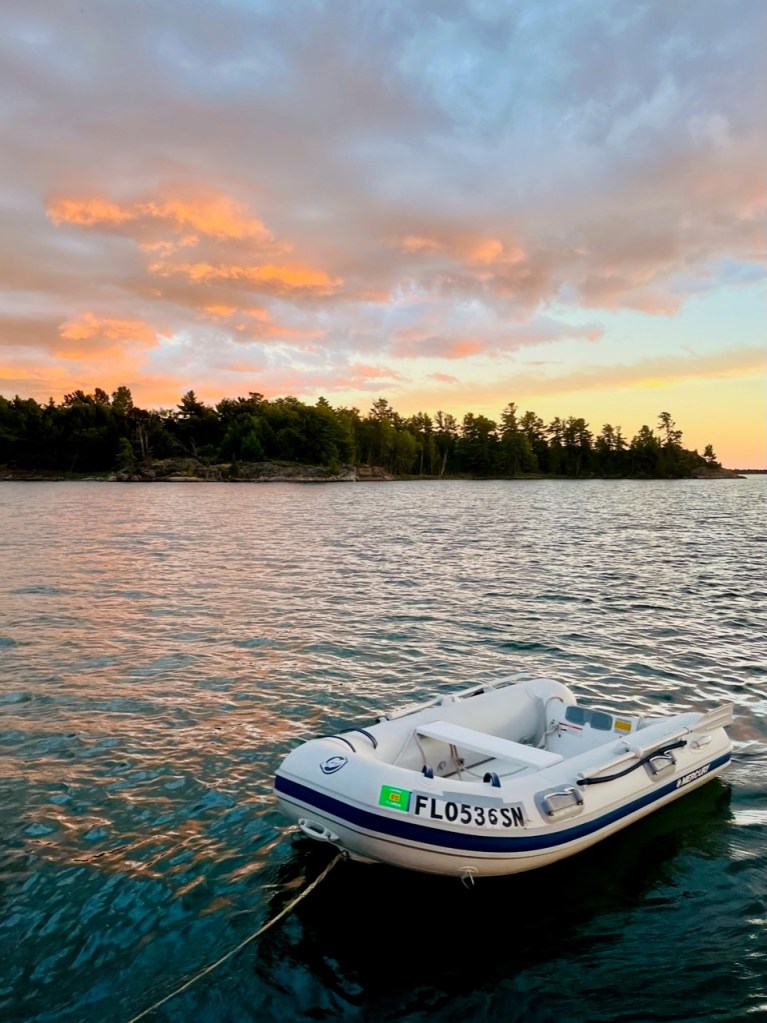
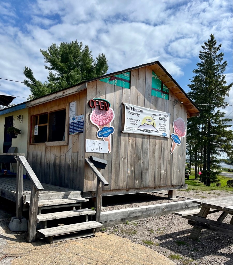
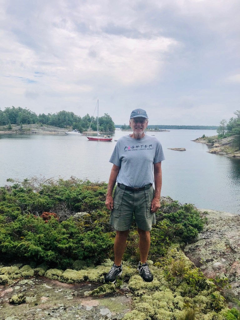
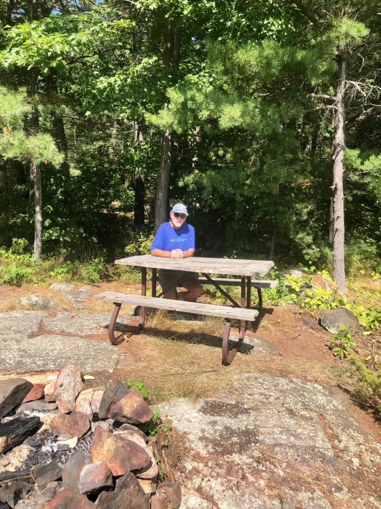
We had the best ice cream in Little Current at Three Cows and a Cone!Captain Pat checking out the real estate in Little Current.
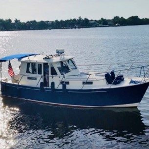
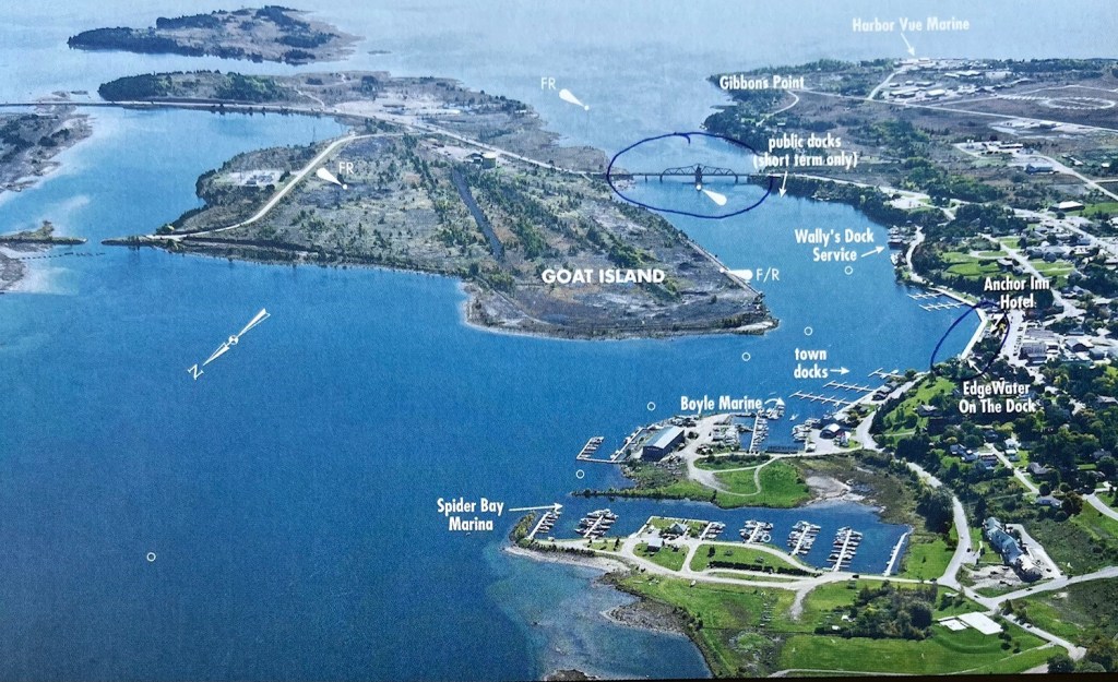
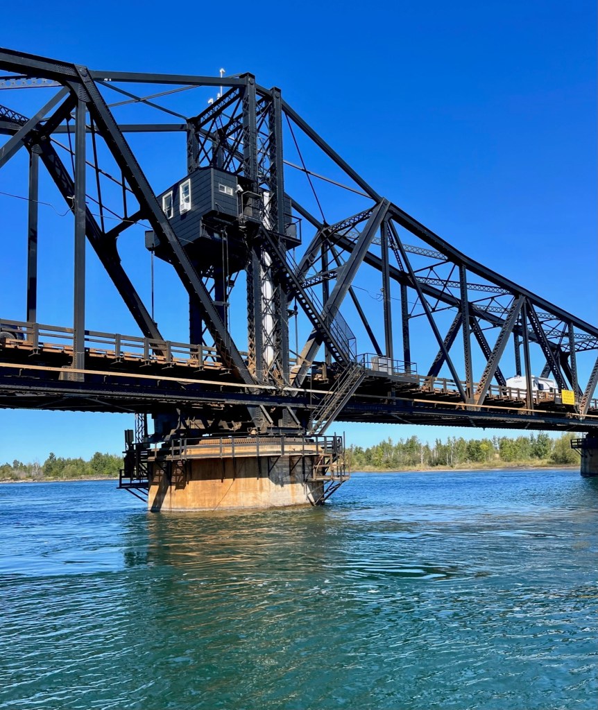
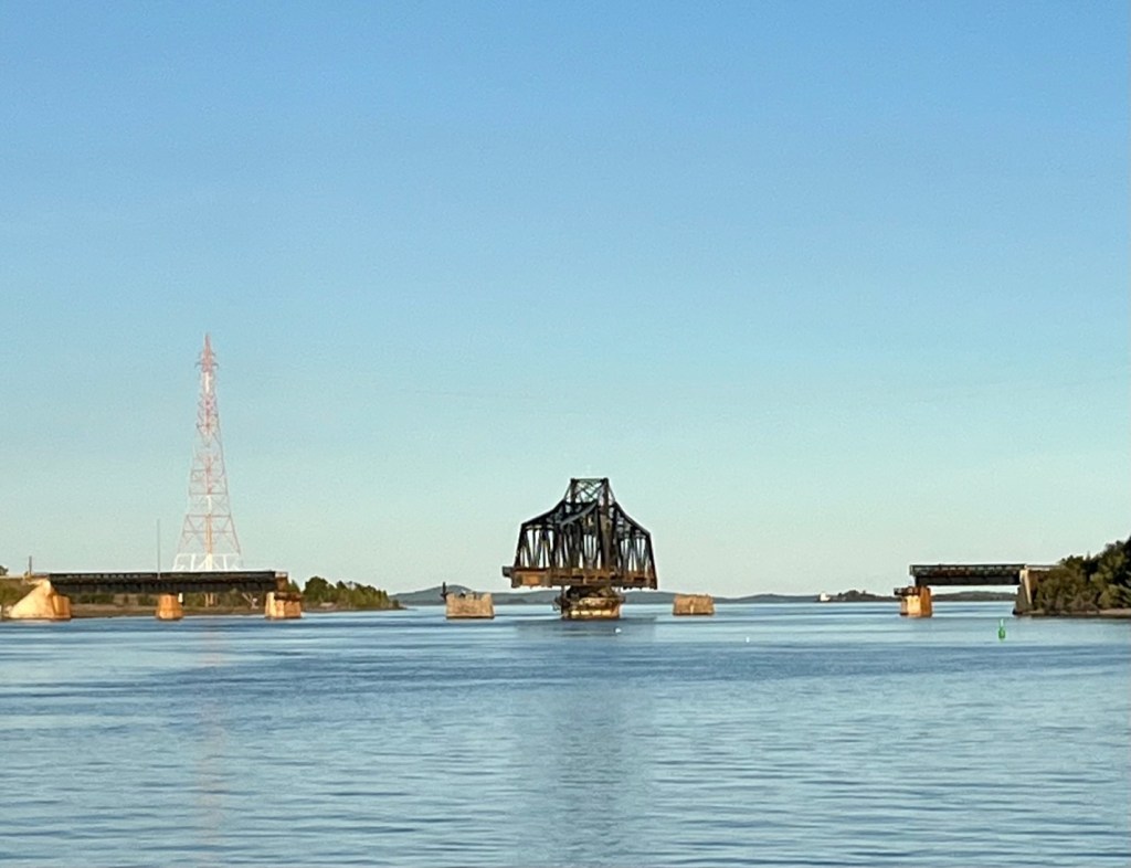
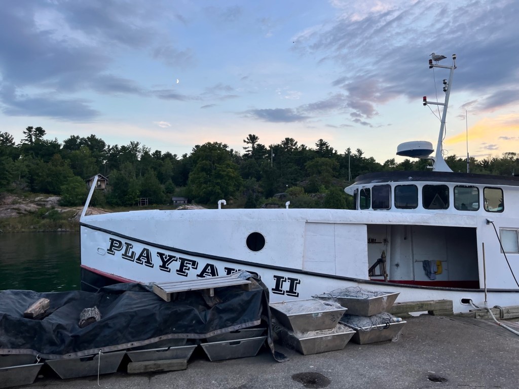
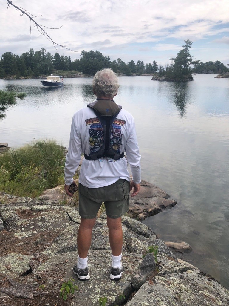
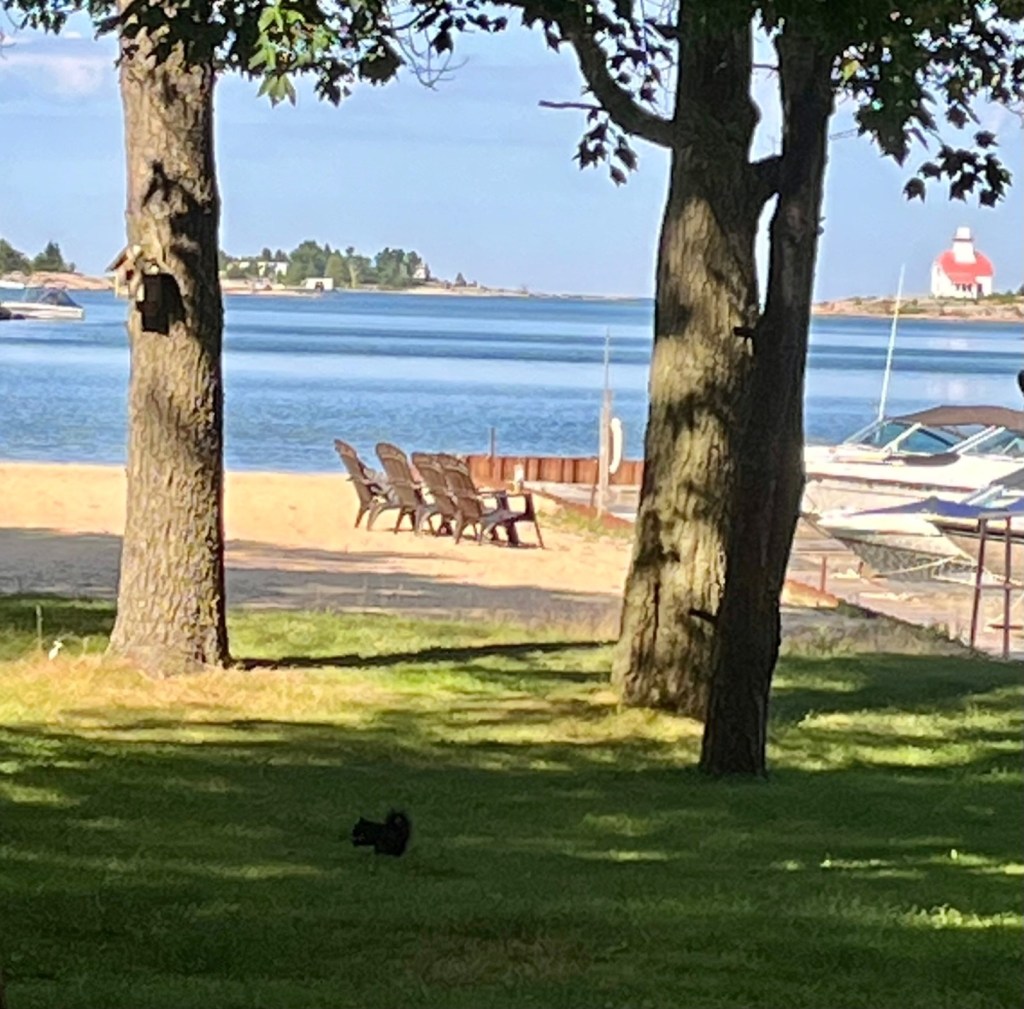
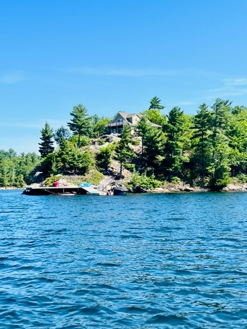
Labor Day we departed Killarney and headed to the town of Little Current. Little Current – Baiewejewung, “where the waters begin to flow” – is the gateway to Manitoulin Island which is said to be the largest fresh water island in the world and a popular Canadian resort area. Little Current is located between Goat Island and the northeast tip of Manitoulin island. It is here that the waters of the North Channel are funnelled into a passage only 100 yards wide, creating stiff currents as they empty into Georgian Bay.
Little Current is on the right. You see Goat Island on the left. There is a swing bridge between the two. We stayed on the town docks, circled, by the Anchor Inn Hotel.
The largest community on Manitoulin Island (population 1,700), Little Current offers a good choice of shops and services for provisioning. We stocked up on groceries and had a wonderful late lunch at a local diner – Elliott’s.
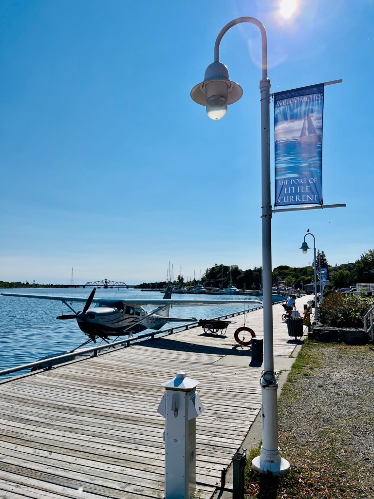
We ended up staying the night rather than leave late afternoon for Baie Fine. We shared dock space on the town dock with fellow Loopers and pleasure boaters and the weekly cruise ship – even a sea plane!
Sunshine docked in Little Current – see sea plane behind.
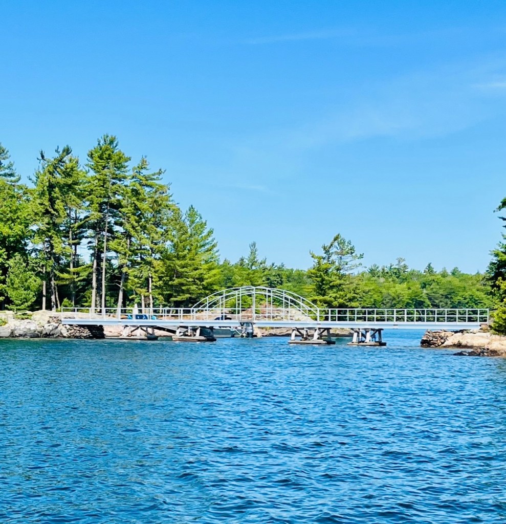
A single-lane swing bridge crosses the channel at Shutin Point, east of the town. This bridge provides the only land access to all of Manitoulin Island. (The Chi-Cheemaun ferry from Tobermory to South Baymouth provides the only other access to the island for vehicles.) The bridge opens every hour on the hour for approximately 15 minutes – dawn to dusk – for pleasure craft during the summer (mid-June to mid-September). Boaters should note that the 15 minutes refers to the time road traffic is stopped, not the length of time available for boat traffic to pass through.
Another blessing to having a 34 foot boat – we do not have to wait for the bridge opening. Sunshine sails right through.
Passing under the swing bridgeAerial view of swing bridge
We were told to exercise caution when passing through the channel due to the current, which is strongest at the bridge. With a strong wind from the east or west, the current can run at more than four knots, depending on the wind speed and direction! (A 30-knot west wind, for example, could give you a four-knot current setting east.) In addition, the current can reverse several times in a day. You have to watch the buoys to get a sense of the direction and strength of the current.
Little Current is also home to Roy Eaton and his “Cruisers’ Net” which broadcasts each morning on VHF 71 from the Anchor Inn during July and August. Roy’s Cruisers’ Net provides marine weather forecasts, local and international news, sports and community. Loopers can call in their positions and local conditions and relay messages to others. Operating out of the second floor of the Anchor Inn, Loopers are encouraged to visit. It was unfortunately closed for Labor Day. (We were surprised to learn Canadians also celebrate Labor Day.)
Here are more photos from our stay at Little Current:
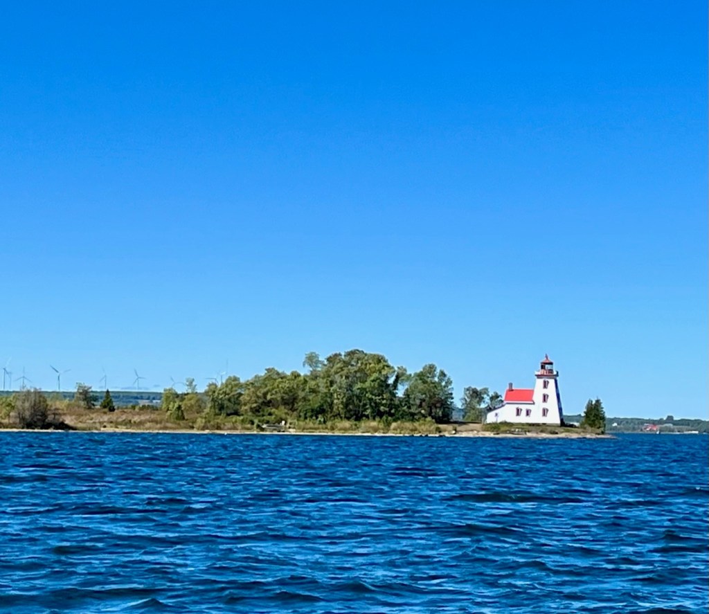
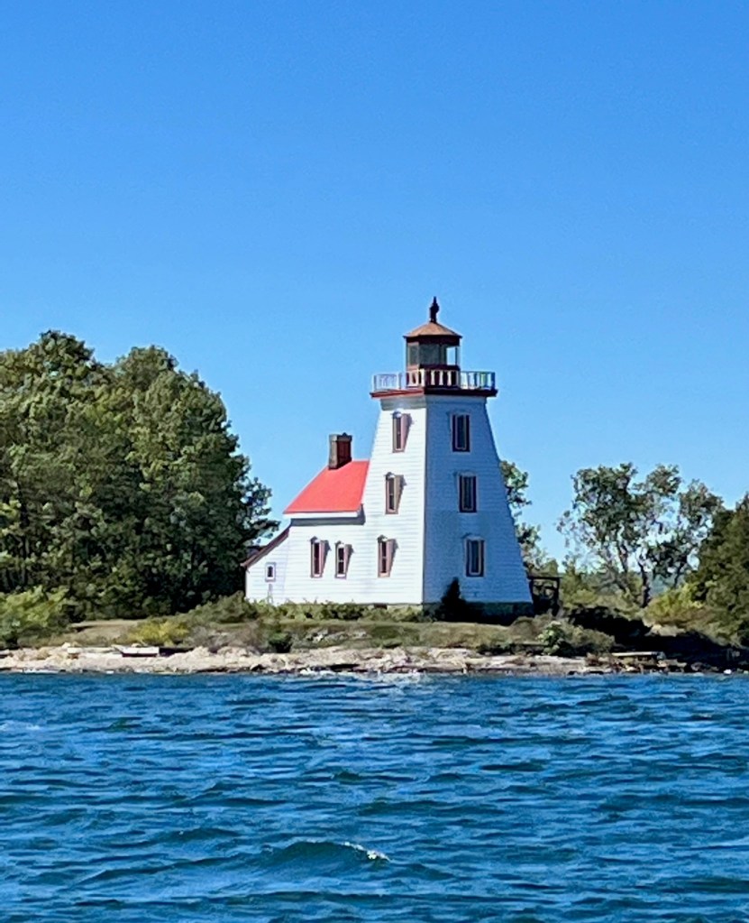
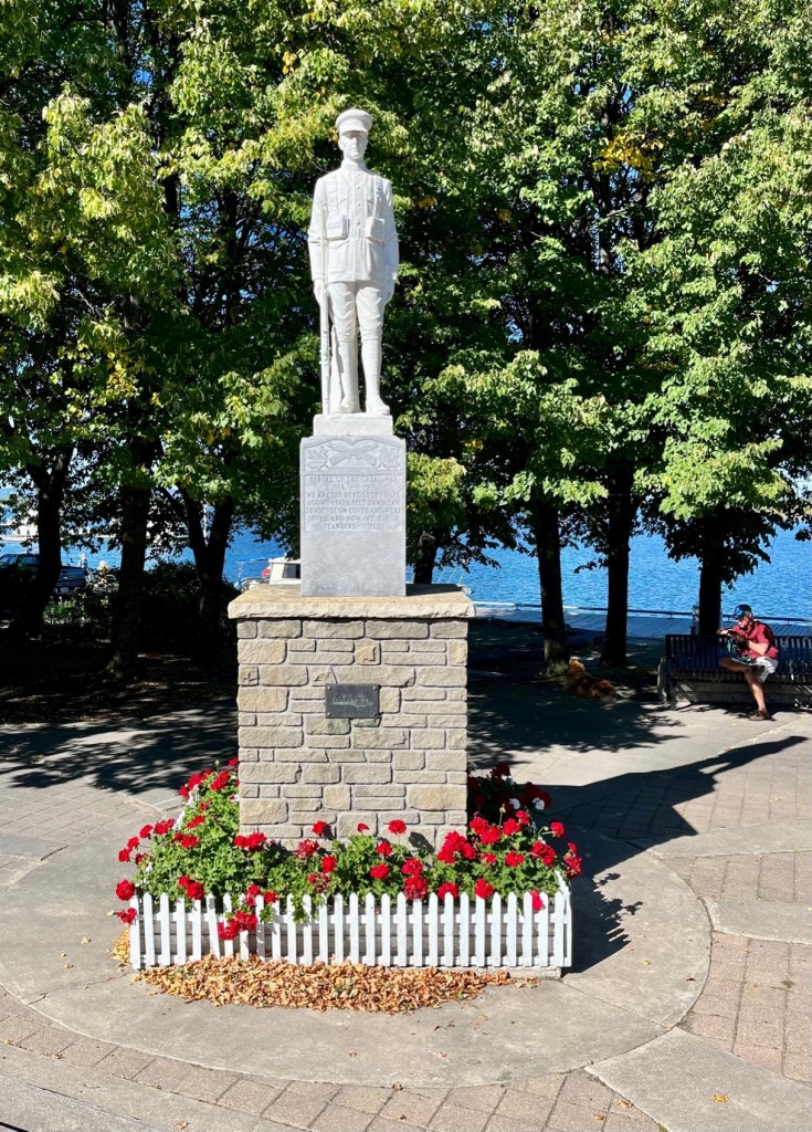
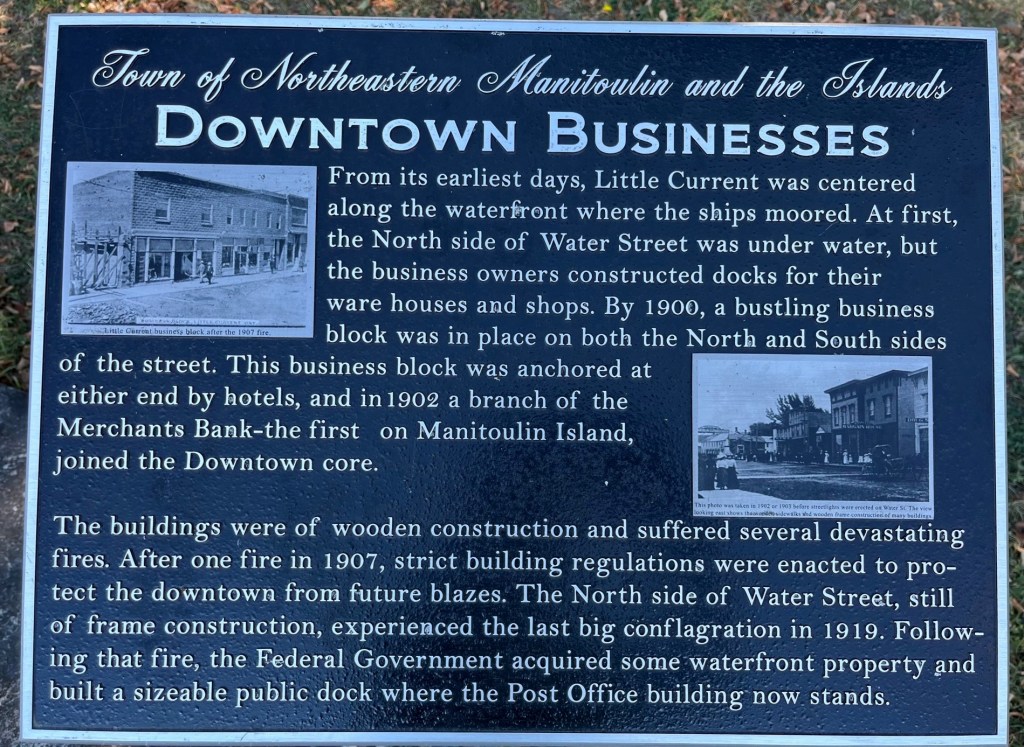
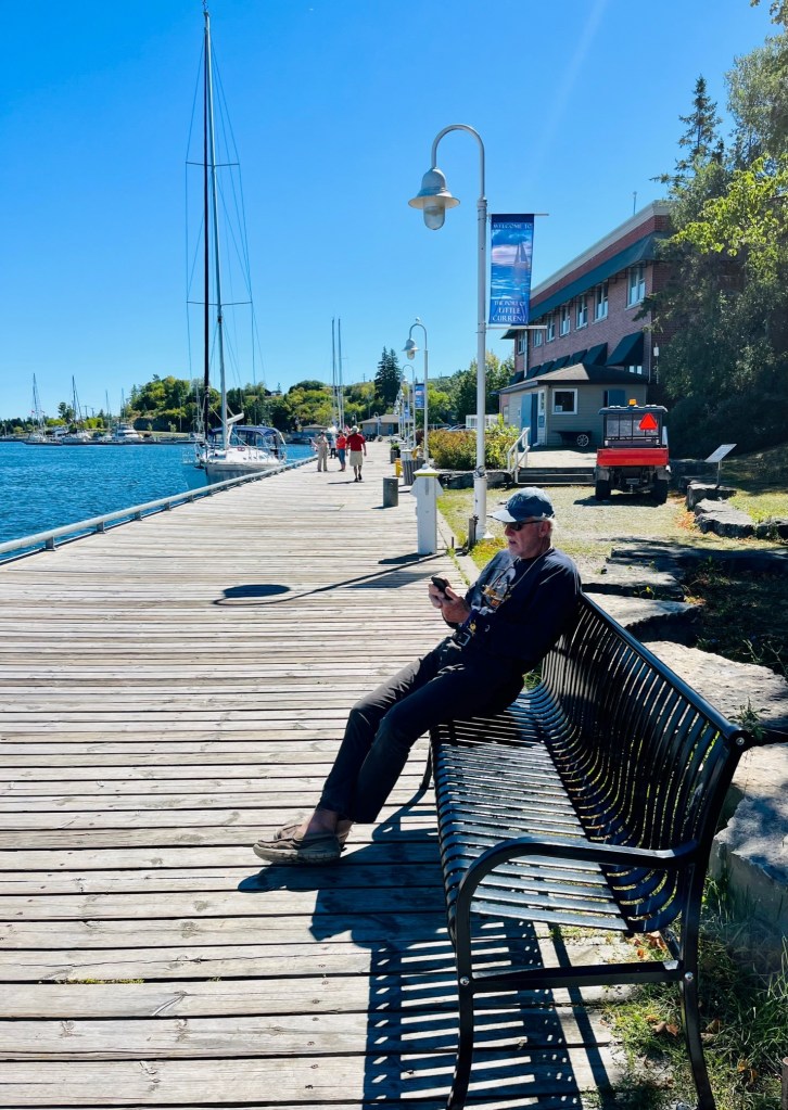
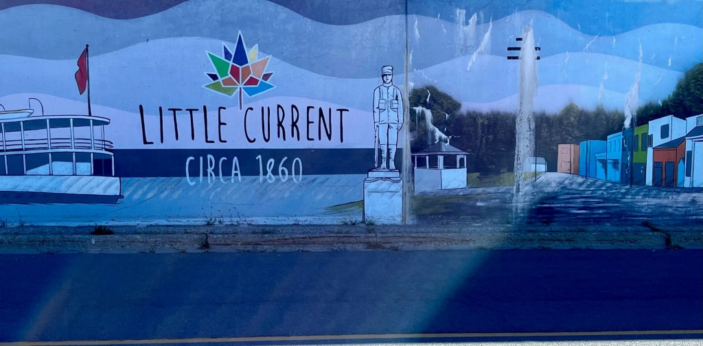
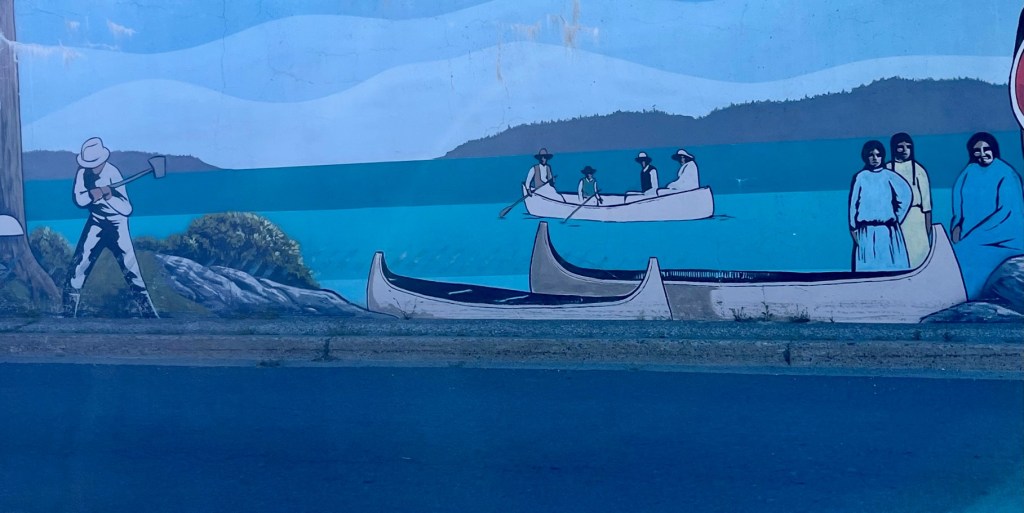
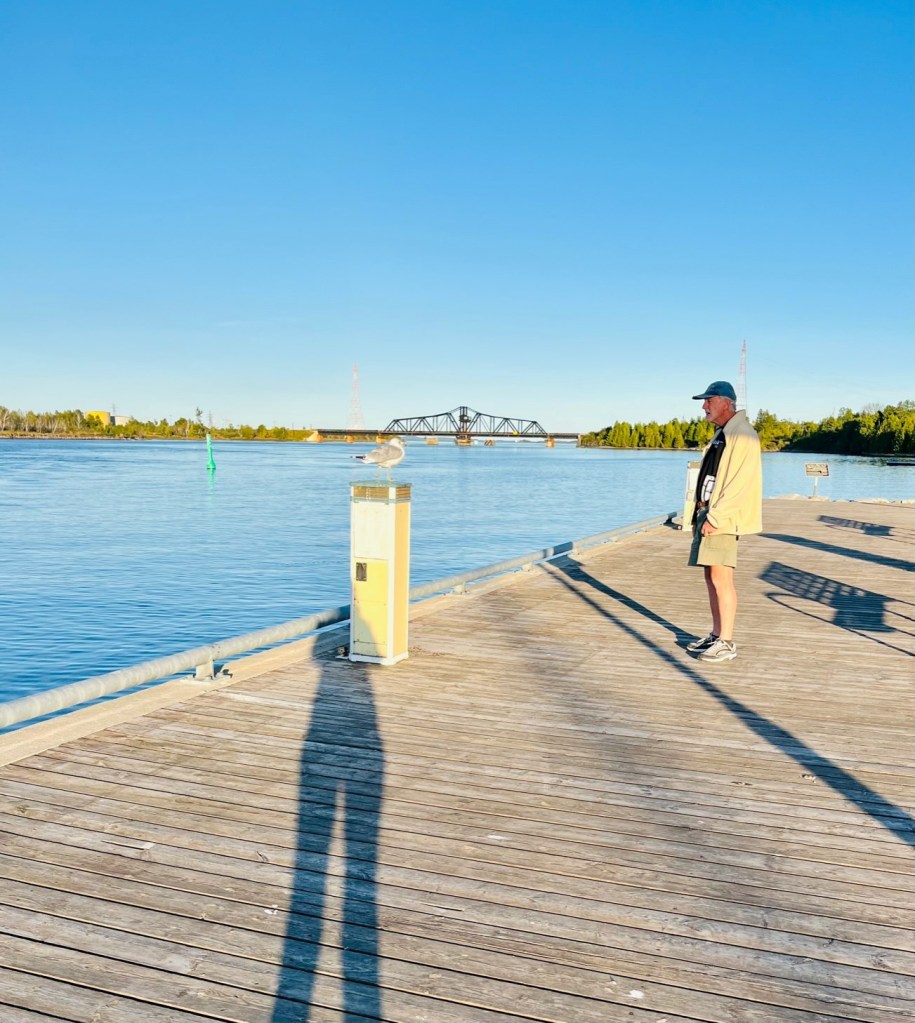
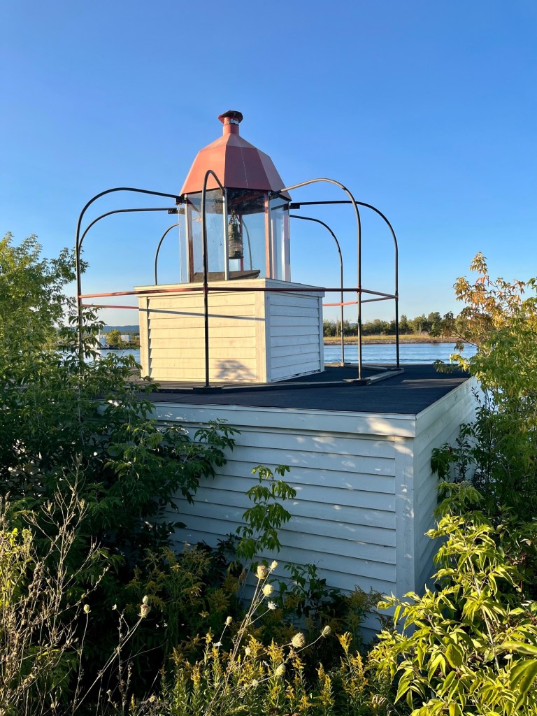
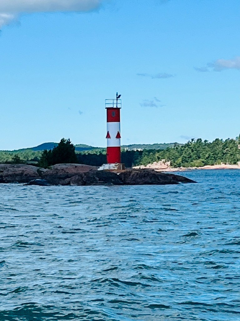
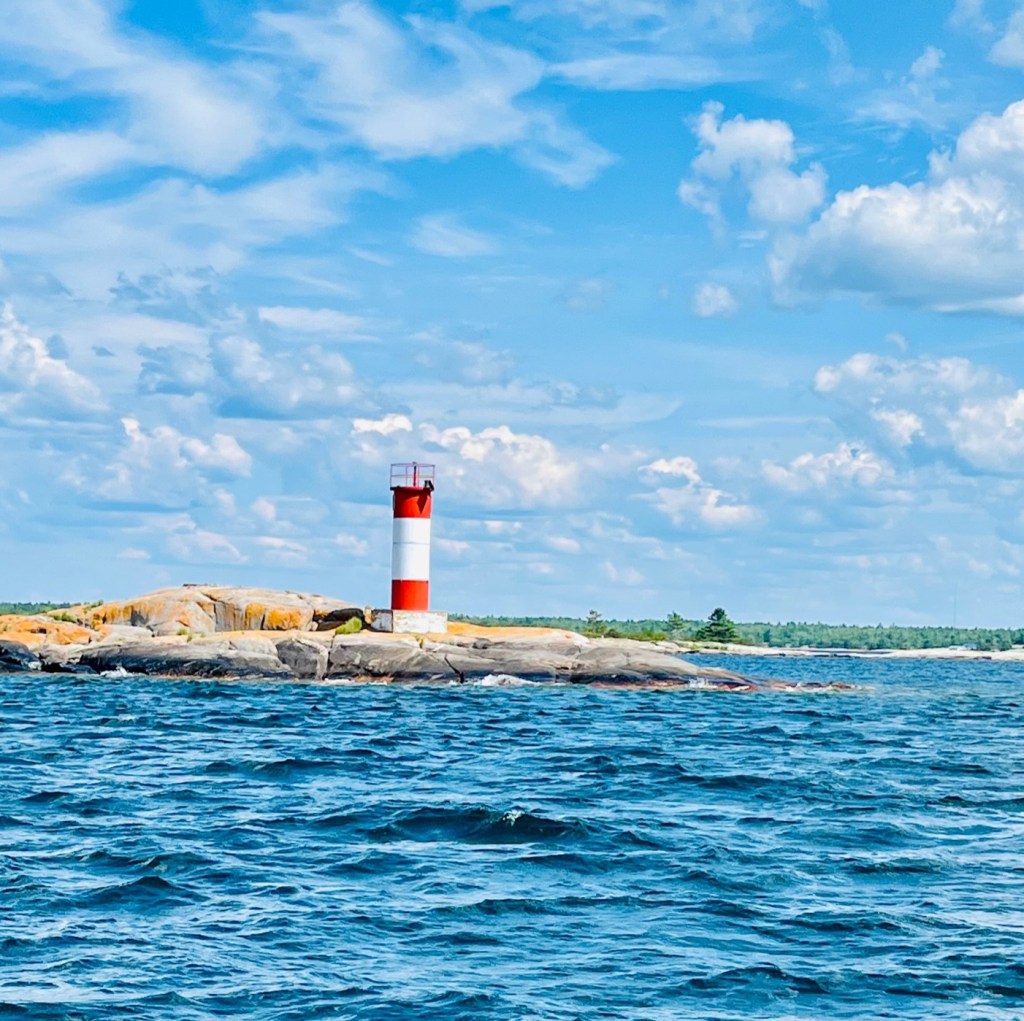
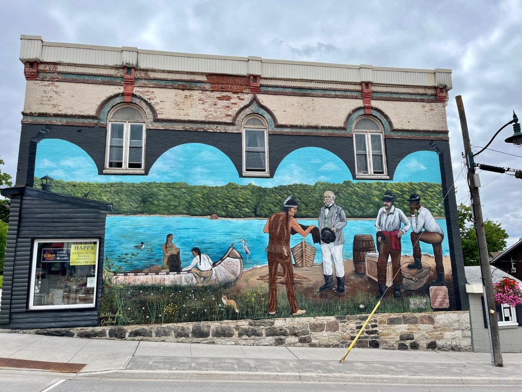
Approaching the lighthouse as we get close to Little Current.So many towns have memorials to honor the veterans who serve. I am surprised that many mention the Korean War, as this one does.History of downtown Little Current.Captain Pat waiting for his Admiral -:)Downtown sign pays tribute to Manitoulin and Islands.The towns usually have a mural depicting the history and culture of the town.Second portion of mural.Third portion. Love the canoes. I want to get one!Tribute to the Indian tribes.Wherever we go, Pat loves to check out the real estate.There was a wonderful walking trail that took us to the ice cream shop. The swing bridge is in the background. A little seagull with an injured leg is on the lamp post.This replica of a bird-cage lighthouse is on the trail.We walked past this couple fishing. I thought of my brother Paul and his wife, Gail!Tribute to Goat Island and transfer of coal to the island.Captain Pat enjoying his ice cream! Pralines and Cream!On our return we captured this beautiful sunset with our little hurt seagull.Swing bridge at night.
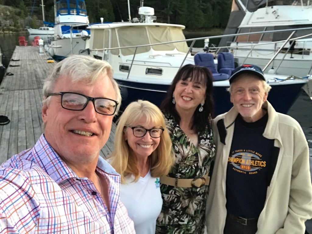
The Admiral finds a new friend!The Captain leads the way on our walk through Killarney, Ontario.New friends we met at St. Bonaventure Church – Ed and Geraldine!
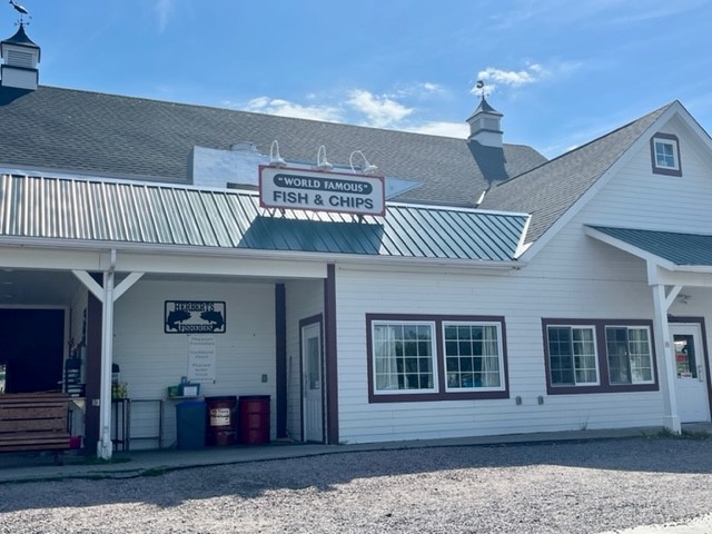
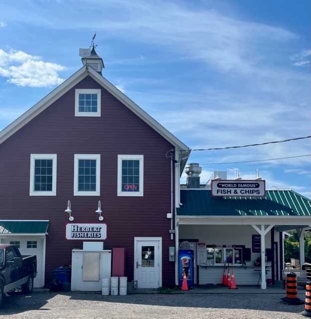
Our first night in Killarney found us at its most popular restaurant – Herbert’s Fisheries. Initially run out of an old school bus serving only takeout of fresh fish caught steps away, it is now housed in a stand-alone building where you can dine inside or out.
The fish and chips are “world famous” for a good reason – they are caught fresh from the harbour just outside the restaurant. This isn’t the Captain Dee fish and chips my mother loved!
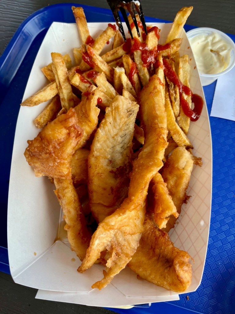
Fish and Chips from Herbert’s – Yum!
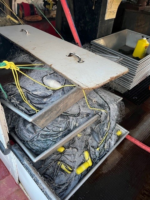
We visited the fishing boats located just outside the restaurant.
These are old working boats, ready to hit the seas.How would you like to be inside these boats with nets filled with fish?
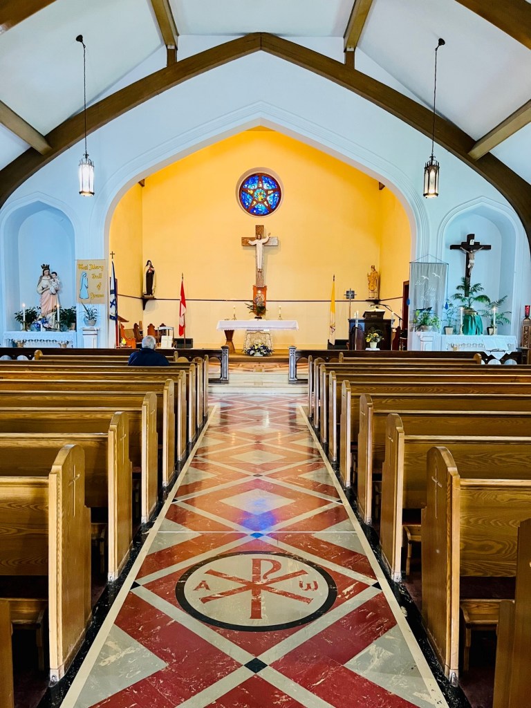
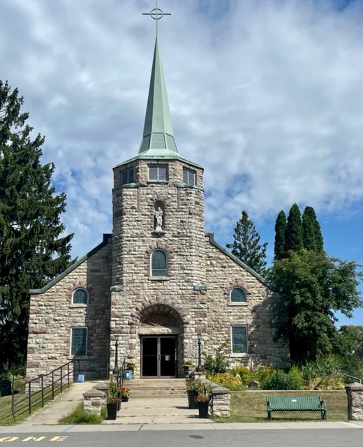
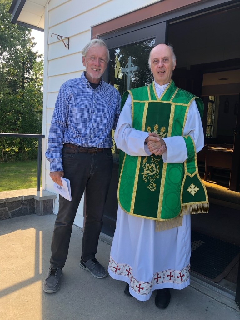
Sunday we went to the one weekend Mass offered at the Church of St. Bonaventure. It was held at 1:30 p.m. There were card tables set up in the back of the church, and coffee and pastries were ready to be served following the Mass. The priest – Father Jim Hutton – jokingly commented that this was the only way to get people to come to Mass – to serve food!
At the beginning of Mass, he asked for visitors to stand and tell where they were from. (He had already met us and some other visitors.) He said whoever visited from the farthest away, will be first in line for the refreshments!
After everyone introduced themselves, he mistakenly awarded Pat and me the honor of first refreshments. He was later reminded the woman from Edmonton, Alberta, Canada, had actually travelled the farthest!
His homily was well received. He spoke from the heart, had a sense of humor and asked questions. He noted “Catholics never like to answer questions. They are afraid they will be mistaken and give the wrong answer.” -:) Probably some truth to that. He asked “what was the word that Jesus talked about in the Gospel, that can keep us from being His disciples?” No one knew, so he read it again. The word was “hate.” I still remember his message.
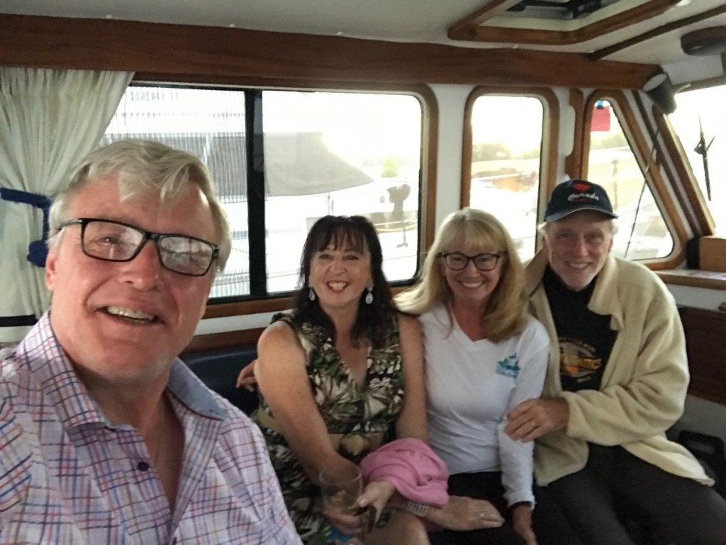
The couple behind us – Ed and Geraldine – introduced themselves and we discovered they were also visiting the Lodge for the weekend, celebrating their 25th Wedding Anniversary! Geraldine is from Ireland, Ed from Canada, and they reside in Sudbury, Ontario, with their two daughters.
Ed and Geraldine paid a visit to us in Sunshine, bringing us a bottle of wine! We will keep in touch. More wonderful people enter our lives!
Ed and Geraldine visited us on Sunshine.Captain Pat in front of Church of St. Bonaventure
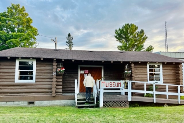
After MassWe visited the Killarney Museum. It was housed in an old log home.
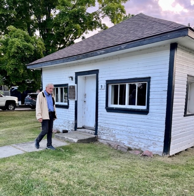
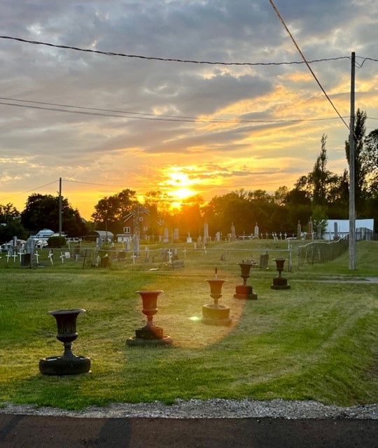
House beside the MuseumCemetery beside the Museum
We rarely visit the museums in the little towns we have visited. This one had many treasures. Here are some pics:
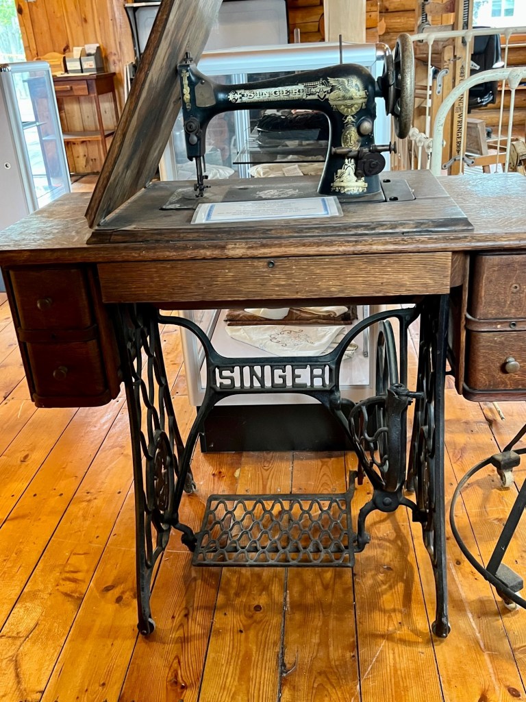
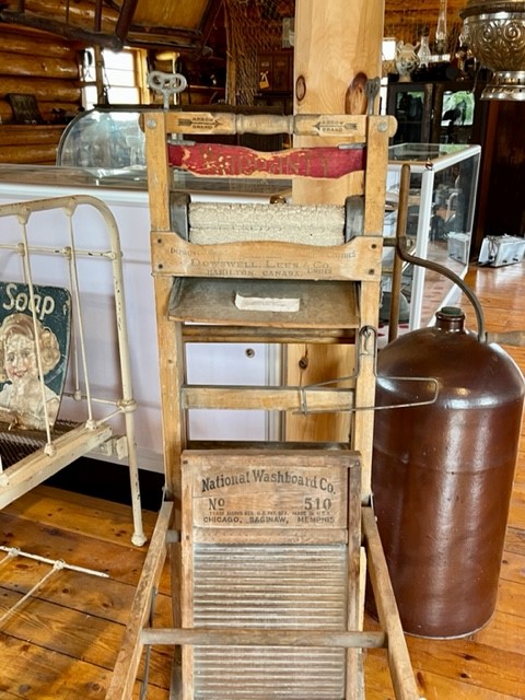
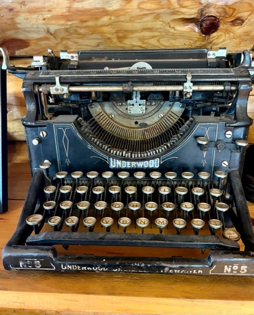
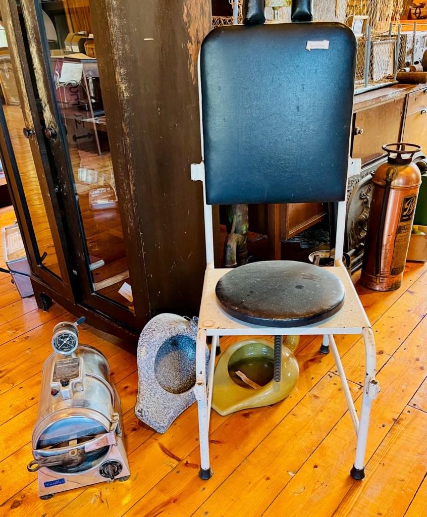
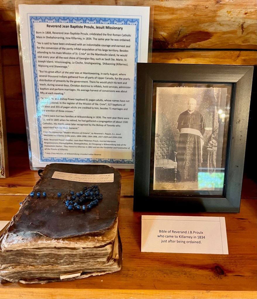
Pat’s mother had an old sewing machine table. It is in our cabin at the lake.An old washing board.Vintage typewriter – for me, as I used to teach typewriting to high school students!For the dentists in the family – check out this old dental chair, and the machine on the floor, for sterilizing instruments. Tribute to Reverend Poule – Jesuit Missionary. The Jesuits did so much to further the faith of the people of Ontario.This log structure is so beautiful.
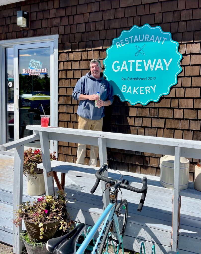
There is a wonderful coffee/breakfast nook in Killarney – Gateway. The home made bread and pastries are to die for. We met the owner, Dave. He is a mason and has completed some exquisite masonry work in the town of Killarney, as well as now owning this coffee shop. Really nice guy!
I was told to have the London Fog! my first. It is hot tea with frothed milk and vanilla. Yum!
Here are more photos from our stay in Killarney. Hope to return one day!
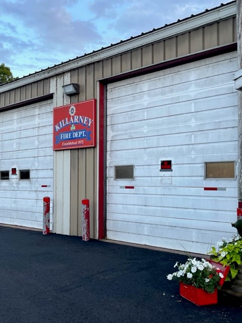
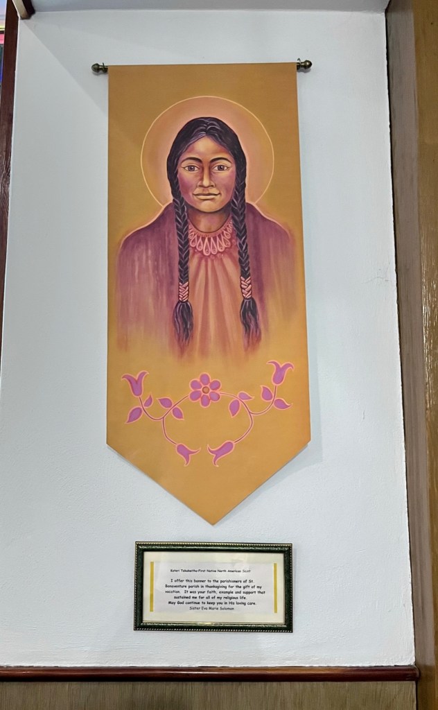
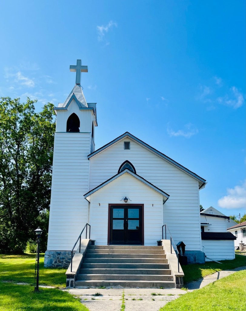
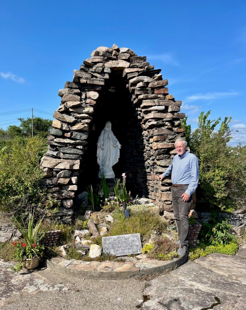
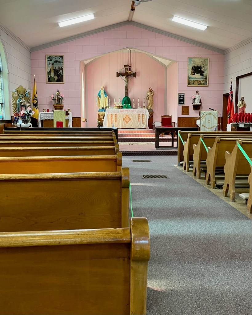
Catholic Church of St. BonavenutreKillarney Fire DepartmentHistory of the Town of KillarneyThese posters are posted along all marinas. Be safe!Tribute to St. Kateri – first North American SaintLoved this stained glass with the nautical theme! See the stars and the anchor.This stained glass is of Jesus calming the seas with St. Peter.Lots of sea planes in the North Channel. This one was right by our boat.Beautiful views from the LodgeGood night from Killarney Mountain Lodge!
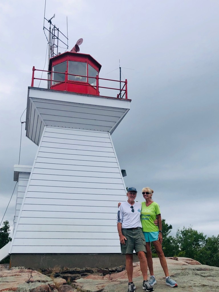
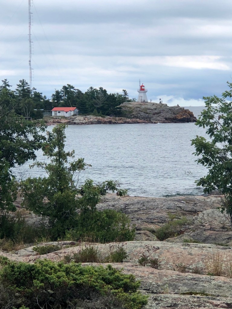
From the Lodge, we hiked to the Killarney Lighthouse.
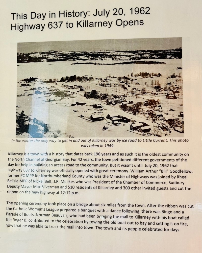
Killarney (population 397) was founded in 1820 by French fur traders and lies on the north shore of Georgian Bay, north of the east end of Manitoulin Island, in the lee of George Island. Killarney has been a center for fishing, canoeing, camping, and hiking for more than 100 years and is now a base for exploring the nearby 120,000-acre Killarney Provincial Park, established in 1964.
It was once a busy commercial fishing village and not until 1962 was the village even accessible by road.
Article on display at Killarney Museum, describing the opening of the highway to Killarney in 1962.
Killarney now relies mostly on tourism, and for many boaters it is the gateway to the North Channel. The harbour, formed by Killarney Channel, provides excellent shelter in all winds, and is a pretty and very popular boating destination. It is a logical stop for provisioning before heading into the North Channel or going to Georgian Bay, where the next providing port is Britt. Britt was our last provisioning stop.
Map showing North Channel at the top, and Killarney – above Little Current. Other ports we’ve visited are circled.
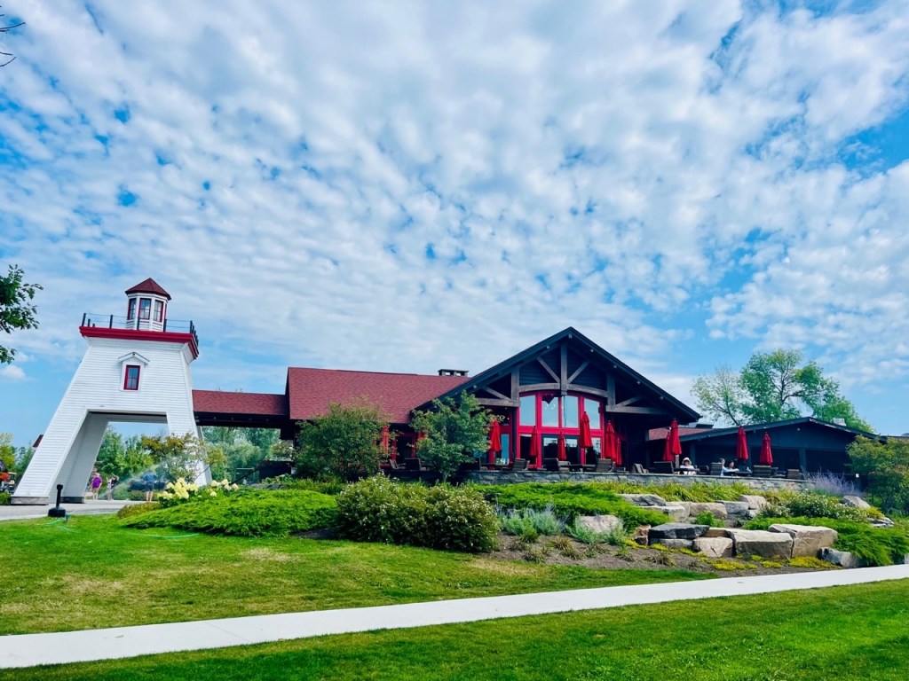
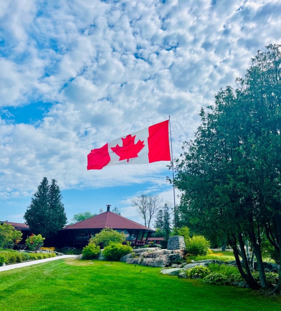
Throughout the summer, members of many organizations, yacht clubs, and marinas make Killarney a rendezvous destination; as a result, docking space often is scarce. Once again, we were fortunate. We couldn’t decide which marina to stop in – the Killarney Sportsman Resort or the Killarney Mountain Lodge. We secured the last spot at the Mountain Lodge, and we were so happy with our stay there. We later discovered both have the same owners.
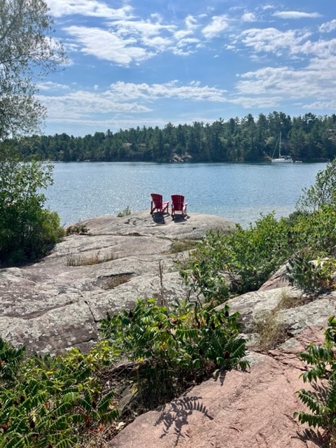
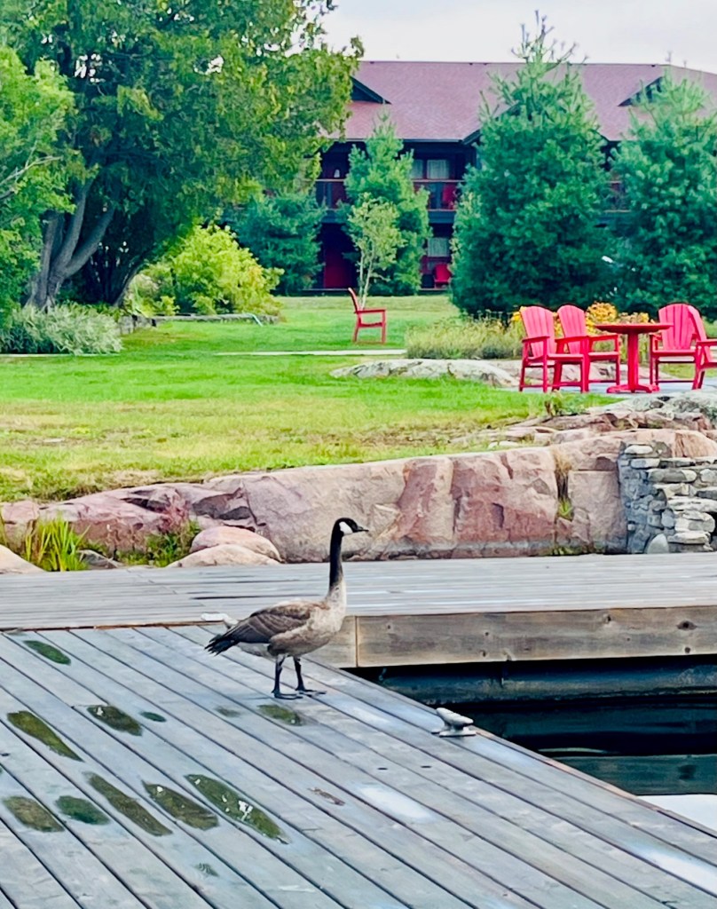
At the end of each dock were two red Adirondack chairs begging for you to take a seat and chill.
Red chairs at end of each dock. The boat belongs to Looper friends Diana and Jerry Merrell from Winter Park, Florida.“Inspiration” – Kadey Krogen 44 – Diana and Jerry MerrellRed chairs on rocks, too.
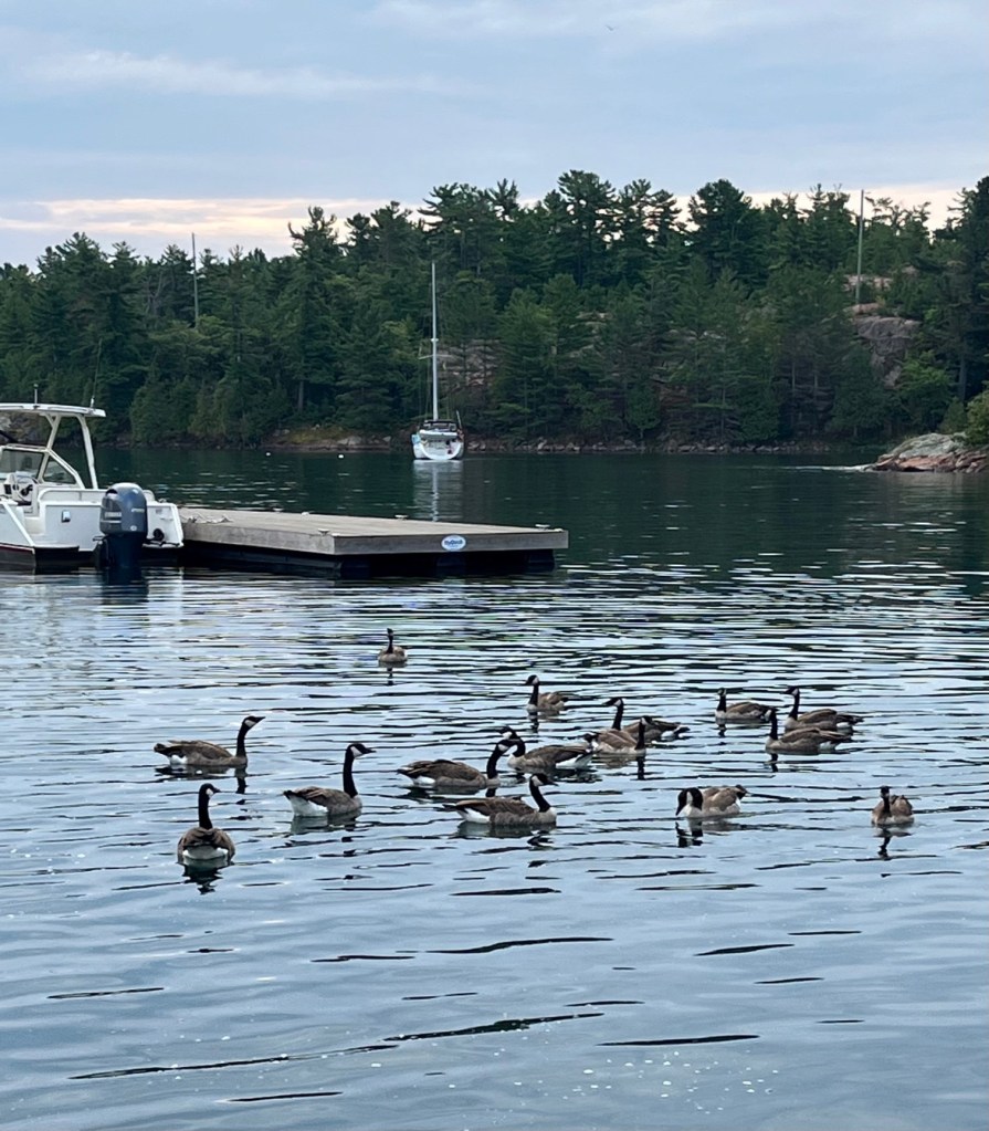
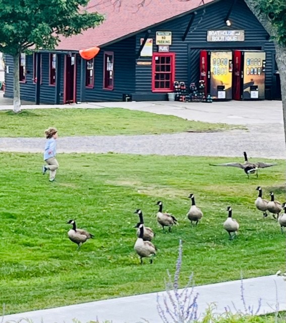
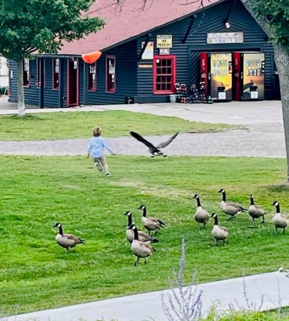
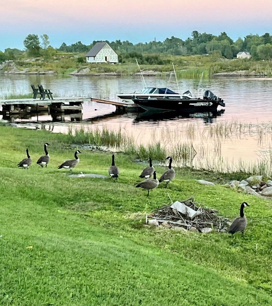
There were lots of Canadian geese. One evening we had dinner at the Lodge, outside, and watched this cutest little boy chasing the geese! He was relentless.
Geese just outside of our boat.The cutest little boy chasing the geese.Lone goose on the dock. A dog chased the others into the water.
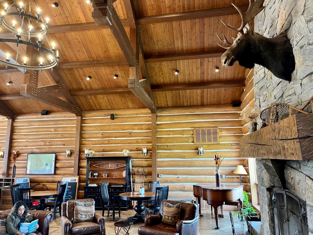
The lodge had the typical log cabin, rustic look.
Lodge lobby – great place to catch up on email and just relax.
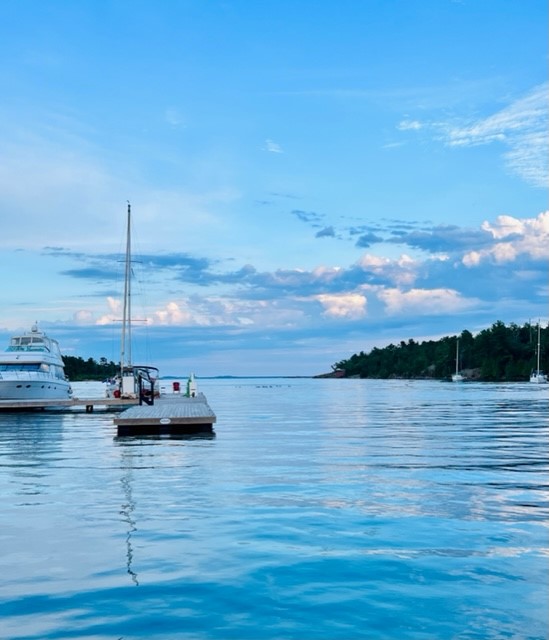
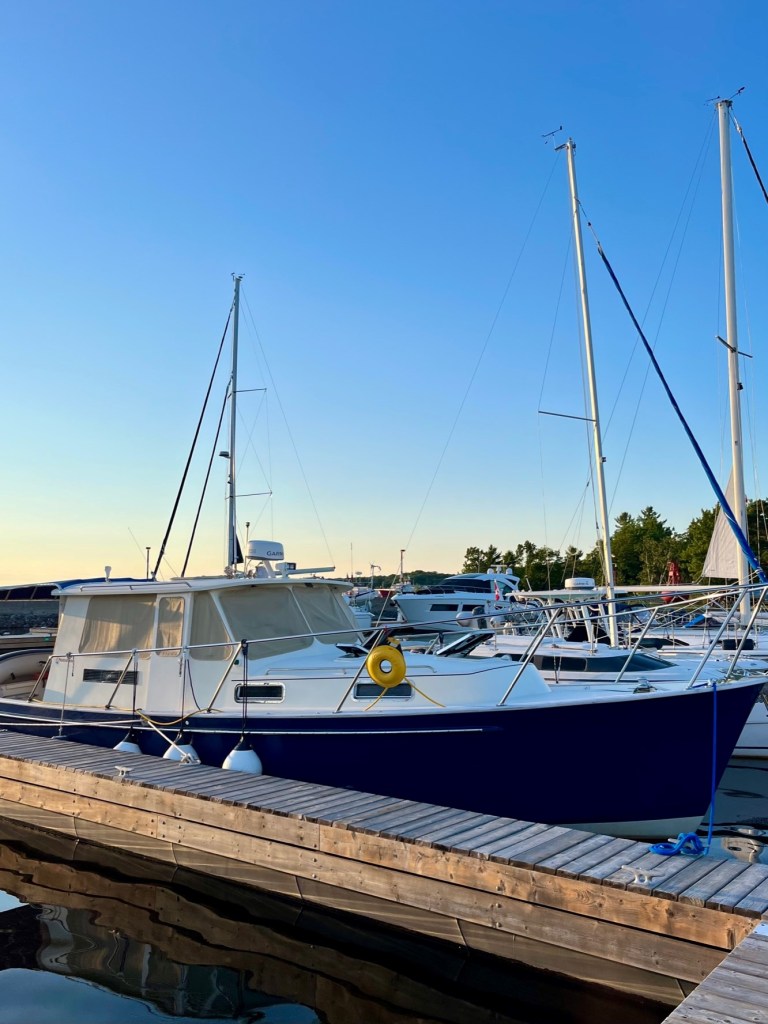
The views from the waterfront marinas are spectacular.
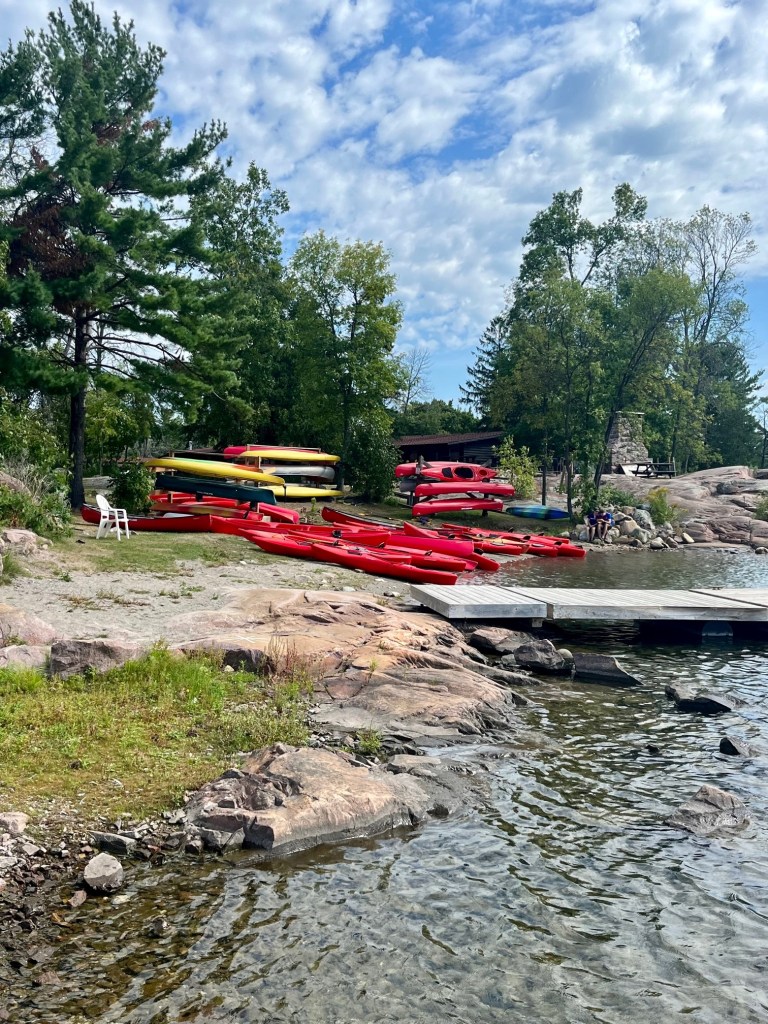
Kayaks and canoes for loan.Views from our boat.You can rent sailboats.Marina by sunset.
We always help other boaters depart the dock, as they return the favorite to us, and I am always most grateful for any docking help! Here is Pat helping the sailboat next to us depart. The little doggie – Daisy Jane -below is on that boat – “True North”! I wonder if she’s named after the song by America.
Daisy Jane – Pup on sailboat beside us, came to visit us on Sunshine.Daisy Jane riding on side of his sailboat.Captain Pat helping True North depart.They are off! Headed to home port in Michigan.
Outside the Lodge is a conference center and wedding venue. There is the entrance to hiking trails. At the foothill of the trail is this beautiful tribute to the canoe, “one of Canada’s richest tradition of transport that transcends both commercial and recreational purposes. It is as relevant today as it was two hundred years ago.”
The “Big Dipper” – created by Mike Ranta.
This paddle, known as the Big Dipper, was built by one of Canada’s most famous and ardent canoeists, Mike Ranta. Mike has already crossed solo in his canoe from British Columbia to Nova Scotia twice, with each journey over six thousand kilometers.
In 2017 Mike chose Killarney as his home and built this, the world’s largest paddle, in commemoration of Killarney’s 200th anniversary in 2020. A time capsule is in the shaft of the paddle to be opened 200 years from now.
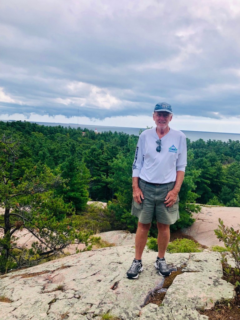
Hiking to the Killarney Lighthouse. Some hikers stop and swim in the waters.
One of the highlights of our stay at the Lodge was hiking to the Lighthouse. It was a steeper hike than anticipated. But we made it! We met some interesting people along the way, who helped us with photo ops. We made it home just before the clouds opened up with rain.
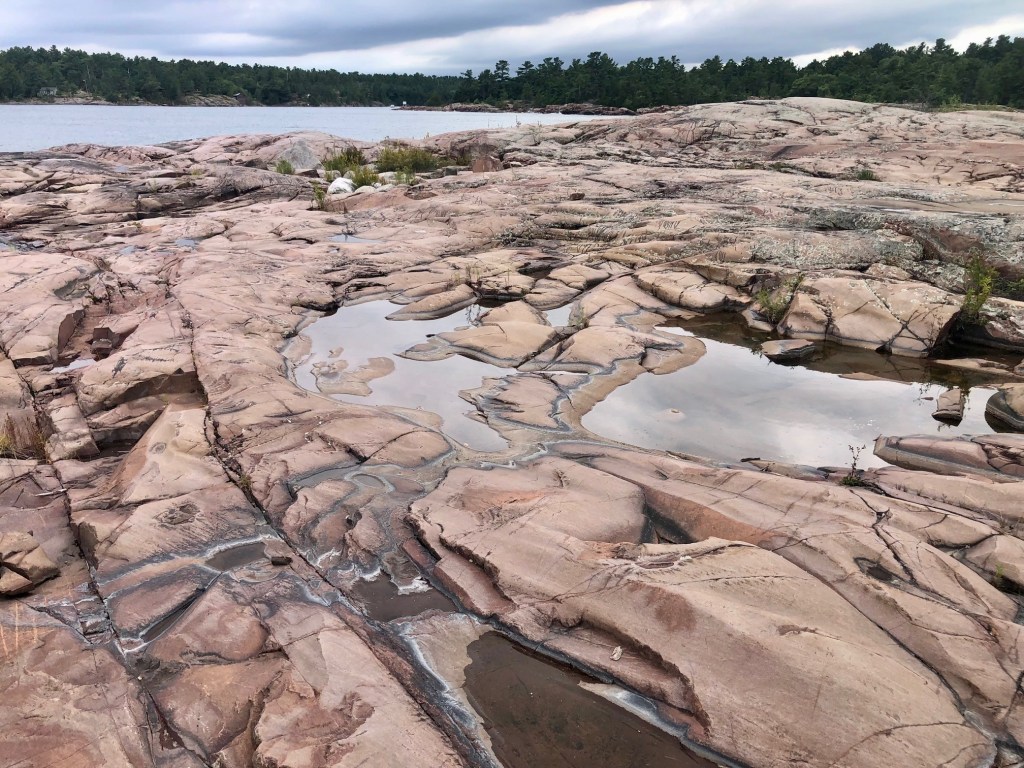
Along the hike we saw these incredible rock formations.The path for the most part was well marked and trampled, except for the root system at times.I think the golden flowers are goldenrod – Kentucky’s state flower. They are all over Canada.There are lots of quartz among the pink rocks. One of the mountaintops on our way to the light house.Captain Pat! The Admiral would have never made it on the hike without him!
In our next blog we will show you other sites from our visit to the town of Killarney.
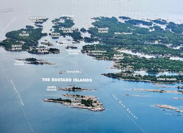
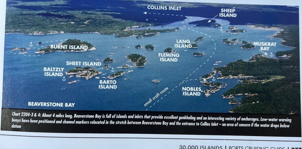
Sunday, August 28, we departed Wright’s Marina in Britt and headed for a few days of anchoring in the Bustard Islands. Our plan was to anchor out until Thursday, and then travel Collins Inlet en route to Killarney. Collins Inlet is a route everyone advised us to take. It is considered a premiere spot in Georgian Bay.
The first night we anchored in the Bustard Islands in the bay between Strawberry and Tie Islands – Burnt Island is behind us, and Philip Edward Island is in front of us.
See top left Tie Island and then Strawberry Island, in the Bustard Islands.See Beaverstone Bay on bottom left. We anchored here and then took the Collins Inlet to Killarney.
Travelling to the Bustards we saw these beautiful windmills.
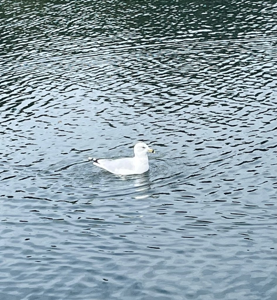
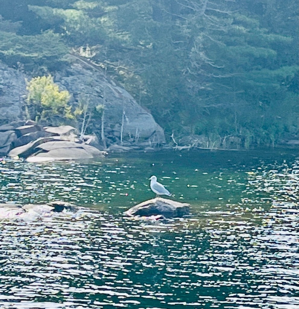
Entering the bay of Strawberry Island
In the bay of Strawberry Island we saw this lone seagull. There were no other boats or creatures. It was so quiet! Scary quiet. Our cell service did not work so our only means of communication was the VHF boat radio. I thought of Tom Hanks in the movie, Castaway, when he befriended Wilson the soccer ball. It can get lonely without sound or creatures around!
Finally the last day I broke down and fed some bread to the seagull, and he was most happy. I just had to feed him.
In Beaverstone Bay we did see a family of loons. But here, in addition to no cell service, we experienced gale force winds. It was a fitful night for Captain Pat. Thankfully the anchors held and we were secure.
Family of loons – first time I’d seen so many together. We heard them during the night and in the mornings, especially after the storm, as they were hunkered down as well.
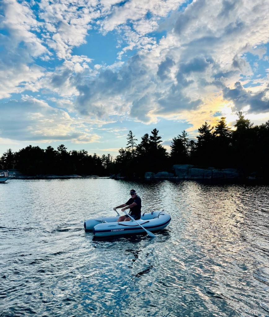
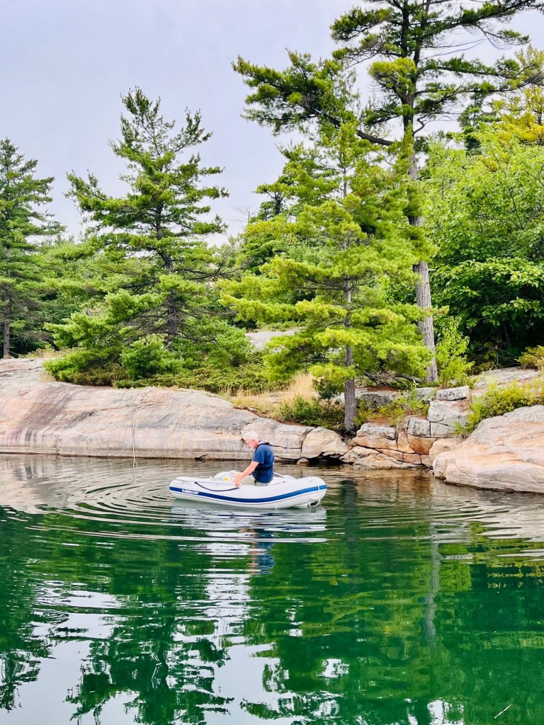
At the islands, Captain Pat takes the dinghy first to explore and check things out. Then he’ll take the Admiral to the islands, as he knows she is antsy to get off the boat. And it is good for both of us to hike.
Captain Pat scouting out island trails.Letting the Admiral know he is ok.
The storm and the lack of cell service didn’t hamper the beautiful views. We hiked and rowed the dinghy, did our exercises and swam.
One stormy afternoon I looked out the galley window and spotted two fishermen in a bass type boat go by. I called to Patrick to take a look. By the time he got to a window, the fishermen were nowhere to be found. Patrick couldn’t believe they dared venture out into the storm. He thought I had been seeing things! I swear they were there. They must have tucked into an island camp. Earlier I thought I saw a white dog on one of the islands. So Patrick was already wondering about me. -:) Too much eerie alone time I guess.
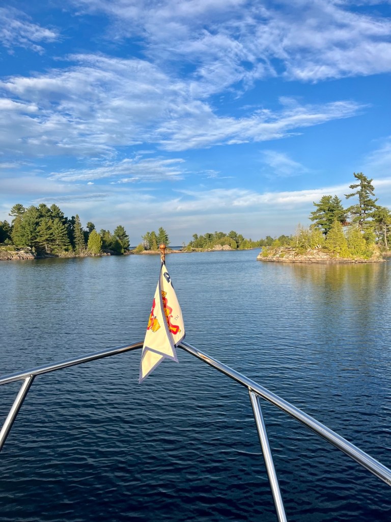
The days went fast and before we knew it we were travelling Collins Inlet.
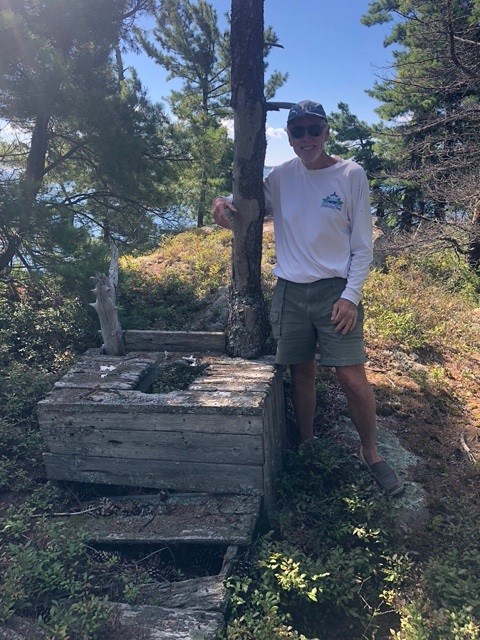
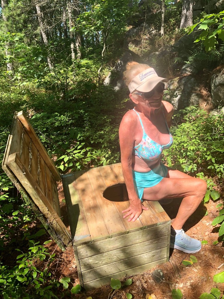
View from the islandView from SunshineThe Admiral settled in comfortably in her “chariot,” with Captain Pat rowing away.It was a tad bit chilly one day.Look what Pat found on the island! Katherine and Becky, what do you think of this outhouse?!Beaverstone Bay
Here are more photos from Bustard Island and Beaverstone Bay, before we head to Collins Inlet.
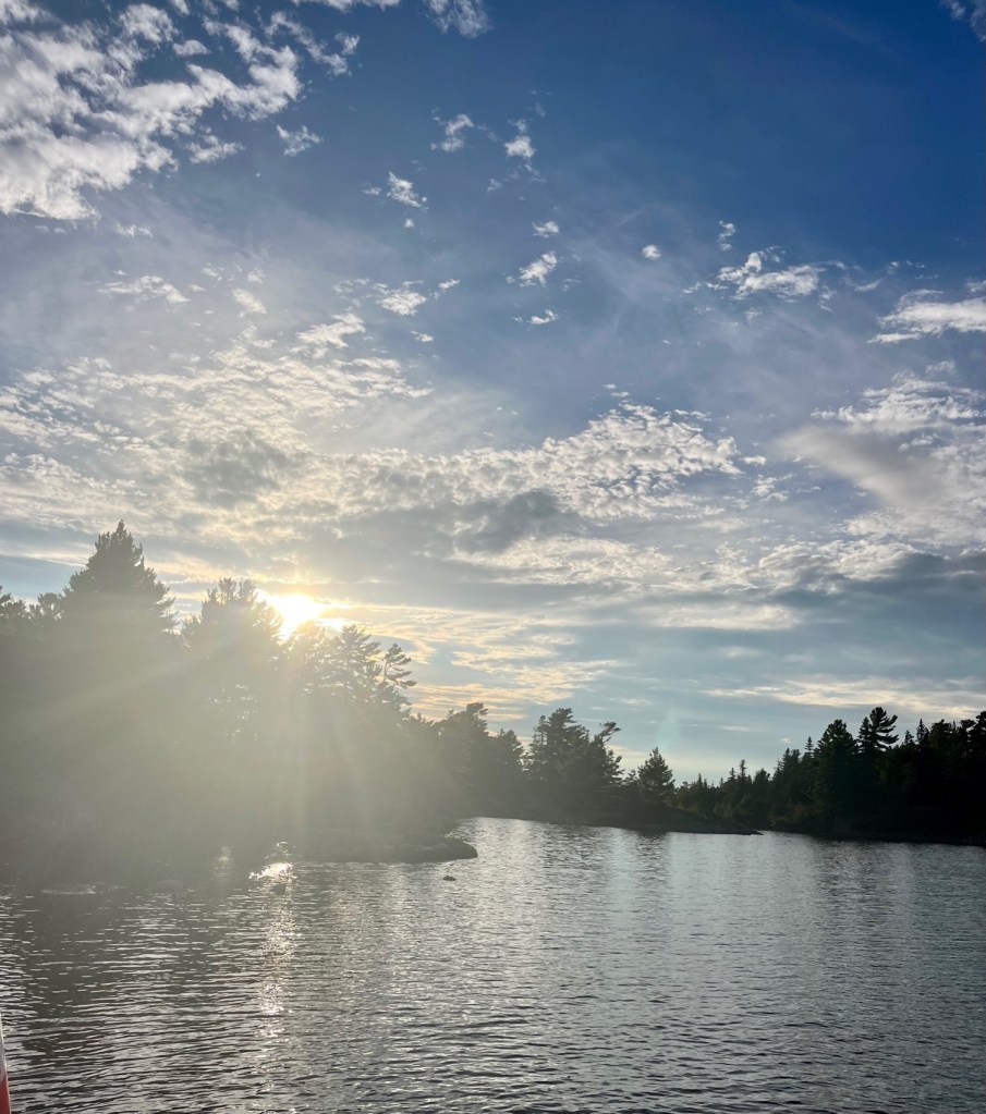
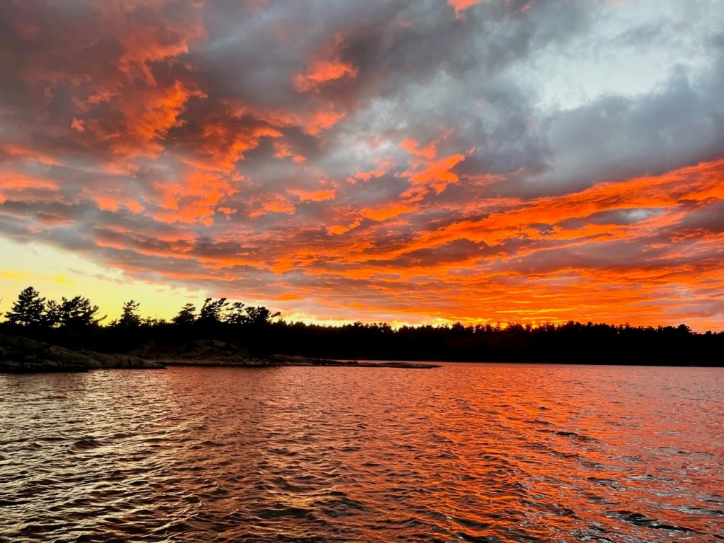
Dinghy at sunsetLighthouse on way to Bustard IslandsIncredible sunset – last night
Here are photos as we travelled through Collins Inlet, on our way to Killarney for the weekend. The photos just don’t do the Inlet justice.
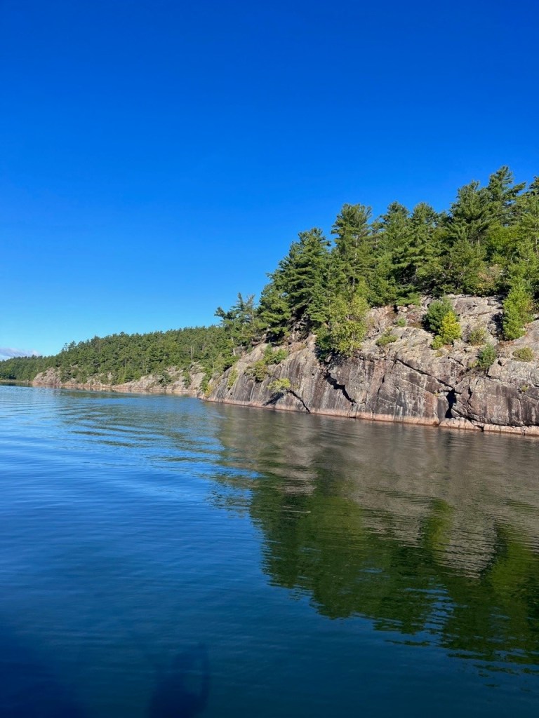
Water reflections from the rocks and cliffsFish camp in Collins Inlet. We saw many canoes, kayaks and people fishing.The trees somehow find a place to grow in the rocks.There’s a boat ahead that we followed. The water was spectacular, like glass.
More Canadian Geese – country setting A first – we went to church via golf cart!We met a delightful priest from Scotland – Father Neil Campbell.
Britt and Byng Inlet are two small communities on the rocky shores of Byng Inlet (the body of water) which is the outlet of the Magnetawan River – about three miles up from the “Small Craft Route.” The channel is well marked on the charts and takes you directly to Britt.
Because the inlet offers deep-water access from Georgian Bay, both communities were settled as logging towns with many sawmills. The towns then became busy shipment ports for first coal and then oil.
Oil-carrying lakers still use the harbour every year – you’ll know if one is coming by the security calls it makes on VHF 16 when entering the narrows at Clark Island.
Although the commercial boom is over and the marina in Byng Inlet closed in 2010, the marinas in Britt are fortunate to be on the shipping channel and therefore are not affected by the recent low-water levels of Georgian Bay.
With a well-sheltered natural harbour, this is the last place for Loopers to stock up before Killarney for those heading North and Point au Baril Station for those heading south.
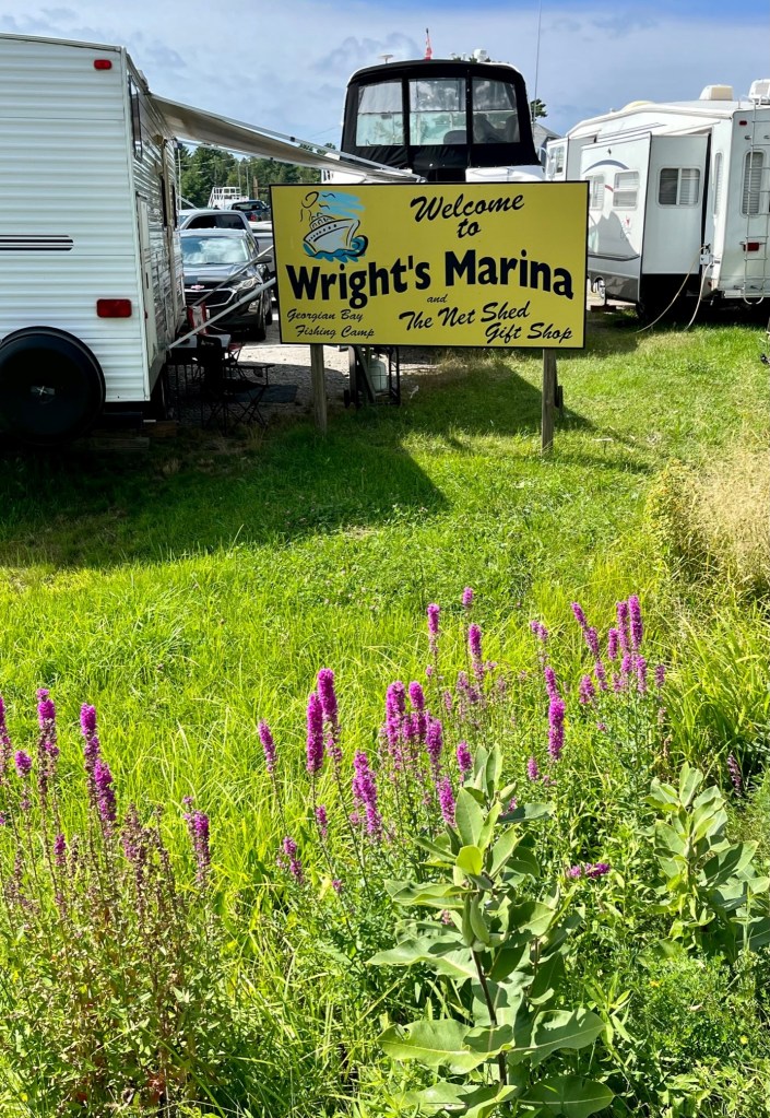
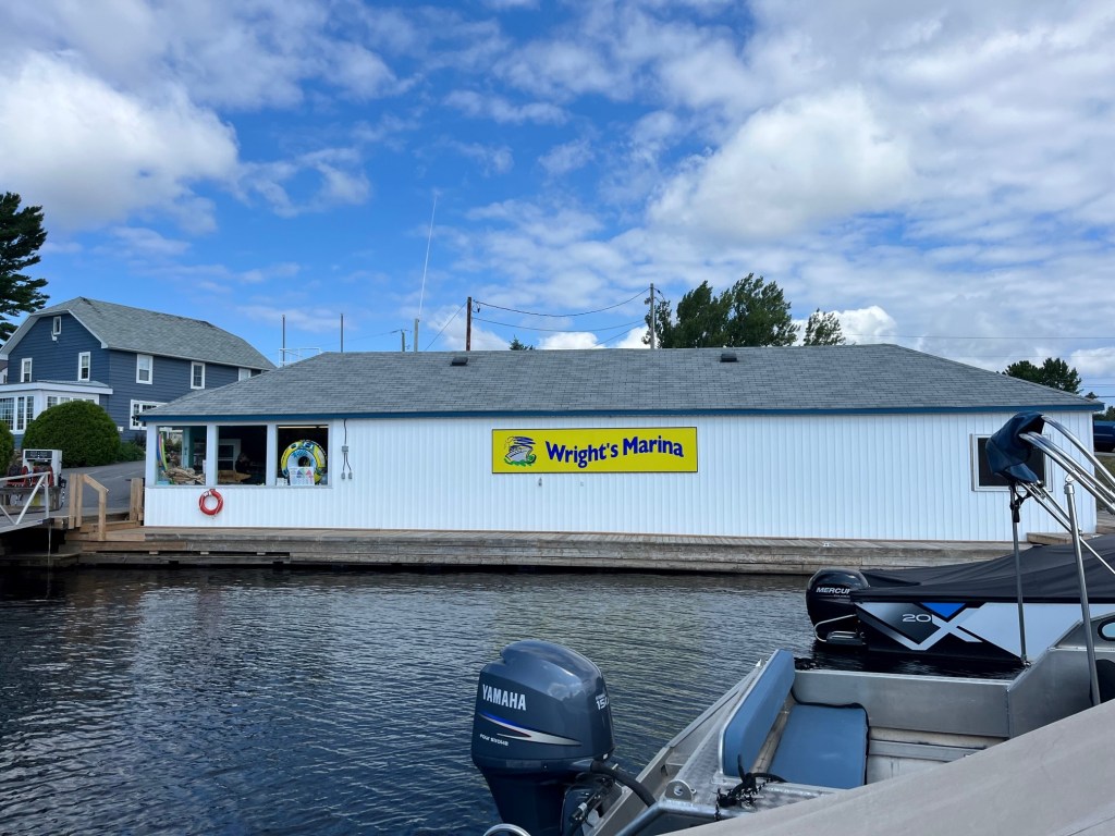
We stayed two nights at the Wright Marina in Britt. AGLCA members received free pump outs – that’s a plus. This is a family-owned marina that recently sold to the owner of Hindson Marina in Penetanguishene. We met him – his name is Kelly, the owner of this beautiful Chris Craft, and other boats!
The Chris Craft is a classic boat. This one belongs to the marina owner.
The marina and the town took a hit with COVID. The local restaurants closed due to lack of business. There used to be a loaner car for Loopers but no longer. I did appreciate the laundry facilities and the grocery store that was a golf cart ride away.
The boat just next to ours hailed from Toronto. Victoria and Patrick spend get-away weekends on their boat here at Wright’s Marina. Victoria and Patrick say they have met many Loopers this summer! Victoria was so kind, offering us fresh watermelon, cherry tomatoes, and lemons. Both Victoria and Patrick spent an hour with Captain Patrick reviewing charts and offering suggestions for anchorages. Yes, Patrick is Irish like Captain Patrick and just as gregarious!
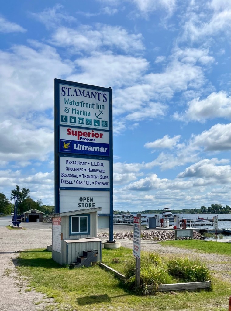
Saturday morning we took the golf cart to the next marina – St. Amant’s – as they have a grocery. It is only a mile away and an interesting ride, with colorful lodges and trailer setups along the way. Everyone is friendly, sitting outside and enjoying the waterfront view.
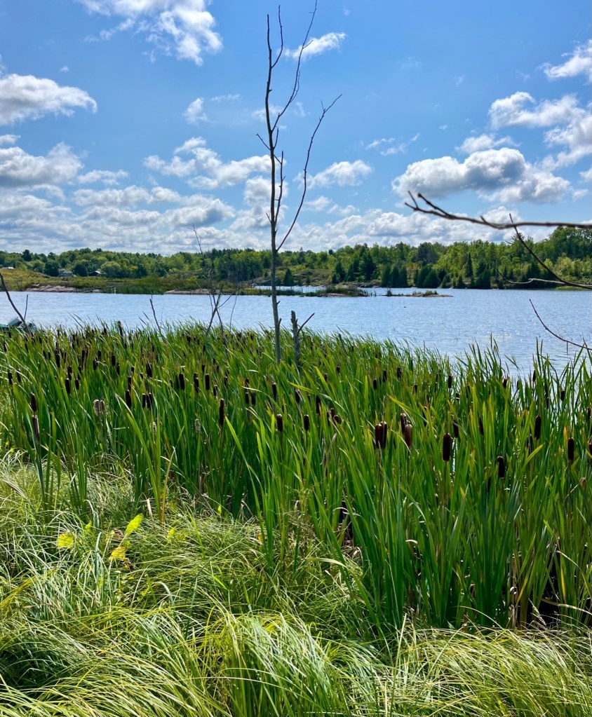
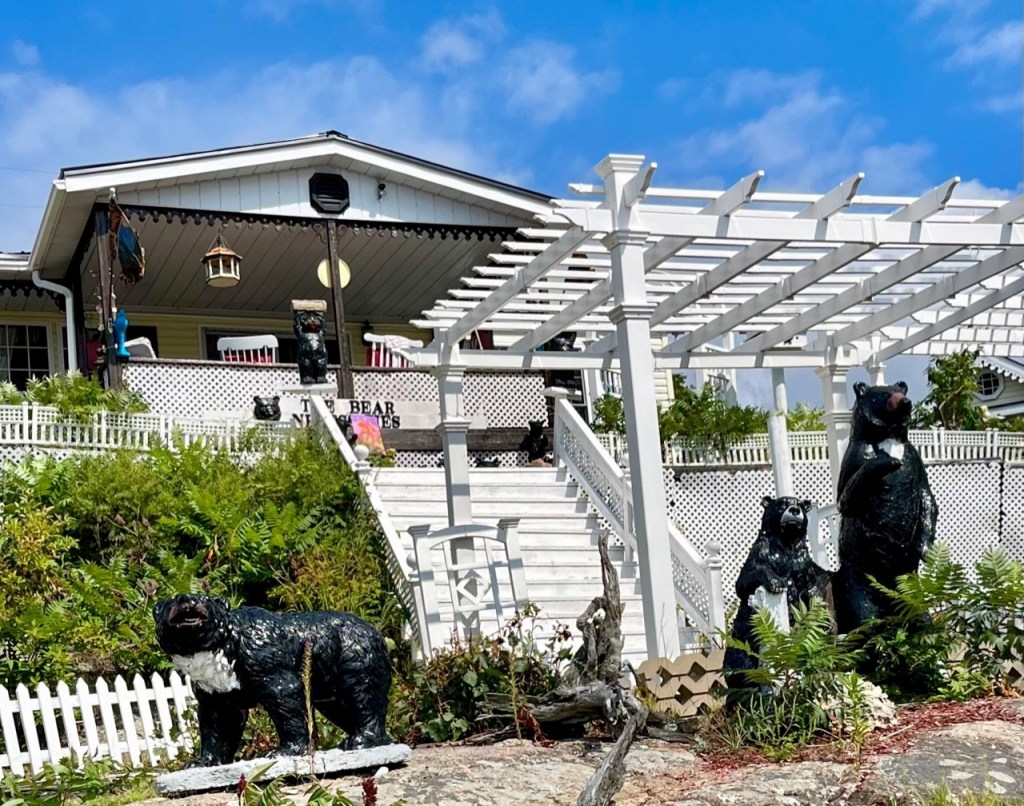
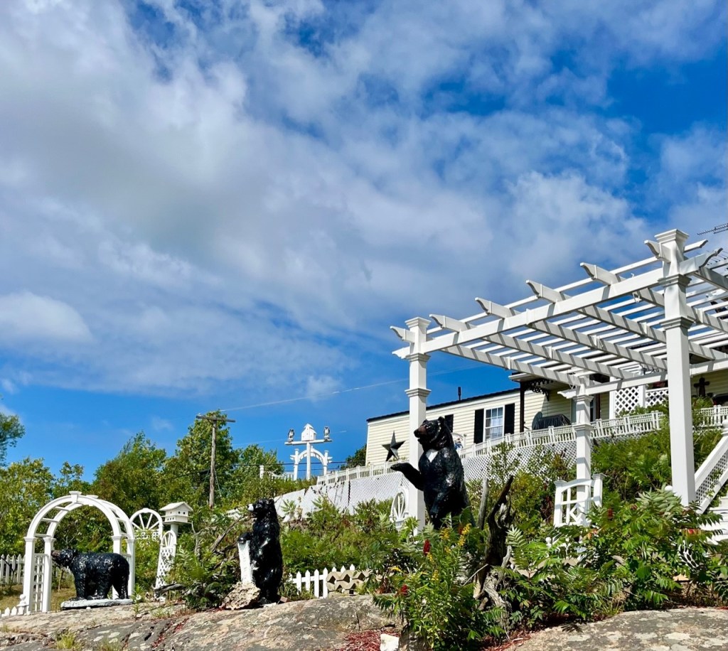
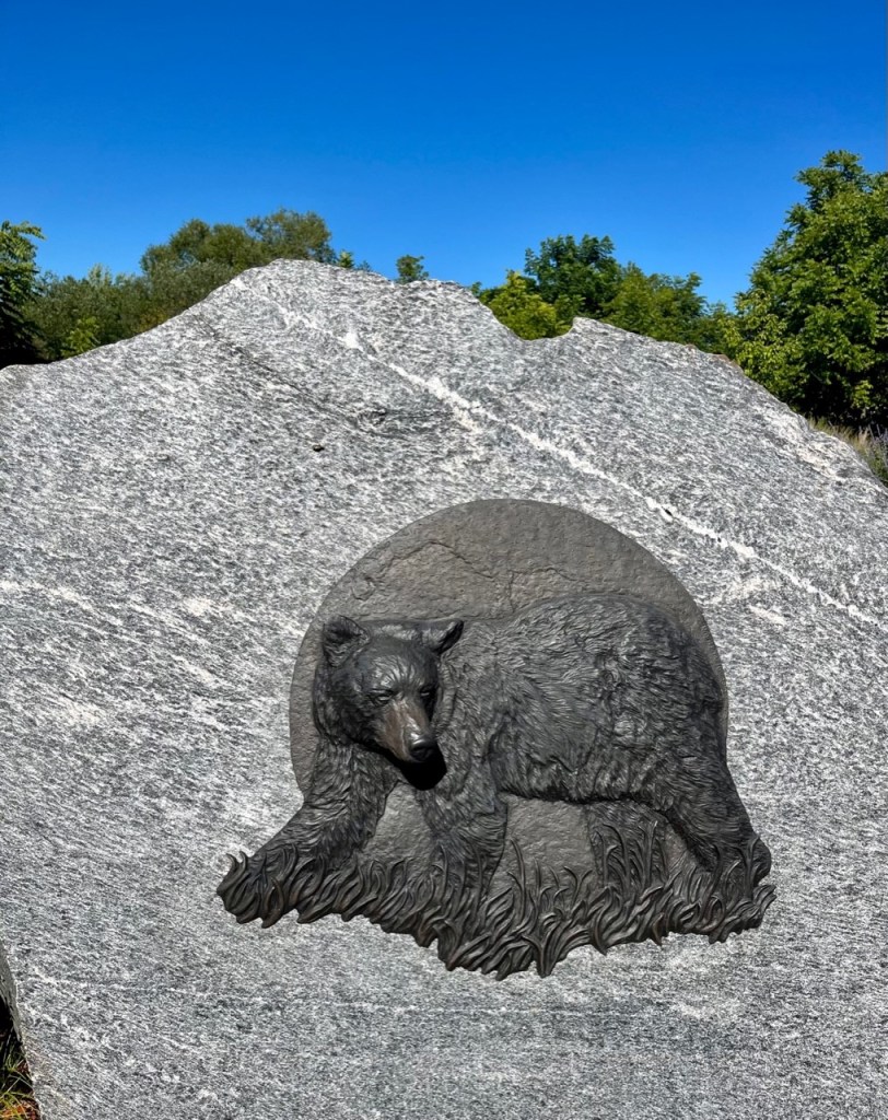
Cattails on our way to St. Amant’s. Cattails always remind me of growing up and swimming at Miller Lakes.Driving the golf cart to St. Amand’s – lovely flowers and trees lined the road.The summer cottages were so ornate. This one – “The Bear Necessities” – had so many bear statues!I wish I could have seen a real bear! They were sited at the marina. There are special “bear proof” trash containers you must use.Now there is just the store at St. Amant’s.Lots of fishing in Byng’s Inlet
We later stopped at the local Kawartha ice cream stand and received some more Georgian Bay visiting tips from the locals. Kawartha and Chapman’s are well known Canadian ice cream brands – you have to try them.
Little ice cream shop that sold grilled hamburgers and hot dogs.
We bought steaks and pork chops and Patrick cooked them up on one of the many grills available. Nice to have dinner meats cooked up for the week.
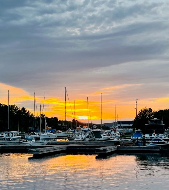
The grounds were amazing at the marina, especially this front dock with Adirondack chairs and many grills for boaters to use. So many amazing spruce trees, each perfectly shaped.
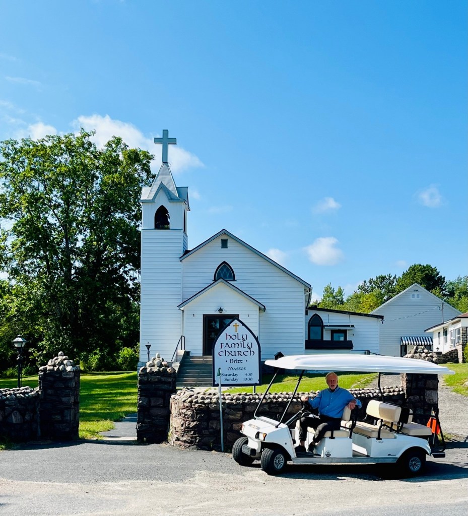
Saturday evening we attended Mass at the local church – just about two miles away. This was a first – we went to Mass by golf cart! There was a lovely priest there from Scotland – Father Neil Campbell.
Captain Pat with Father Neil Campbell
He showed us around and shared stories about the parish. He showed us photos of the many bears that visit his campus! We heard many stories of bears visiting the marina as well. I wish I could have seen a big black bear. Be careful what you wish for!
Father Campbell is 63 and has been at this parish for 26 years. Ten more years and he retires. We invited him to visit us in Boca Raton!
Holy Family Church – Britt, OntarioThere is a wonderful grotto dedicated to the Blessed Virgin Mary.And a lighthouse too! Love the stonework. My Granddad Thompson had flower pots made of concrete and stones like these.Inside Holy Family Church – Britt, Ontario.
We had a fun and relaxing stay in Britt. Sure hope to return some day!
The Admiral taking a ride in the dinghyCaptain Pat on a hikeHiking – See Sunshine in the backgroundCaptain Pat setting the anchor – Regatta BayTime for a swim
You may think if anchored out on the boat, we don’t get much exercise. Not the case – as you can see by the photos above! We swim, hike, row the dinghy, and even do an exercise routine on the bow of the boat, with weights we brought from home. And there is always something to do with the boat – adjusting the anchor, cleaning up, fixing things, working with the dinghy. Captain Patrick today had to adjust the anchor for 40 mph winds today! And he switched out the lights in the kitchen and bedroom to LED, because our batteries are losing their charge. We stay pretty active when we anchor out.
We departed Parry Sound August 21 for a week of exploration and anchoring out – continuing with our gunkholing adventure. Here is commentary from our Looper’s Companion Guide that further explains the fascination with Georgian Bay:
“Georgian Bay is recognized as a premiere destination for boaters. While the Caribbean is a great winter retreat, and the Chesapeake is certainly very appealing, when it comes to the rugged beauty of windswept pines, on colorful rock, scoured clean by glaciers, offering snug anchorages and sunsets, nothing compares to Georgian Bay. The sheer beauty of anchoring out in remote Bays and anchorages is distinguished by picturesque towns and urban ports of call that make Georgian Bay so interesting.”
“Both Georgian Bay and the North Channel offer more anchorages than one could visit in a lifetime. You need a good understanding of your charts and you must always know exactly where you are.”
Captain Patrick preparing for voyage, consulting the charts and maps.
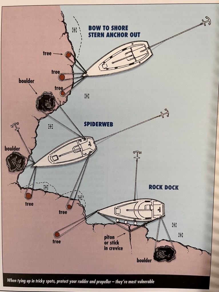
“When anchoring, use the anchoring technique of those who were there first. If they are all swinging on one anchor – you must do likewise. If they are Bahama moored with two anchors – you must do the same.
For this reason, all cruisers should have two anchors with at least chain rode the length of your boat and 200 feet of rope; plus a minimum of 200 feet of ½ inch plus shore line.”
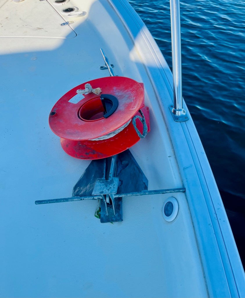
FYI – Sunshine has three anchors, and the dinghy has one as well. Our main anchor – a plow anchor – has 300 feet of chain. Our second anchor – a Danforth shoreline anchor – has 50 feet of chain and 150 feet of rope. Our third anchor is a small stern anchor, with 60 feet of floating propeline rope. The dinghy anchor is a fold -up anchor with 30 feet of line. Yes – Captain Patrick may go a bit overboard when being prepared. But it is better to err on the safer side.
Captain Pat setting the main anchorCaptain Patrick securing second anchor on back of boatSunshine’s second anchor
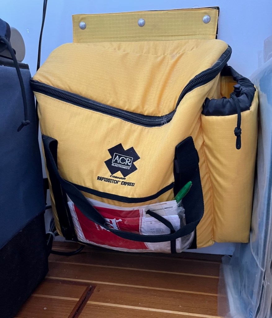
The dinghy anchor is in the dinghy ditch bag. A ditch bag is a floating bag of essentials that you have handy in case you exit the boat in an emergency situation. The ditch bag contains survival items, such as flares, bottled waters, vhf radios, etc. and personal items you wish to keep safe.
Ditch bag aboard Sunshine
“There are two routes for cruising Georgian Bay – direct and indirect. The direct route option takes boaters into open waters. These channels are well marked, but are mostly used by the commercial vessels that run ‘on the clock’ and need to get where they are going on a schedule. You will see some sailboats using the direct route because they can proceed under sail to and from Lake Huron.
The indirect route is the “Small Craft Route.” It is the most scenic route and safest and best way to go. This route will take you safely west along the north coast of Georgian Bay, through the popular 30,000 islands.
The scenery is breathtaking, and the cruising arguably the most challenging on the entire Great Loop. That challenge, however, is not a result of danger as much as it is concentration and paying attention. This portion of your voyage always demands an alert Captain at the helm. It is also important to maintain a very slow speed. In this manner, this area is similar to the 117-mile stretch of the New Jersey ICW (Intercoastal Waterway).Only there if we run aground, we run over soft mud. Here, if we venture out of the channel, we are most likely to hit a huge underwater granite boulder.”
I am most grateful for the diligence of Captain Pat at the helm. He is prepared with charts and weather predictions, and stays alert. For the most part we are on the Small Craft Route, but we have ventured at times into the open waters.
Command Central – the Captain’s helm and all his navigational systemsThe Captain remains diligent to stay on course and follow the route
Our first four days of gunkholing found us in Regatta Bay, Alexander Passage and Snug Harbor. See photos below:
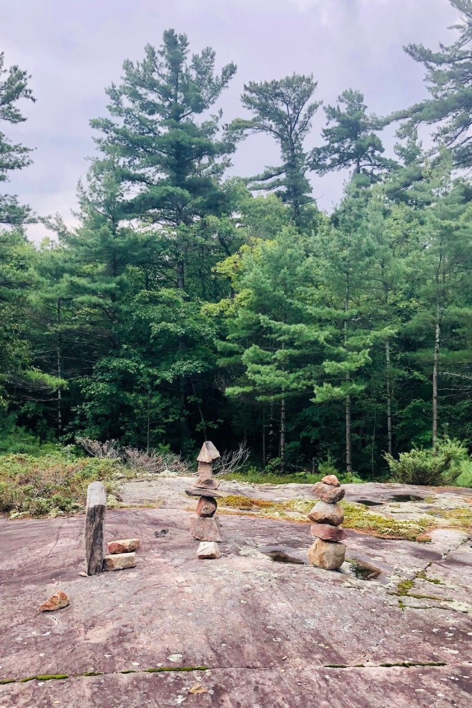
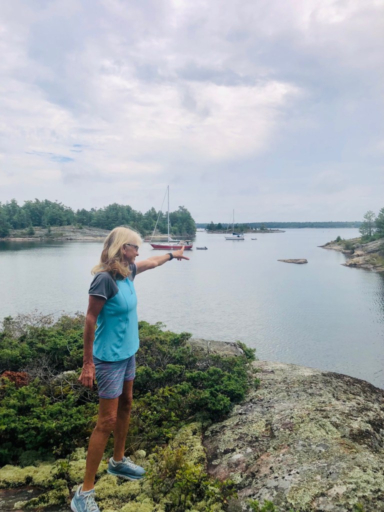
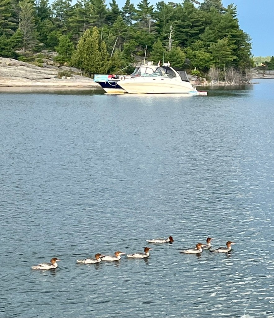
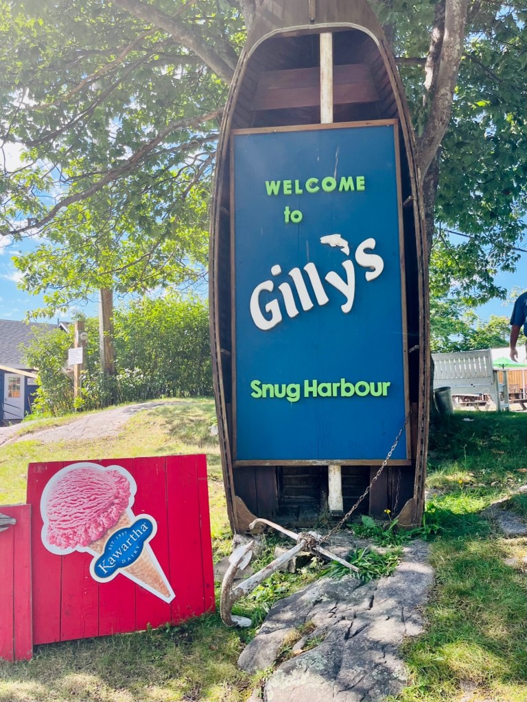
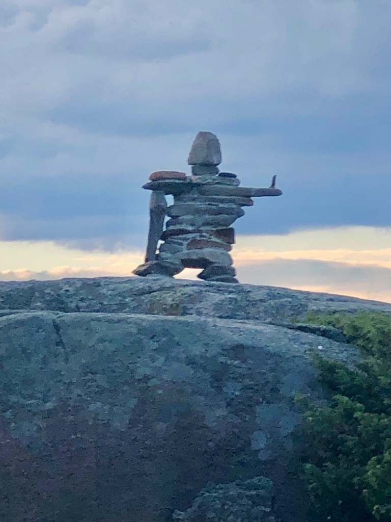
We saw more cairns in Regatta Bay and Alexander Passage. I learned from Irene Phair there is an indigenous term for cairn – it is “Inukshuk!”The Admiral pointing the wayA family of Merganzer ducks. Thanks to Irene Phair for the clarification!Captain Pat surveying the island.Sailboat sighted on way to Alexander Passage.Walking the islands.Lighthouse on way to Snug HarbourOne morning we visited Snug Harbour and had lunch at Gilly’s.Cottage to rent at Snug HarbourBeach at Snug HarbourSnug Harbour ResortBirch trees on the walking path in Snug HarbourSunshine safely tucked away in her cove for the evening.
We spent a wonderful weekend in the town of Parry Sound, August 18 – 21. We try to explore and anchor out during the week as there is less boat traffic. Then we hit a marina for the weekend to restock provisions, do laundry, catch up on wi fi, and get our steps in. Friday and Saturday were record walking days for me. My Fitbit registered 19,000 steps on both days!
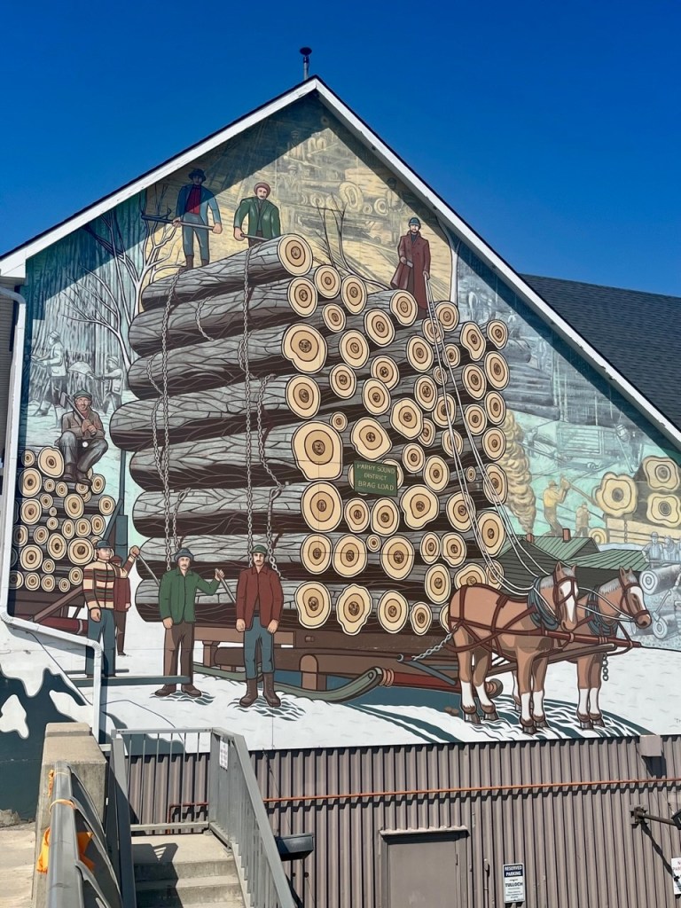
Mural of sawmills – downtown Parry Sound
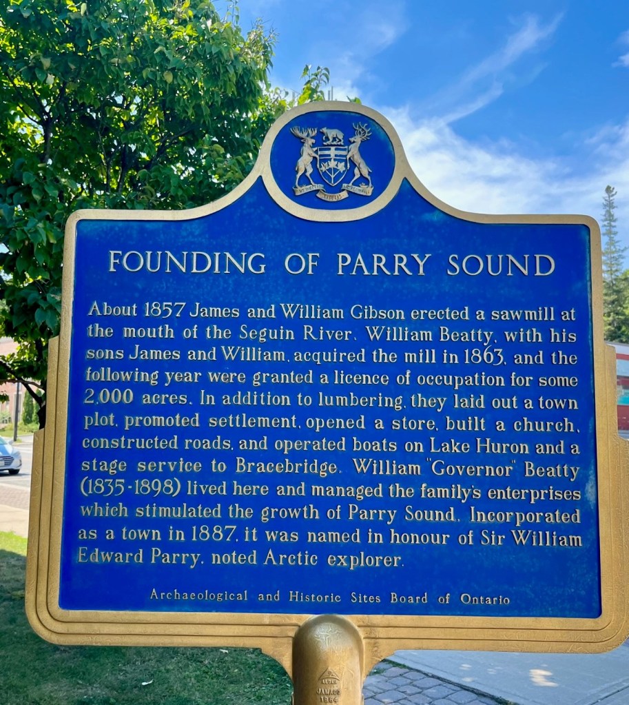
In 1863, William Beatty, with sons James and William, acquired a sawmill erected at the mouth of the Seguin River. The following year they were granted a license of occupation for 2,000 acres. In addition to lumbering they laid out a town plot, promoted settlement, opened a store, built a church, roads and operated boats on Lake Huron.
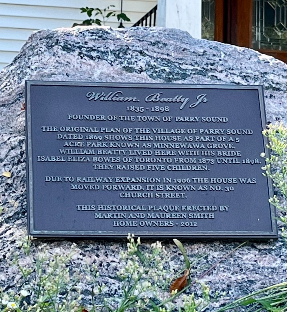
Tribute to William Beatty, founder of Parry Sound
William “Governor” Beatty (1835-1898) lived here and managed the family’s enterprises, stimulating the growth of Parry Sound. Incorporate as a town in 1887, it was named in honor of Sir William Edward Parry, noted Artic explorer.
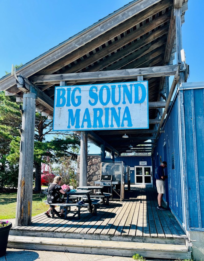
We stayed at Big Sound Marina – a decent and welcoming facility.
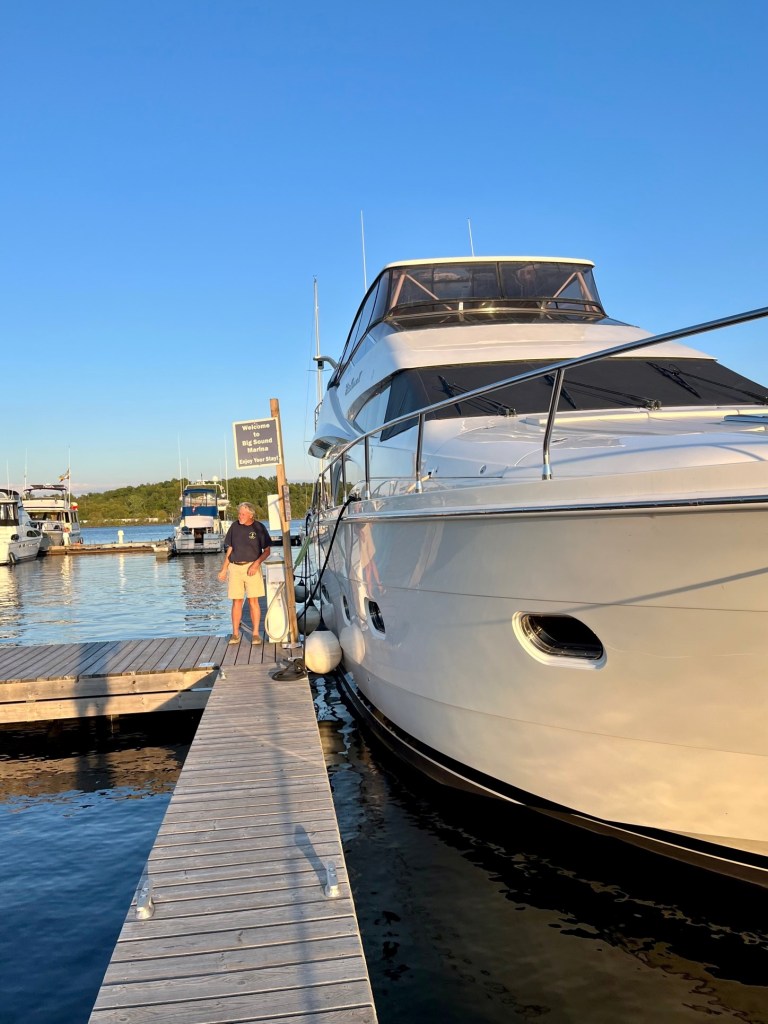
Pat by one one of the big boats!
We met many local boaters as this marina is their home port. For these local boaters, this is their weekend getaway. They stay on their boats like staying in a cottage, and the docks are common ground to meet and greet. They barbecue at the grills, take short boat rides, lounge on the grounds reading books, and visit the town. They are curious about “Loopers!” Saturday we were pleasantly surprised as Laurie and Ray (they took us to Costco in Penetang!) showed up with another couple. It was great to see them again.
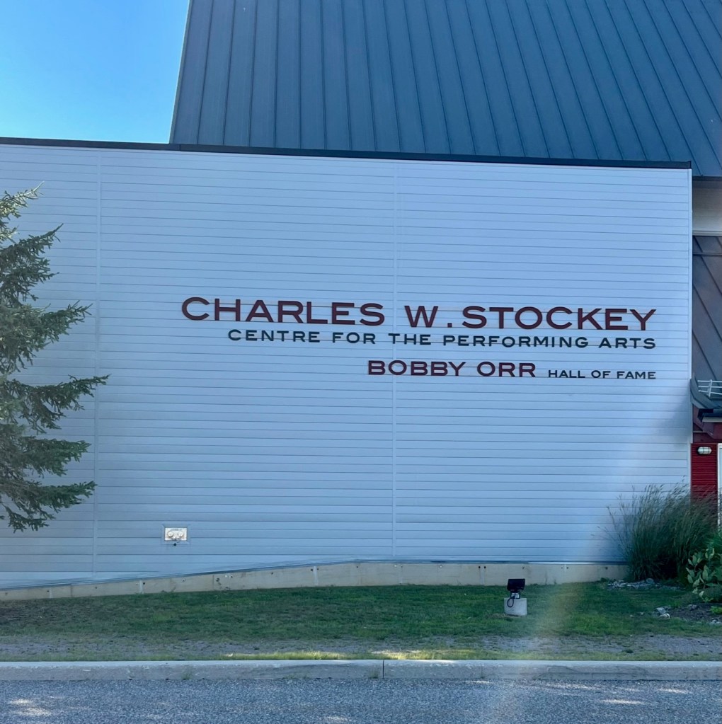
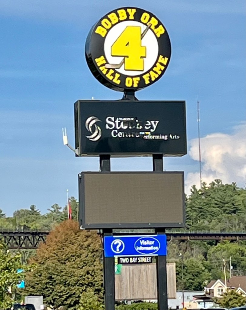
Just steps from the marina is a museum dedicated to Bobby Orr, a famous hockey player born in Parry Sound, who played for the Boston Bruins.
Bobby Orr – hometown hero and hockey legend
Patrick remembers his sister Kathleen having a poster of “Bobby Orr, No. 4” in her room when they were growing up.
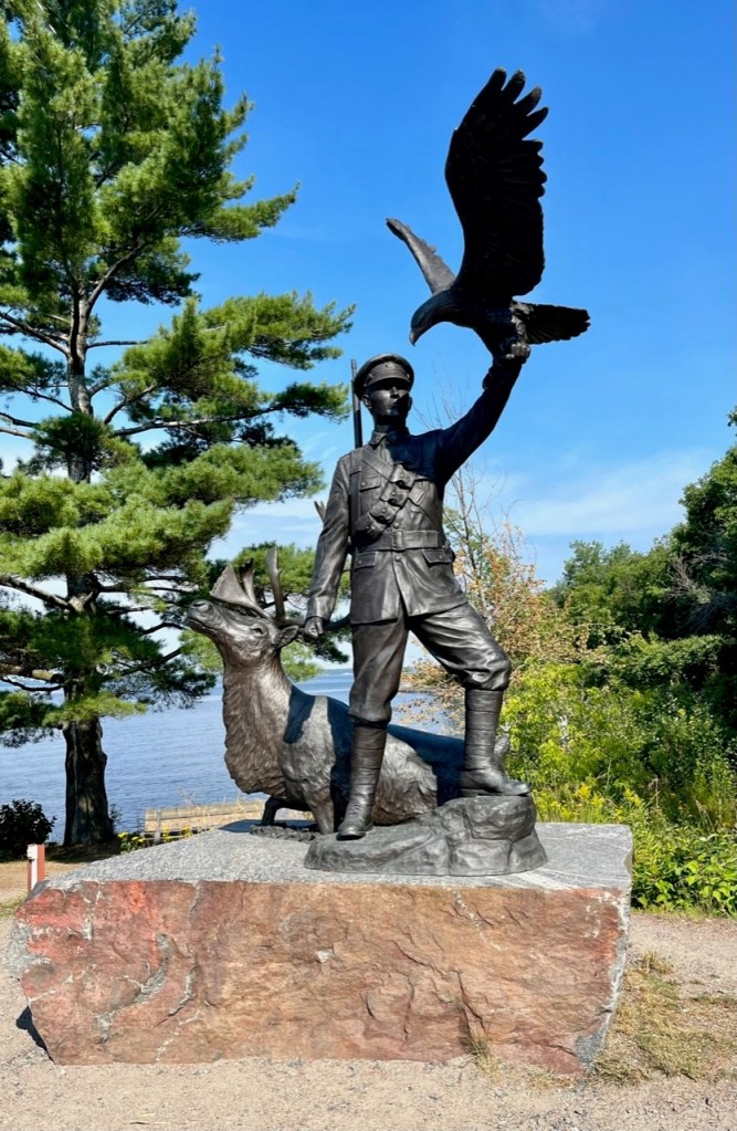
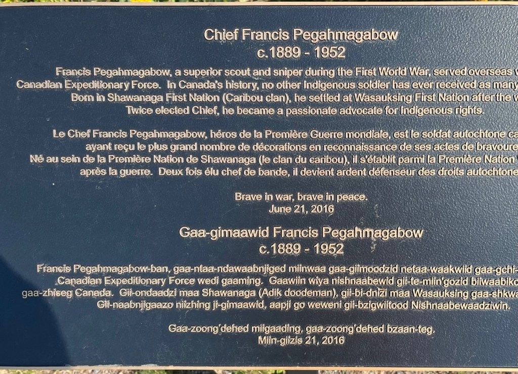
Just past this museum is a walking/bike trail around the town with serene views of the bay. This statue greets you at the entrance of the trail.
Tribute to Chief Francis Pegahmagabow, superior scout and sniper during First World War. See explanation below.One of the waterfront restaurants
There are restaurants within walking distance. Always nice to have a dinner out – and more French fries with gravy – yum!
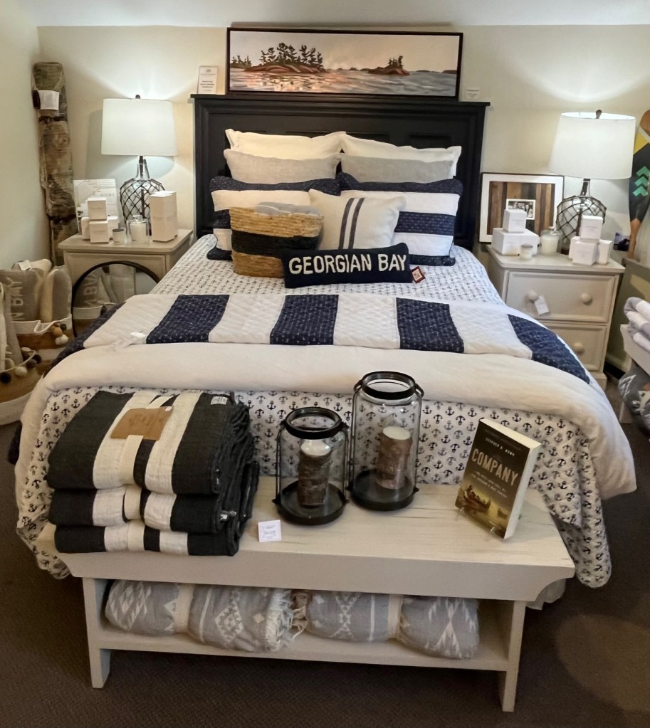
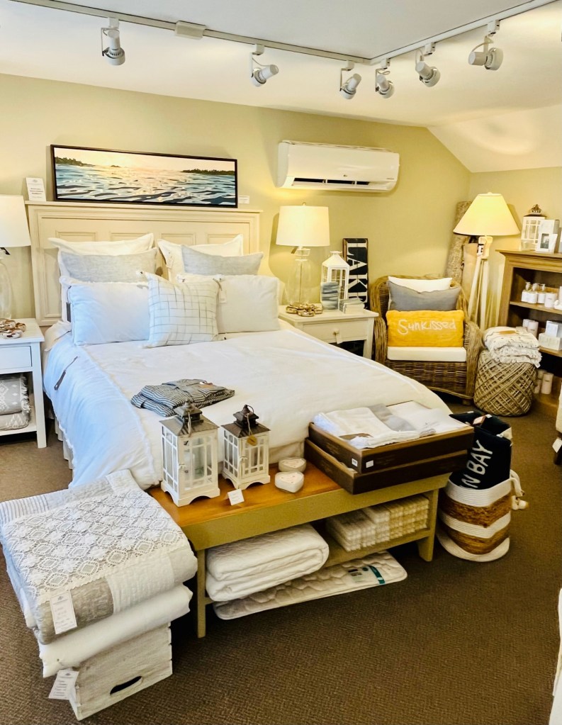
I loved this one upscale home furnishings store – Huckleberry’s of Ontario.
I want to change out my bedroom furnishings! These I should have bought. When I go home will visit their website!Oh, the innocent faces of these deer!
It had been so long since visiting a store like this – one where I don’t buy but get inspirations from. It’s like a Pottery Barn for all things nautical and Georgian Bay. I’ll definitely visit their website when I return home.
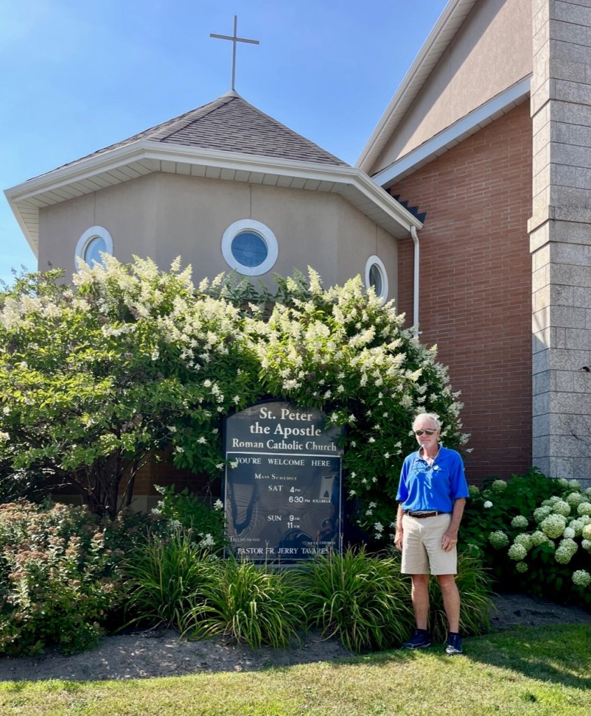
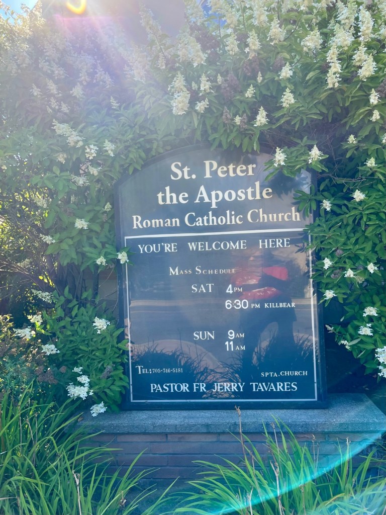
I walked to the Solby’s grocery store one day, and to a farmer’s market the next day. Patrick and I walked to Mass on Saturday afternoon at St. Peter the Apostle.
It was one of the best Mass services we have attended during our Loop journey.
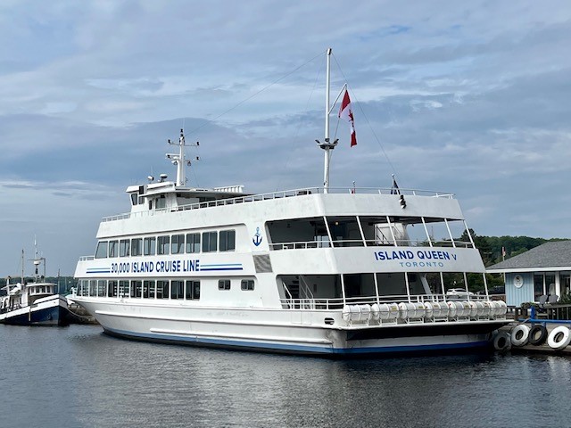
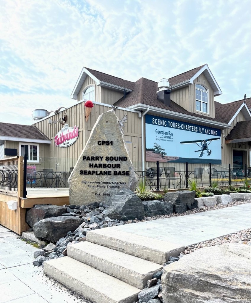
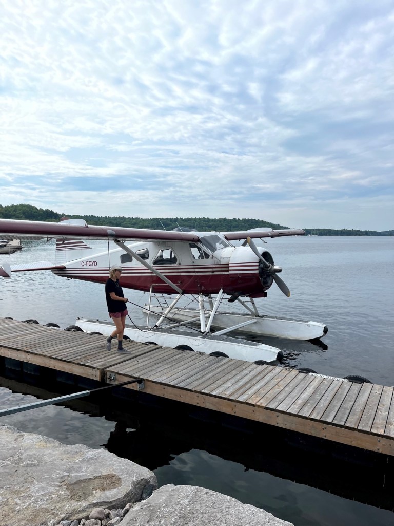
Another cool feature of this town were the two options for scenic touring – the 10,000 Island Cruise Line – Island Queen of Toronto and Parry Sound Harbour Seaplane Base.
You can book a sea plane tour here. You hear them overhead all the time.This young girl flies this plane! Thought of Andrew – he would love to fly these sea planes.
We left Sunday, August 21, to continue our exploration of Georgian Bay, heading to Regatta Bay.
More on that in our next blog. Following are photos from our stay in Parry Sound.
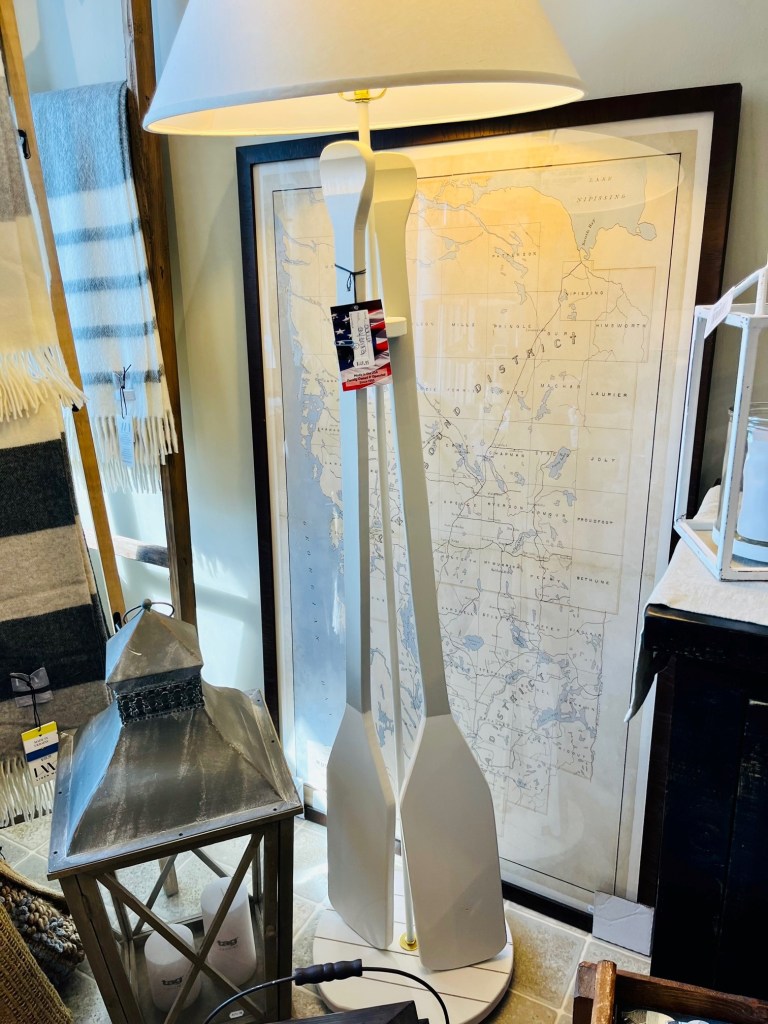
Found this amazing store that sells used books. I was able to surprise Pat with more Vince Flynn books. This is a series that you read in chronological order. Thanks to George Kunzmann for the reading recommendation!This bear welcomes you! And there is a big black labrador that roams the bookstore aisles. So cute!Very nice Mass service here.We met a wonderful couple aboard this sailboat – Ray and Saskia. She is Dutch and this is the name of Rembrandt’s wife! This is their home port. They weekend here with their little dog, Cricket.This moose was outside the waterfront restaurant. For you, Kathleen!Captain Pat couldn’t believe this old railway bridge.Quite the cargo.We loved this “Irish” boat! They are doing the loop – Philip and Delores. Look at the name!This artist is amazing. Some of his sketches on word goes for a million dollars. Wish his last name was spelled with a t “Thompson”! Lots of beautiful sailboatsA UNESCO Biosphere Reserve – by the walking path“Sunshine” docked at Big Sound MarinaPat walking the docksLove these pennants at Huckleberry’s! We should do for the islands at Lake Winnipesaukee.These last photos are from my window shopping at Huckleberry’s.Interesting way to capture a boat in this photo.Always loved framed maps – and the oars on this lamp.
Captain Pat and his dinghy in Indian Harbor, Georgian Bay
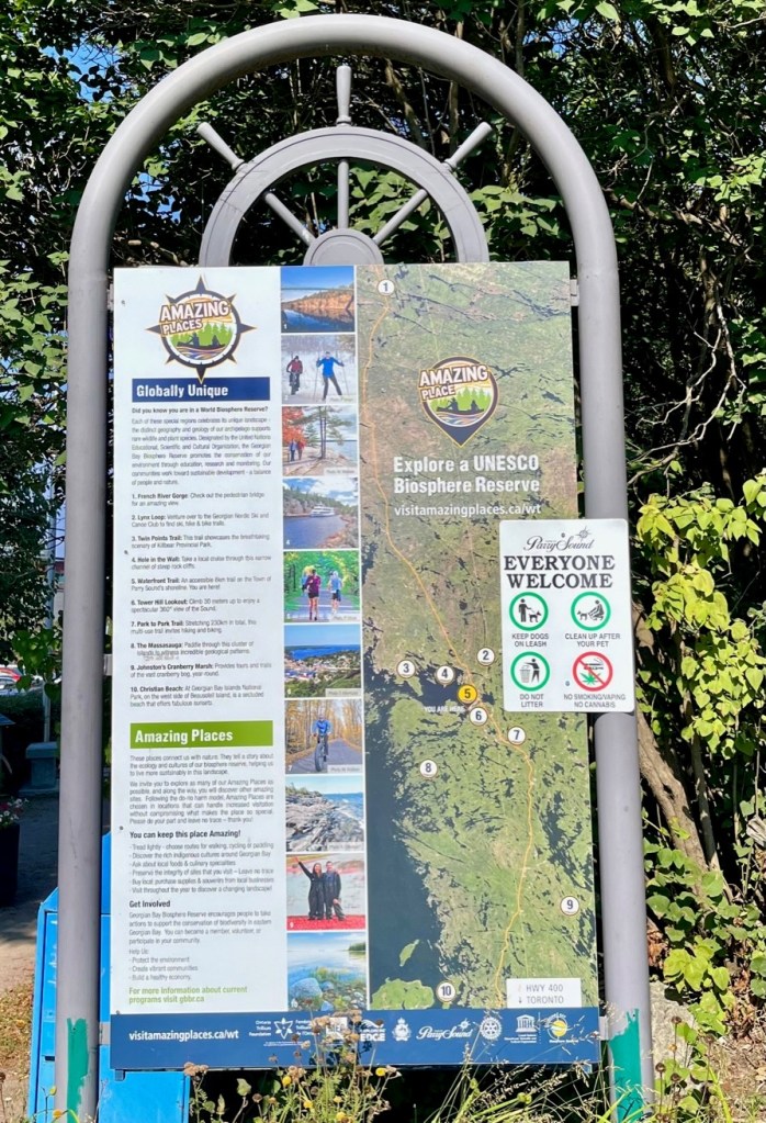
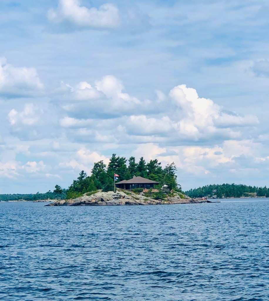
I had never heard of Georgian Bay (French: Baie Georgienne) until learning about the Great Loop. At 5,792 square miles, Georgian Bay is not much smaller than Lake Ontario (7,320 square miles), earning it the nickname “the sixth Great Lake.” With more than 1,240 miles of grayish-pink granite shoreline, this archipelago is part of a UNESCO (United Nations Educational, Scientific and Cultural Organization) biosphere reserve and a summer freshwater playground for boaters, anglers, and kayakers.
It is a large bay of Lake Huron, in the Laurentia bioregion, and located entirely within the borders of Ontario, Canada. There are 31,000 islands in Georgian Bay! To put this in perspective, there are 365 islands (274 habitable) on Lake Winnipesaukee (which is 72 square miles.)
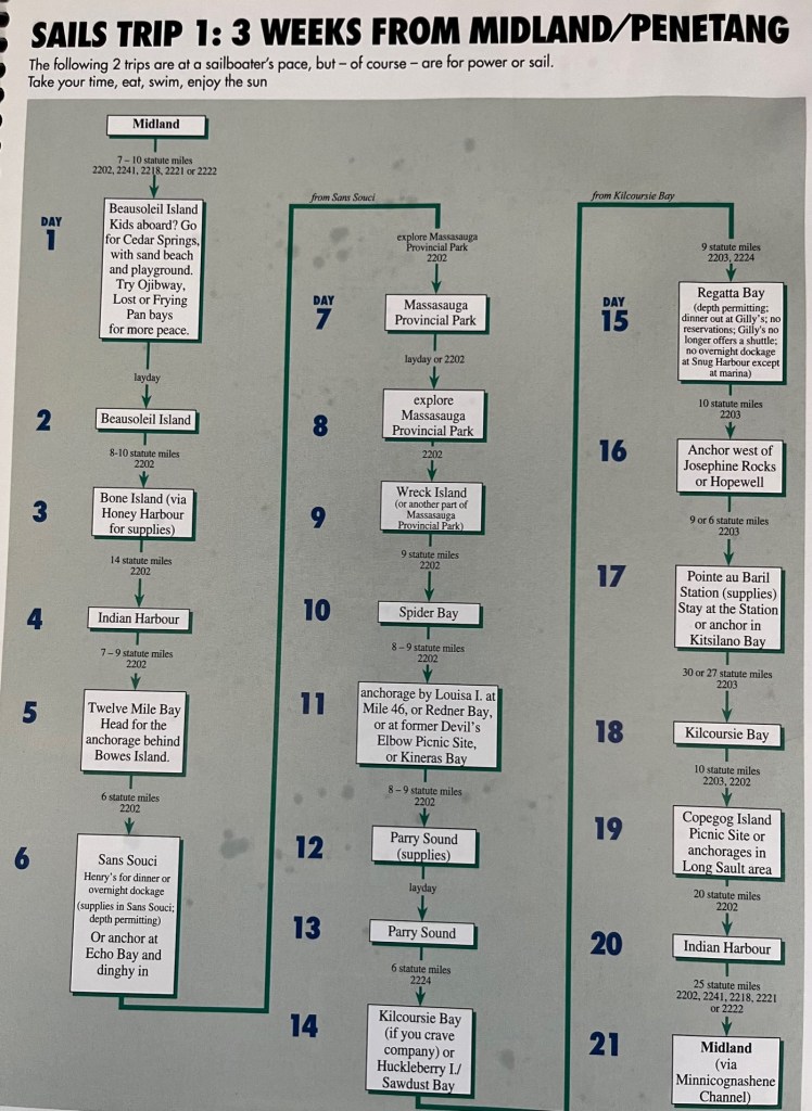
One route to explore Georgian Bay
There are endless route options you can take to explore the Bay. We have talked to many locals who have boated these waters for years and still have much to see. There are many sample routes listed in a resource we have – the Cruising Guides Charts for Georgian Bay. The example above, taken from the Cruising Guide, is very similar to what we are following. You will recognize the names of the places we have visited – Midland; Beausoleil Island; Ojibway; Honey Harbor; Sans Souci (with Henry’s restaurant); Massasauga Provincial Park; Parry Sound; Regatta Bay; and Indian Harbor.
When anchored in Three Fingers Bay, we took our dinghy to this park.
Special thanks to the many people who provided us with excellent resources. Early on Ashley Dawson gave us online charts and maps as she has travelled extensively in Georgian Bay. Susan Molenda, our friend in Victoria Harbor, gave us charts and books, as did Dan and Graeme Arris, and Mitch and Ann Larimore. All the boaters and Loopers we’ve encountered at various marinas have had excellent suggestions. And the AGLCA (American Great Loopers Cruising Association) website has troves of videos and blogs. I’m sure we are leaving some people out – special thanks to you too!
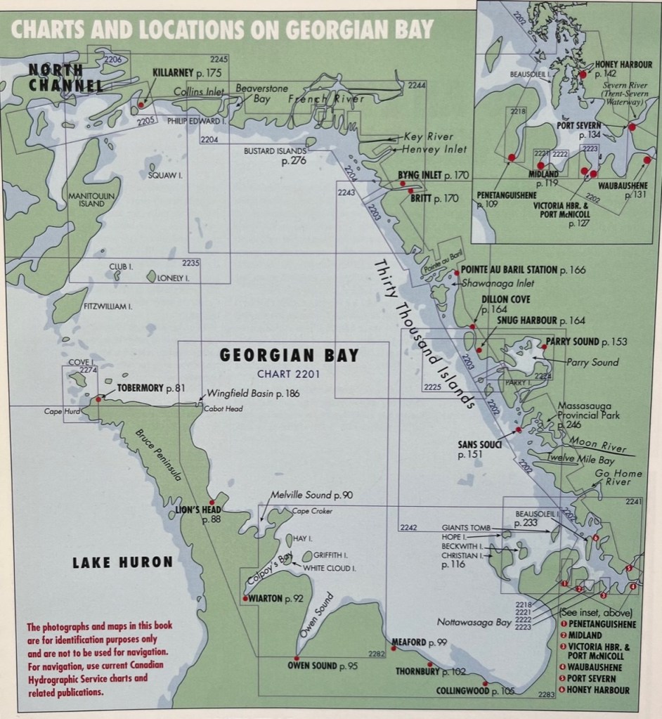
Map of Georgian Bay We have hit the following spots: Honey Harbor, Port Severn, Midland, Penetanguishene, Sans Souci, Parry Sound, Snug Harbour, Britt and Byng Inlet.
To give you an idea of our travels, you will see on the bottom right (southeastern corner, with in inset at the top) the first area we visited in Georgian Bay – Port Severn (where we entered Georgian Bay after the Big Chute) and Penetanguishene, and we have proceeded up the coast. We will take approximately two weeks to get from Penetanguishene to Killarney – at the top left near North Channel. Then we will take about one week to travel from Killarney back to Penetanguishene, cruising the bay by Tobermory, Lion’s Head, etc. – the left side of this map. Traveling through the bay is not as involved and tricky as the right side of the map, taking less travel time. Let’s hope the winds are with us!
What is Gunkholing?
I read this term – gunkholing – in the cruising guide, and realize it describes exactly how we are exploring Georgian Bay! Gunkholing is leaving the main channel (and its navigational aids) to look for secluded anchorages. Most boaters who gunkhole do it to find a place away from towns and marinas to enjoy nature and soak in the spectacular scenery found on Georgian Bay and in the North Channel.
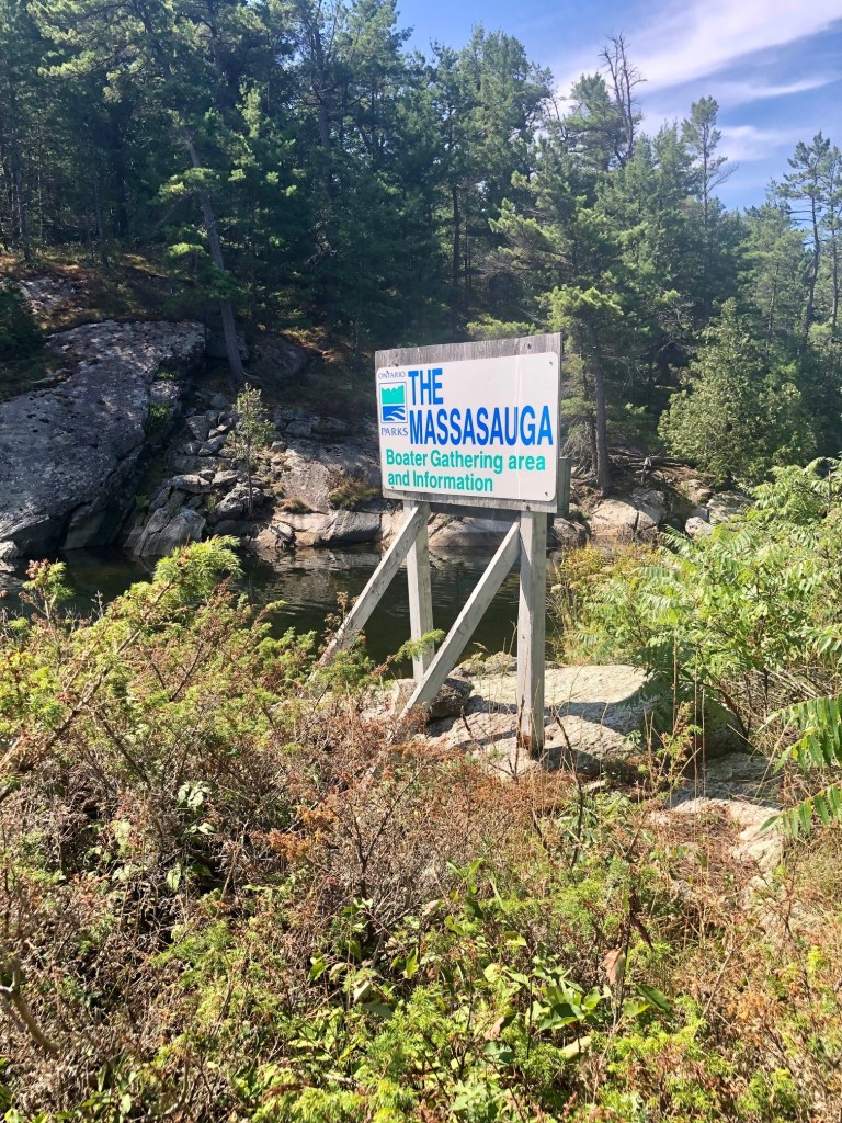
You can see Sunshine in the background, and our dinghy in the foreground. We were the only boat anchored in Three Fingers. We took the dinghy to walk around Massasauga Provincial Park.
You may just be looking for the perfect fishing hole or a prize-winning photo location. For some, the goal is to find a spot without worrying about other people around – to sunbath, star gaze and watch loons go by.
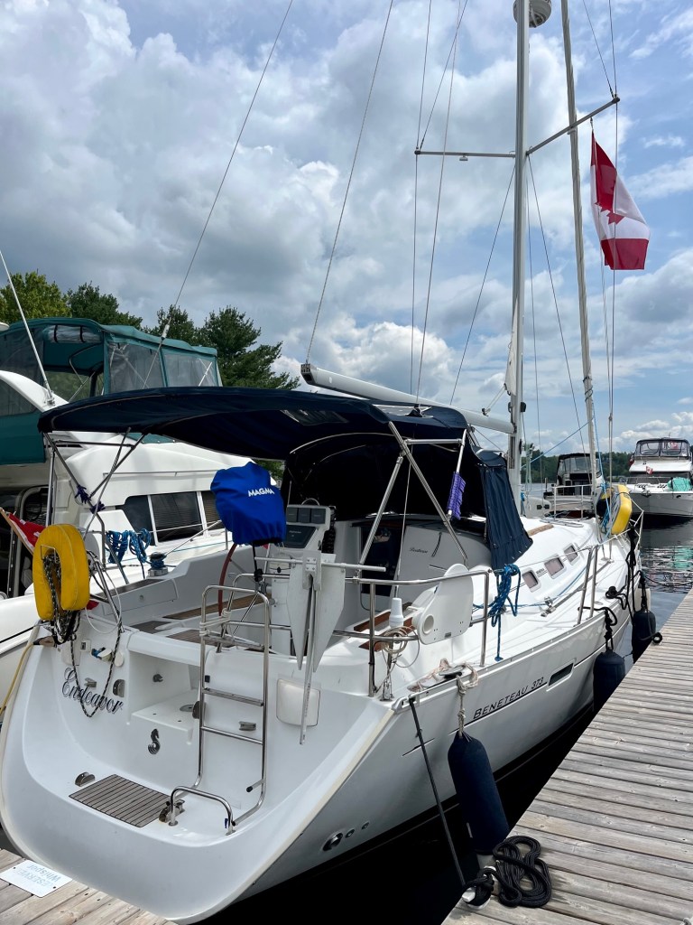
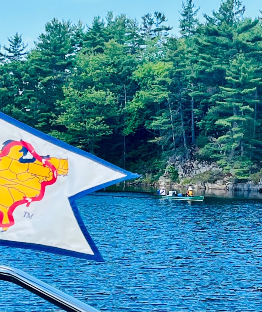
Anchored in Alexander Passage by this sailboat – 33′ Benetau belonging to Catherine and Brian
We met two sail boaters yesterday – Brian and Catherine – anchored in Alexander Passage with us. They told us “if you travel Georgian Bay, expect to hit a rock!” This is what deters many boaters from truly exploring these waters – from gunkholing. But it doesn’t deter Captain Pat. He follows the charts and the marked buoys, and so far we’ve not hit any rocks! He has had some white knuckles though.
Here are ‘gunkholing secrets’ listed in the Cruising Guide. Captain Pat followed these guidelines, long before reading this article!
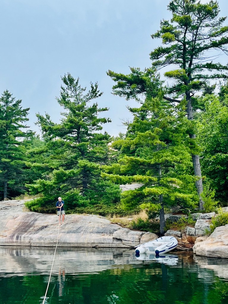
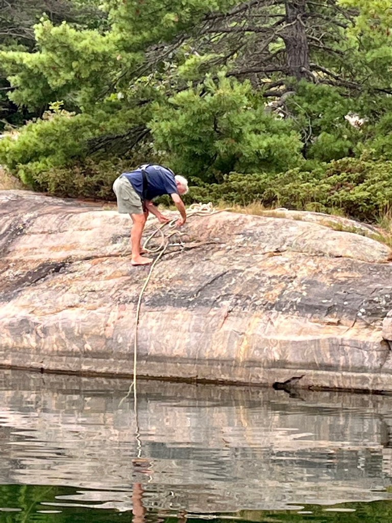
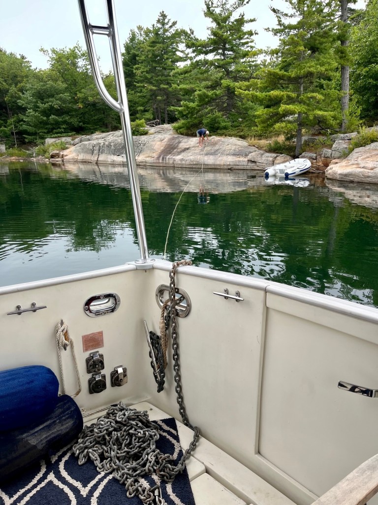
Ask yourself if you’re ok with getting creative with anchoring. Many anchorages have tie-up hooks on the rocks by the island shore. This means a trip in your dinghy (or just swim) to shore to secure your anchorage.
Captain Pat in the dinghy, taking anchor line over to the rock to securePulling the line inSecuring the anchor to the hook in the rockHere you can see how far the rock anchorage is from Sunshine
A perfect anchorage offers protection from all winds; but if you have chosen a spot exposed in one or more directions, are you confident your anchor will hold if the wind blows up? North winds are usually strong, the prevailing winds are from the west and winds from the south and east are not very common (until the night you’ve taken a chance and anchored in a bay that offers little protection from the south or east.)
Do you like the security of having a clean exit so you can leave if the weather deteriorates, or can you handle waiting out bad weather for a few days? We found that as we are now not following a rigid travel schedule, we can better adjust for the weather and other contingencies.
If your crew needs to go ashore (think of your pooch) stay away from private land. Look for national park land (tinted brown), picnic areas indicated with a picnic table symbol), or the boundaries of provincial parks in the area. Farther north much of the land belongs to native bands and, although usually undeveloped, this land is private and the boundaries of the reserves are marked on charts. Some native bands don’t mind respectful use of shore. Others prefer that visitors do not trespass.
Plan your entrance – and your exit. Charts will show you how to access your chosen bay. Check to see if there is a clean route with landmarks along the way. Plot a course with the best information on hand – make note of compass courses, depths, distances, landmarks, rocks and other obstructions.
Some bays have too many rocks in front of them to make it worthwhile negotiating the obstacles to reach the anchorage. For example, between Bad River and Beaverstone Bay, rocks are scattered for a mile or two offshore, making the approach so hazardous that only the most experienced and determined gunkholers will want to attempt it.
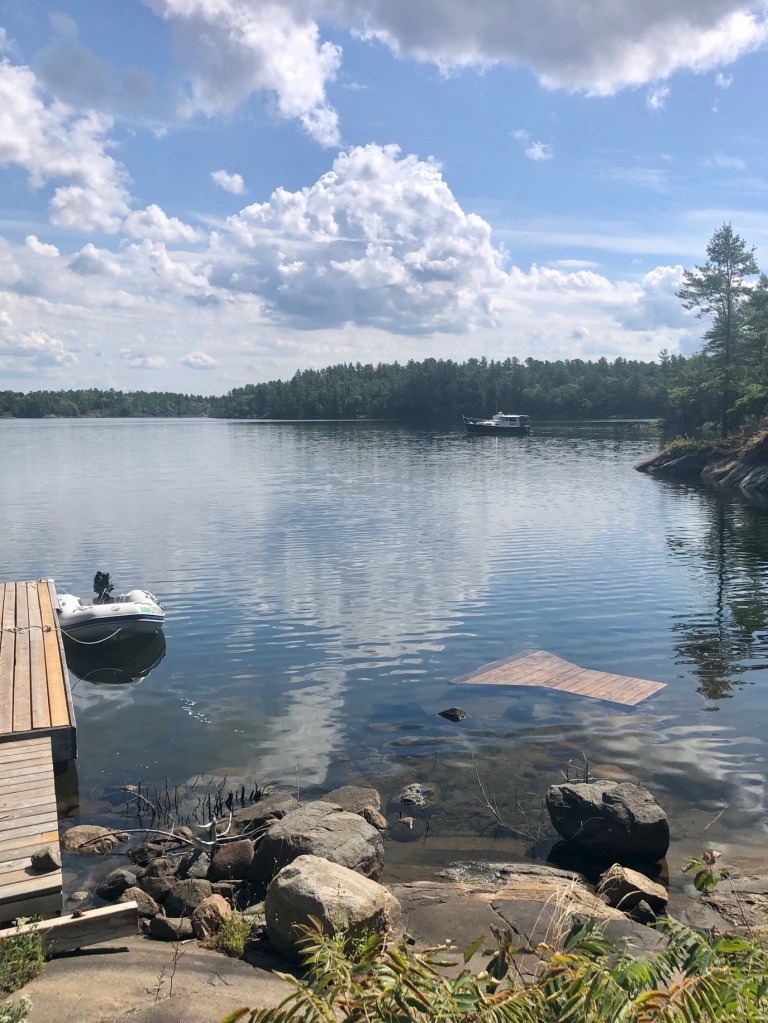
Here are photos from our first four days of gunkholing – August 14 – August 17. We anchored the first night in Indian Harbor, and the next three in Three Fingers.
Indian Harbor – our view from SunshineCaptain Pat put a chair in the dinghy for the AdmiralBridge we passed on Sloans IslandLook close you will see a cairn by the Canadian flagClose up of the cairn. We see cairns on Rattlesnake Island – Julie Caouette is an expert at building them!A couple of canoers n Indian HarborLook what we found at the campground in Massasauga Park!Pat in campground at Massasauga ParkMuskoka Island LighthousePaddleboater in Three FingersCaptain Pat catching up after cruisingThe island homes we viewed were amazing.Stuck out on an island
We just finished our first week cruising in Georgian Bay!
A week ago we left Penetanguishene and started our cruise through Georgian Bay. We anchored out the first night in Indian Harbor. There was more boat traffic then we anticipated. So the next two nights we anchored in Three Fingers cove. This was beautiful! We were the ONLY boat in the cove.
We did see a few dinghys, canoes, and paddle boaters, but for the most part we were secluded. It was so incredibly quiet! One morning we were startled to hear a lone loon. If you’ve never heard a loon – you are missing out.
We hear the loons on Lake Winnipesaukee as well. You can hear them on this video.
The sound of loons
Thursday through today we stayed in Parry Sound at Big Sound Marina. We loved the town and the marina. Our next blog will feature photos of this first week exploring Georgian Bay.
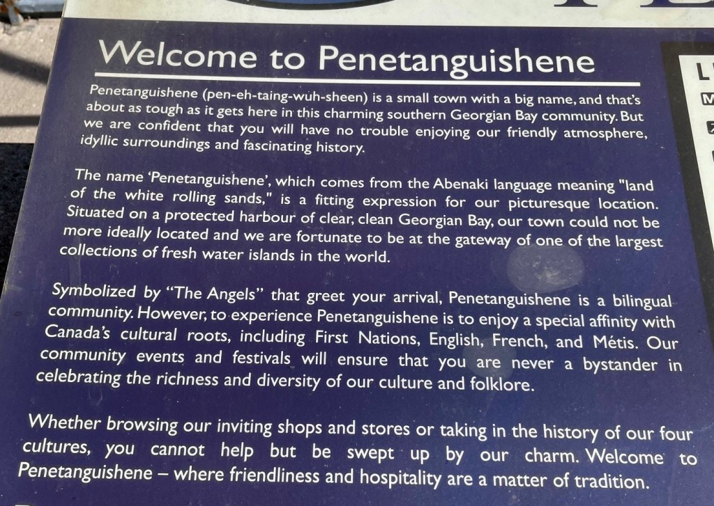
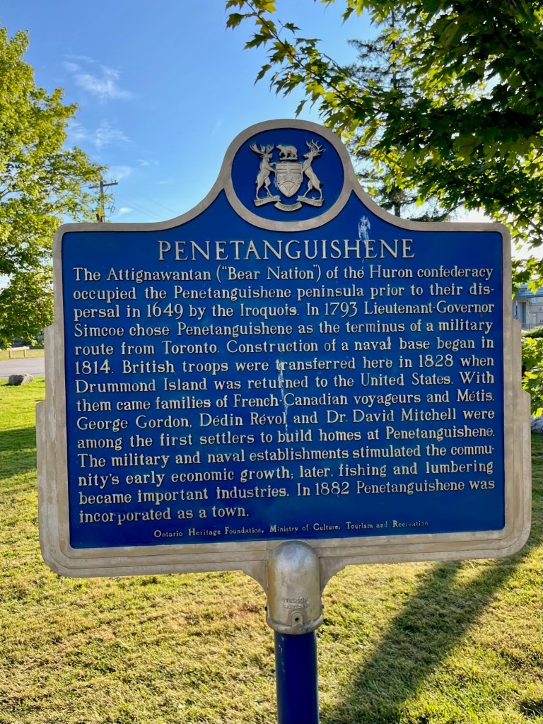
To catch up, here are final memories of our wonderful stay in Penetanguishene. We look forward to returning there in late September to put Sunshine to sleep for the winter.
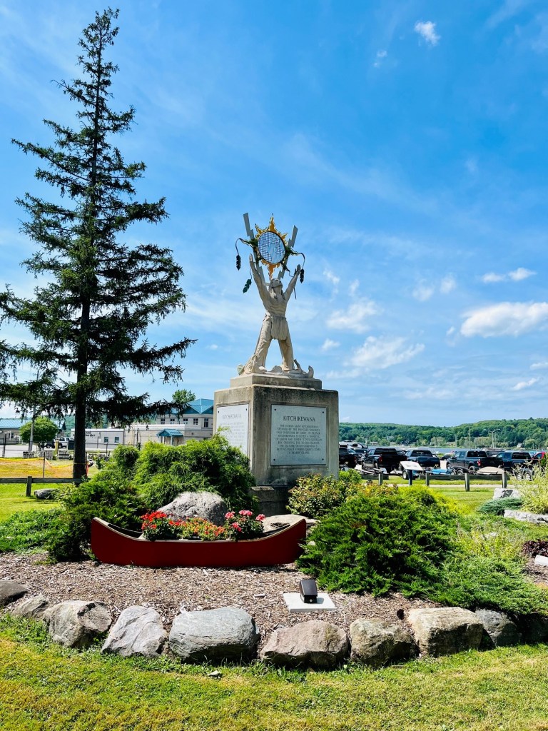
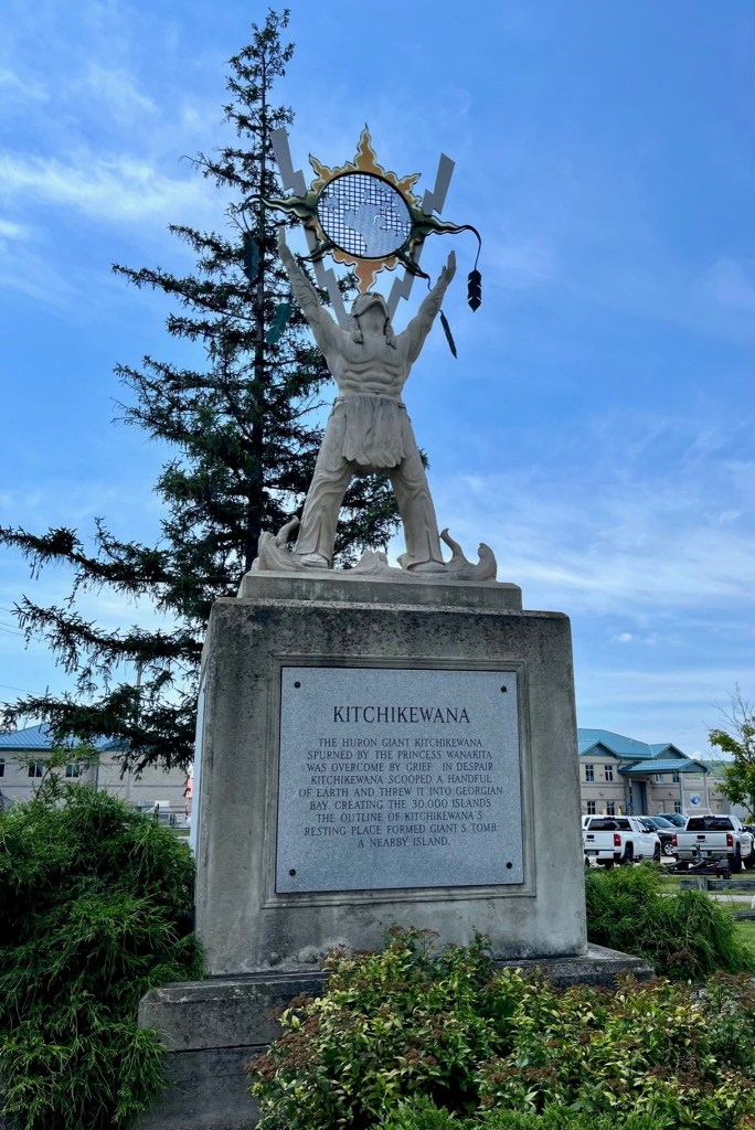
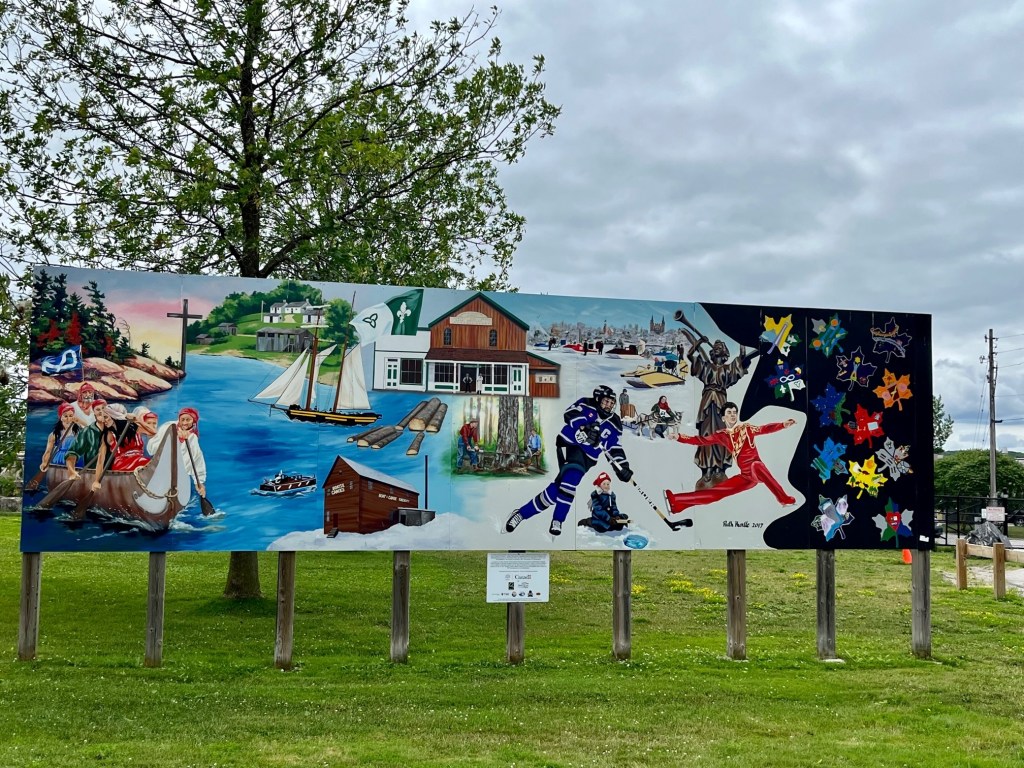
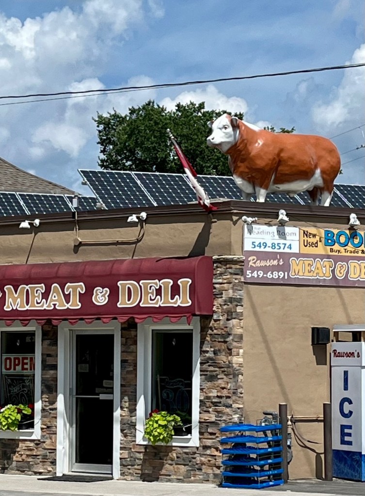
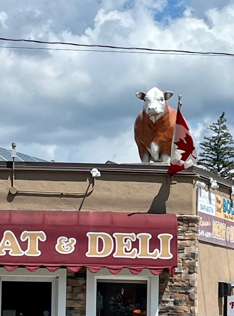
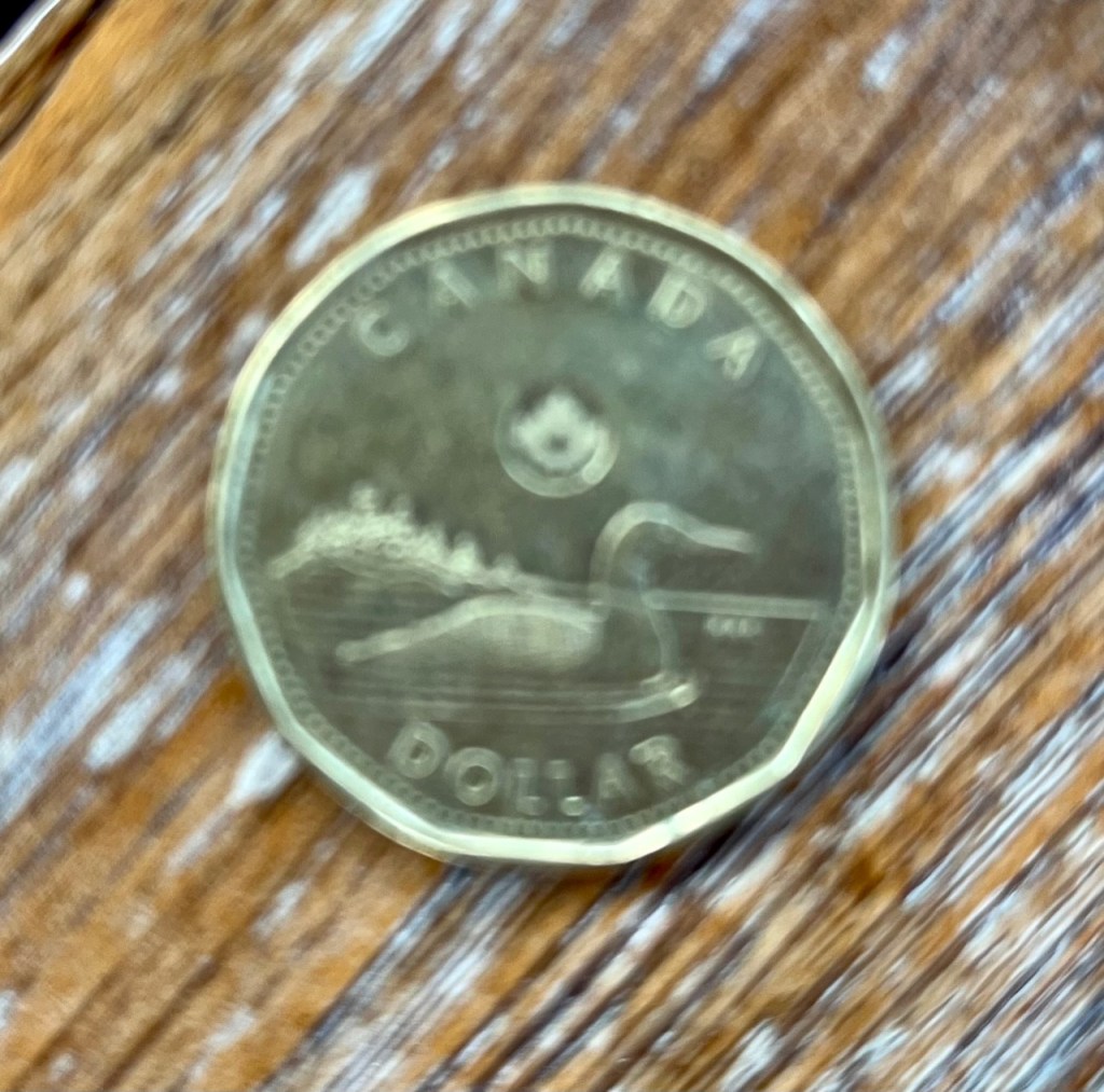
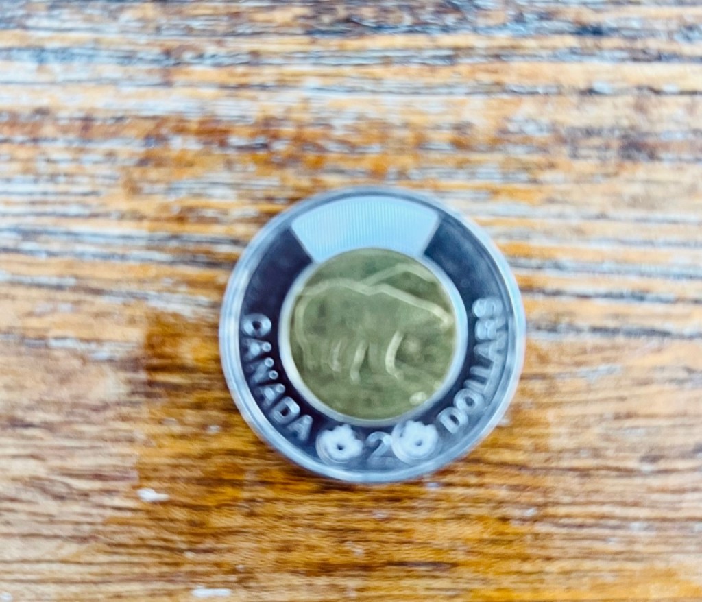
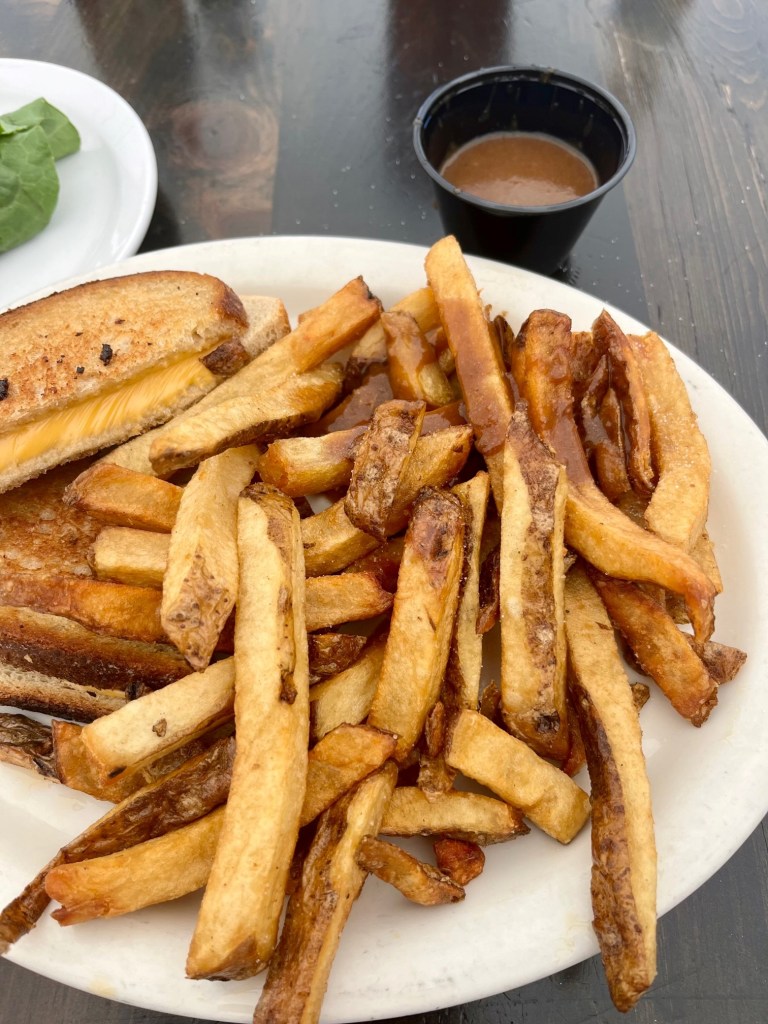
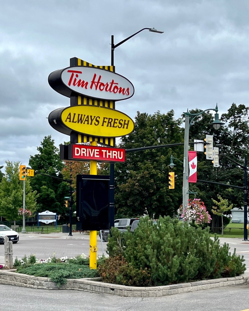
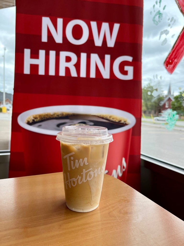
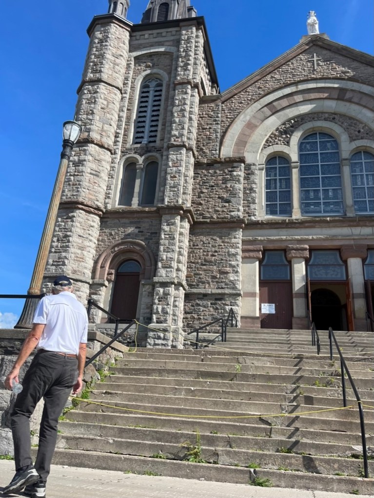
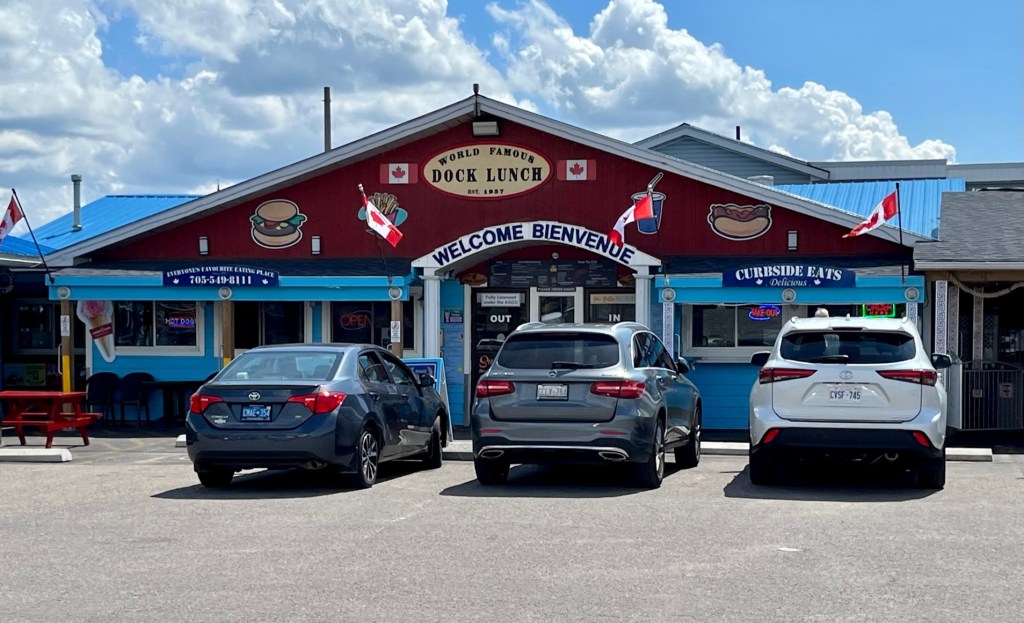
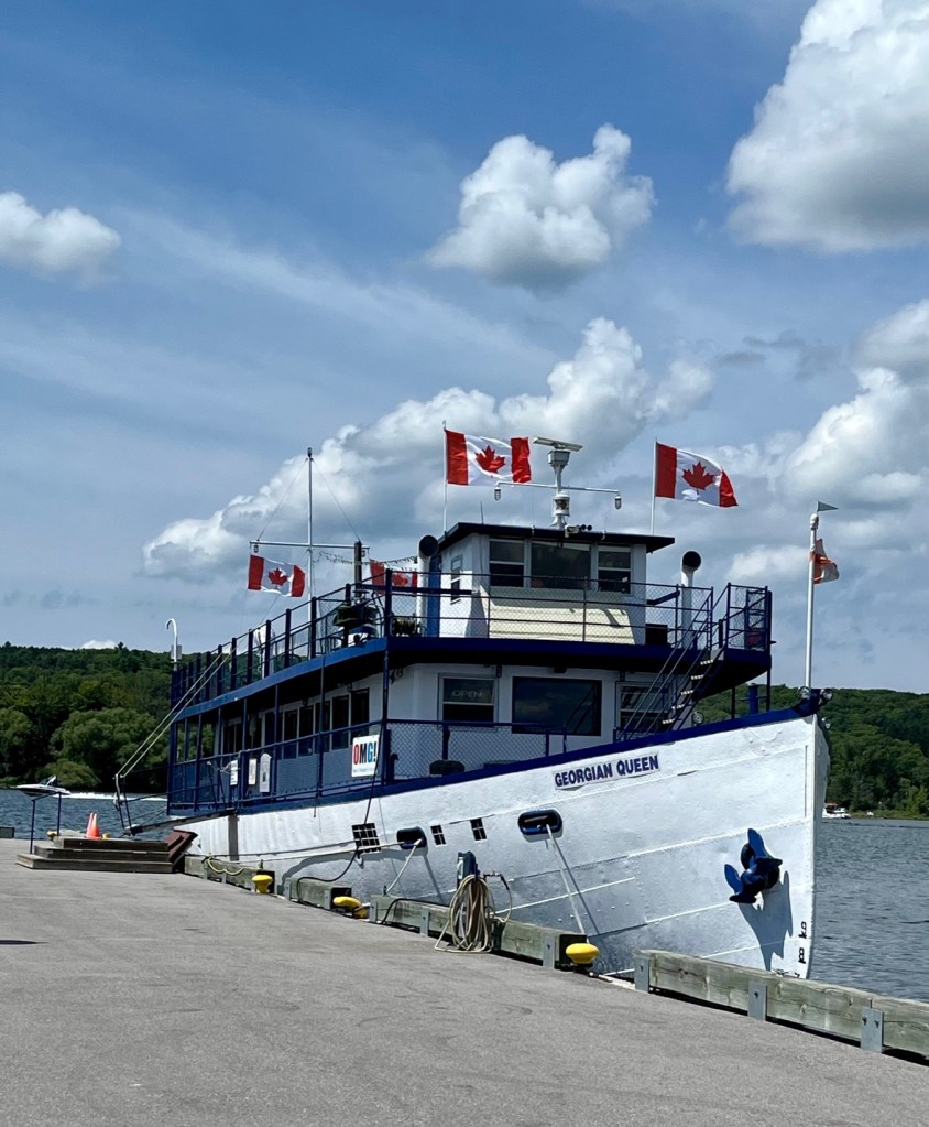
Tribute to Kitchikewana Just outside the town docks is this tribute to Kitchikewana. As the inscription reads, this Huron giant was spurned by Princess Wanakita. Overcome by grief, Kitchikewana scooped a handful of earth and threw it into Georgian Bay, creating the 30,000 islands. The outline of Kitchikewana’s resting place formed “Giant’s Tomb,” a nearby island.A city mural depicting all things CanadianHistory of PenetanguisheneSo thought of my Mom when I saw this cow atop a meat and deli.Another trip to the laundromatWe met the cutest single Dad, doing his laundry before meeting his two kids for a ball game. He helped me navigate the coin machine and decipher what a “loonie” and “toonie” are.A “loonie” is one Canadian dollar. It has a loon on it – hence the name.A toonie is a Canadian Two Dollar coin – hence the name “toonie.”You have to try the french fries with gravy. Delicious! Ketchup, take a back seat.Tim Horton’s are in every town I finally broke down and bought one, As good as Dunkin Donuts!Another tribute to the Indians. This mural is behind a store selling moccasins, totem poles and other Indian memorabilia. I always like to include a photo of the fire houses in towns – special thanks to the firemen who serve.Pat outside of St. Ann’s Church. They are raising money to repair the concrete stairs, which are inoperable now.Inside St. Ann’s Catholic Church.This is the first restaurant we dined in at Penetanguishene – called Dock Lunch. Located at the town docks, it is very well known and busy.The Georgian Queen – tour boat that cruises the bay. I never saw it from our marina, but was told it does venture by there.Approaching the harbor of Penetanguishene. See you in late September!
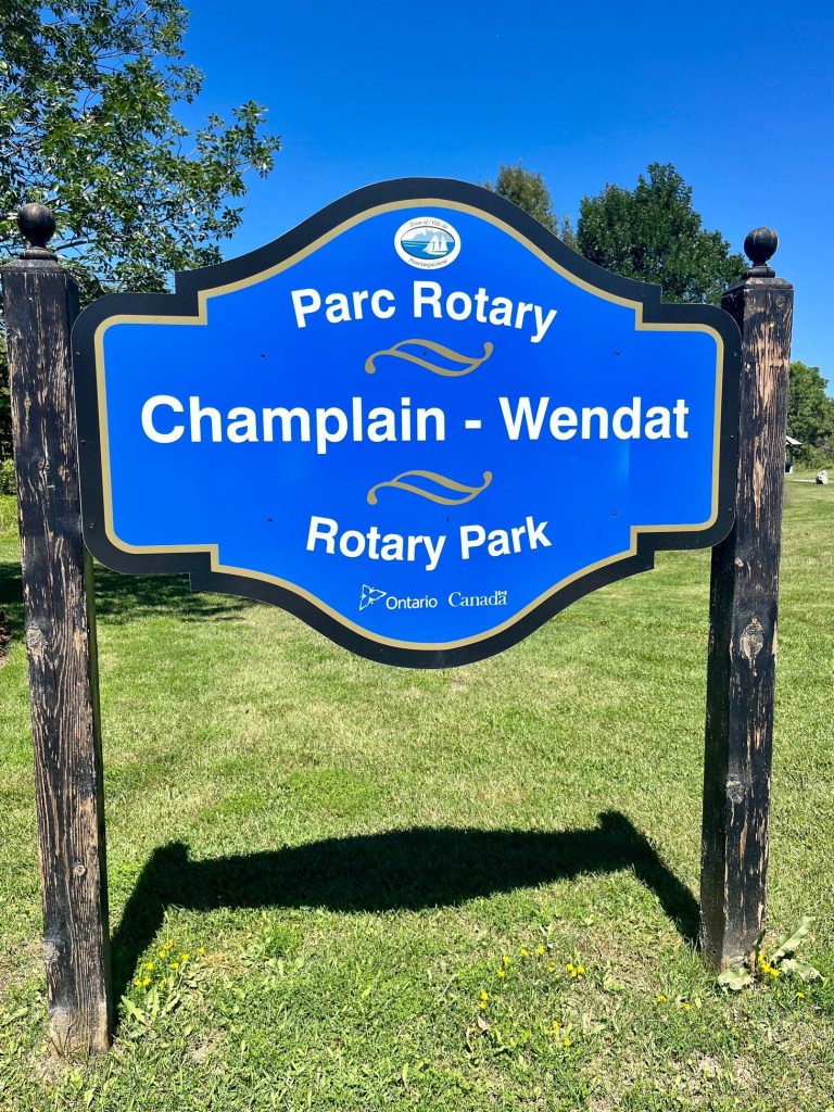
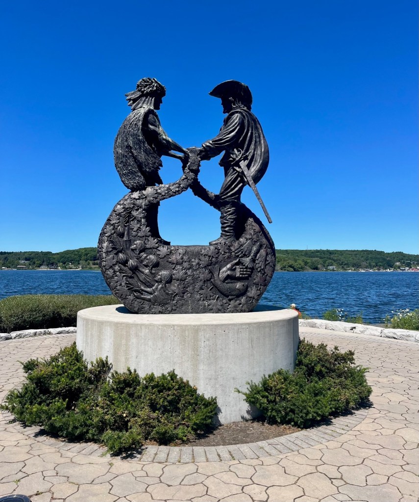
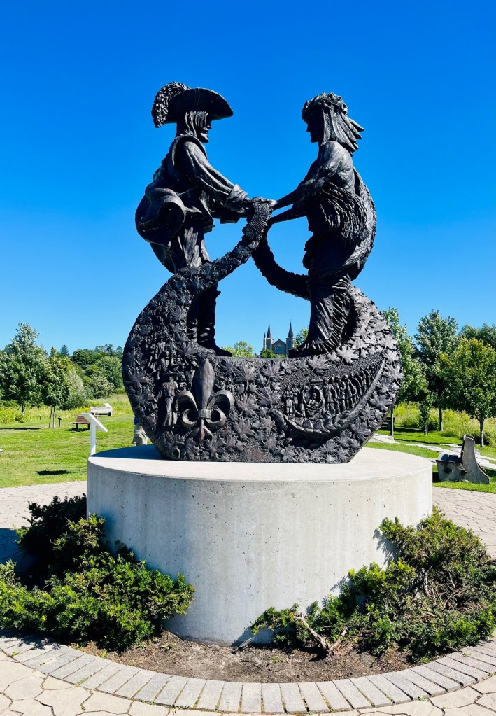
Walking in the Champlain-Wendat Rotary ParkCaptain Pat in front of “The Meeting” Statue
Many have asked, how do you pronounce “Penetanguishene?” It is “pen e TANG wish een.” Big name for a little city! It’s often simply referred to as Penetang.
A favorite of our visit to Penetang was this walking/bike trail just steps from the downtown dock – the Champlain-Wendat Rotary Park. As you wind your way through the park, you pass many statues and monuments with explanations of the history and culture of Penetang. Here are some highlights, with explanations taken from the Rotary’s explanations.
“The Meeting” – Huron-Wendat Chief Aenon and Samuel de ChamplainFront View
‘The Meeting’ Statue
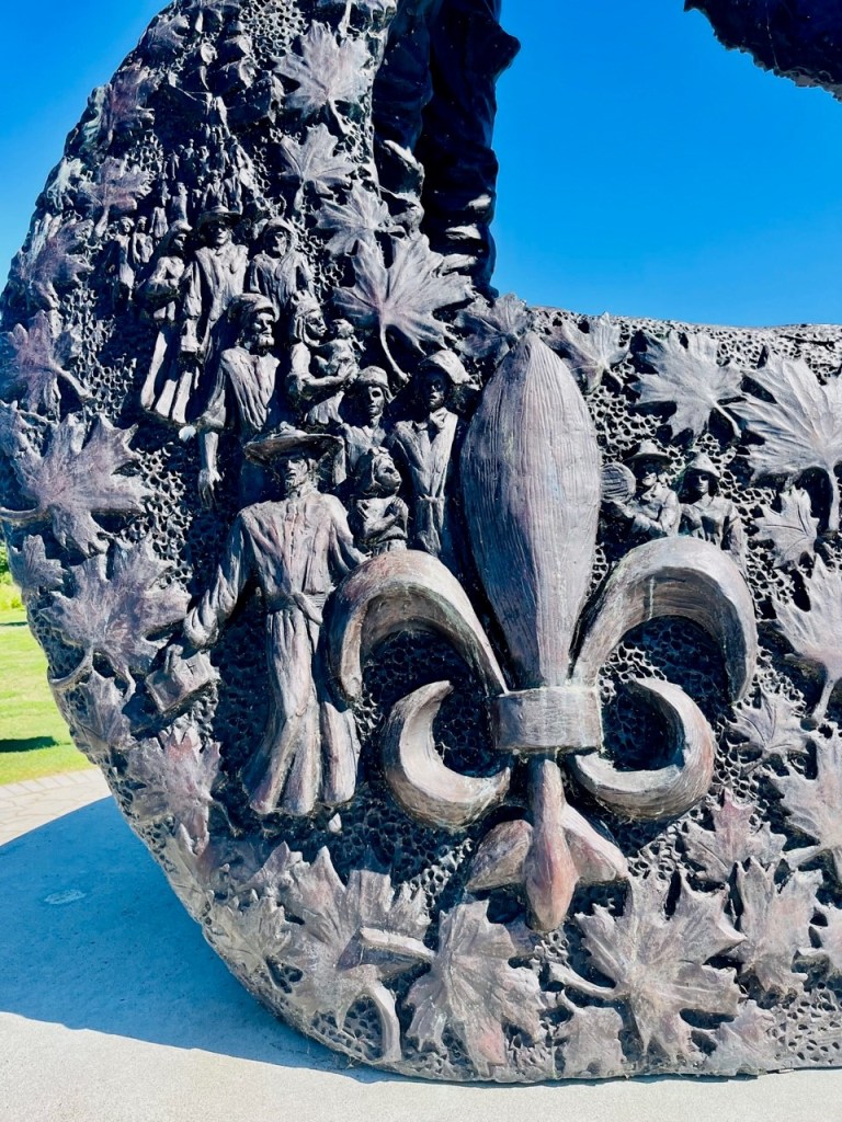
At the end of the path, by the shores of the water, is an exquisite statue, The Meeting, by artist Tim Schmalz. It is amazing, the French and Indian symbolism portrayed by the artist. The Meeting is a celebration of two people, two faiths, and two distinct cultures coming together 400 years ago.
In 1615, Chief Aenon of the Huron Wendat presents the Wampum belt, a symbolic gesture of friendship and alliance to welcome Samuel de Champlain and the French people to their land. On the statue, beneath the two figures, are sculpted symbols from both cultures.
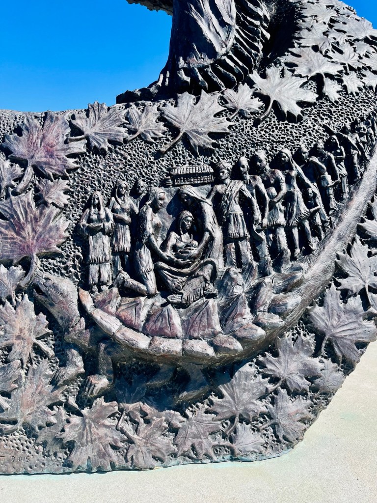
Under the Chief, the artist highlights the belief held by the Huron Wendat that the world is a large turtle. On the turtle live their people.
Close-up of turtle holding the people
Also represented are the Three Sisters, the spiritual providers of what sustains their people – sister corn, sister bean and sister squash.
Sisters holding corn, beans, and squash – Indian food staples
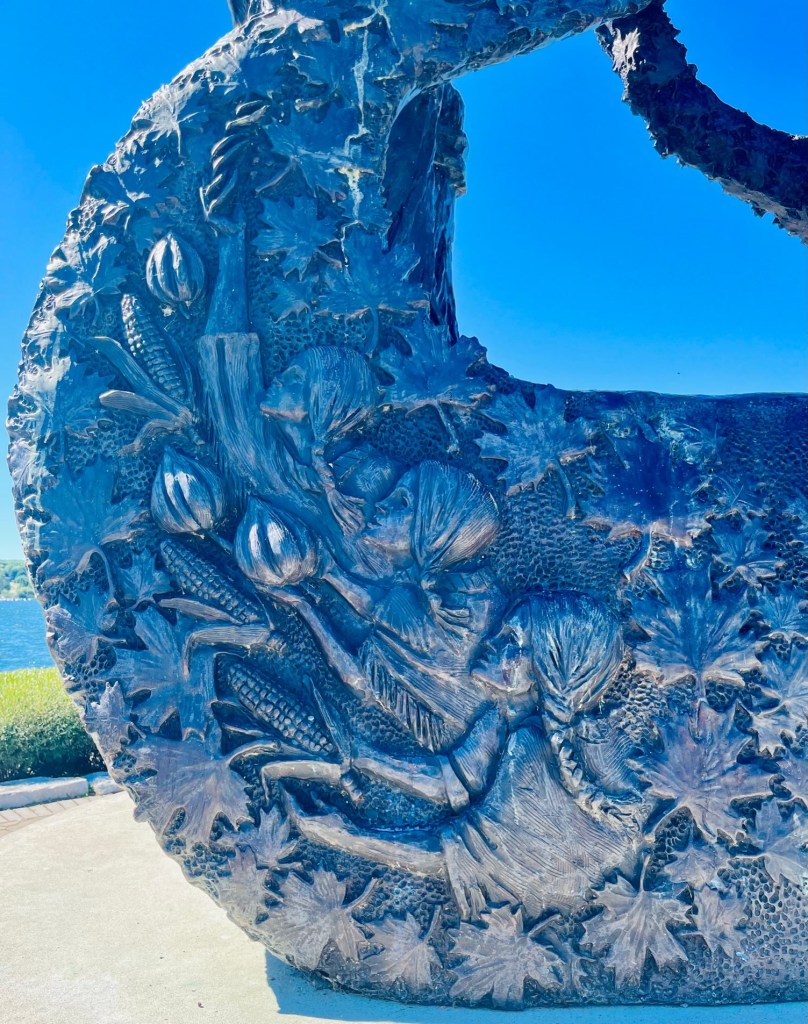
Beneath Champlain is the symbol of the French, emerging from their ship, the ancient symbol of the fleur de lys.
Fleur de Lys – Symbol of the French
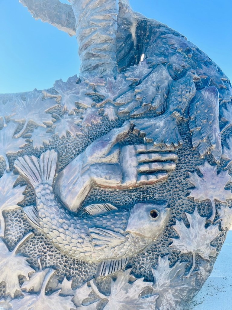
Also you see the Christian symbols of God, represented in three parts – the Father by the hand, the son Jesus by the fish, and the Holy Spirit, the dove.
The Father (Hand), Son (Jesus – the fish) and the Holy Spirit (the dove.)
A ribbon of maple leaves continually flows throughout the sculpture, symbol of our shared nation and the Huron Wendat belief that all meetings never end.
‘The Meeting’ statue is symbolic in itself of the two cultures embracing on the shores of Georgian Bay and their woven history to the area. The artist captured 400 years of history by using 400 leaves throughout the piece.
The Huron-Wendat
In the early 1600’s, the shores of Penetanguishene were the land of the Huron-Wendat Confederacy. The Huron-Wendat were a nation of farmers, hunters, and traders who lived in large communal groups of up to two thousand people in several long houses.
They were a matrilineal society who traced their descent and inheritance through the female line. Girls do rule!
The women were responsible for the majority of the farming which sustained the people as they grew three-quarters of their food. By 1615, the Huron-Wendat had forged a formal trade alliance with the French and befriended Champlain. The Huron-Wendat society would undergo profound change as a result of this relationship. Today the Huron Wendat live in Wendlake near Quebec City.
“Bound Together” – Huron-Wendat Canoe
During the time of Champlain’s arrival in this area, a prevalent means of transportation was the birch-bark canoe. These vessels were elegantly suited to their task, easy to repair, and could be adapted to a variety of needs. This led Champlain and other European explorers to adopt the canoe for their own travel.
Design of the canoes varied greatly depending on the local materials, purpose of the boat, and skill of the builders. Due to their organic components, no physical examples have survived from that time so exact shapes are not known.
“Bound Together” – created by Jonathan Killing and Mike Bilyk – Lafontaine Ironworks
However, based on sketches and descriptions, this sculpture shows a typical Wendat craft at twice-life-size.
The Metis Nation
Prior to Canada becoming a nation, a new Aboriginal people emerged out of the relations of Native women and European men. The initial offspring of these unions were individuals of mixed ancestry who resulted in the beginning of a new Aboriginal people with a distinct identity and culture in west Central North America – the Metis Nation.
Metis
These Metis people were connected through the fur trade network, extensive kinship and a collective identity. In Ontario, historic Metis settlements emerged along the rivers and watersheds of the province, surrounding the Great Lakes and throughout to the northwest o the province.
One of these settlements was a vibrant community in Hurogia. In fact, Metis were among the region’s earliest settlers to Penetanguishene with the Drummond Island Migration of 1828 – 1829.
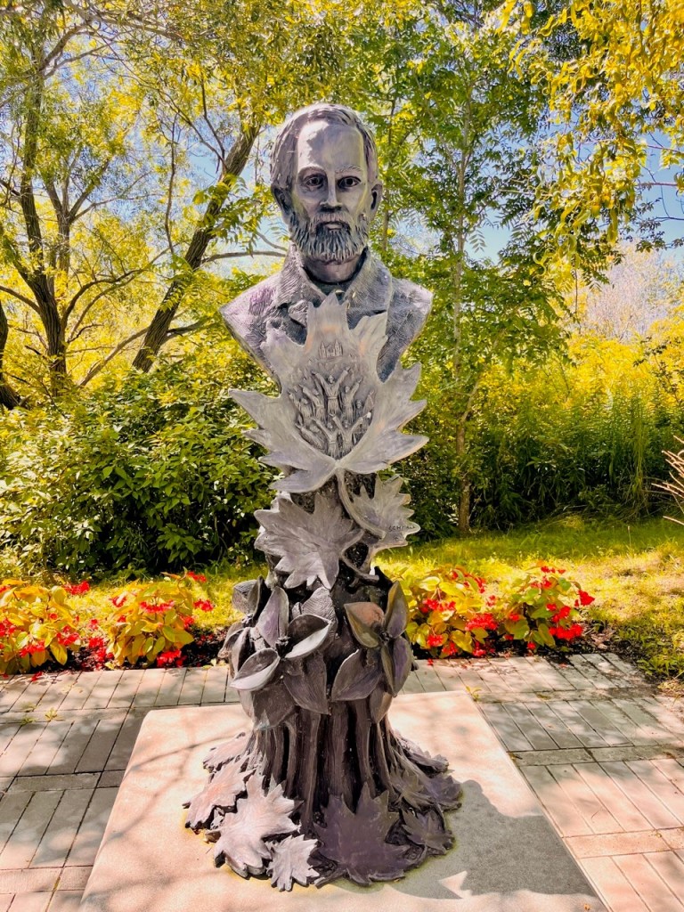
Father Athol Murray
Father Athol Murray, future member of the Order of Canada and Hockey Hall of Fame, came to St. Ann’s Catholic Church in Penetanguishene in 1918, shortly after his ordination.
Father Athol Murray
Father Murray was instrumental in the 300 Year Celebrations of the arrival of Samuel de Champlain that took place in 1921 known as the Old Home Week Celebrations, including a massive re-enactment and the erection of the Angels of Good Intentions at the entrance of town.
Father Joseph Le Caron – 1586 – 1632
Father Joseph Le Caron – Pioneer Missionary
Joseph Le Caron is one of four pioneer missionaries of Canada and the second European to land in Huronia. Born in 1586, Le Caron was a Catholic priest who arrived in Huronia in 1615, shortly before Samuel de Champlain, establishing a relationship with the native Huron-Wendat. On August 12,1615, he held the first Catholic mass in Ontario at Carhagouha, located near the village of Lafontaine in Penetanguishene area.
Father Theophilus Francois Laboureau – 1837-1904
Father Laboureau was born in 1837 in France and was appointed to St. Ann’s Catholic Church in Penetanguishene in 1873. He felt that his small church should be replaced with a fitting memorial church to commemorate the deeds of Canada’s heroic missionaries and deep history of Penetanguishene. For the next few years, Father Laboureau travelled throughout Europe securing funds to build St. Ann’s Church. In 1886, the cornerstone was laid, and the “Cathedral of the North” was completed in 1902.
Father Laboureau
John Graves Simco (1752 – 1806)
John Graves Simco– British military officer and first Lieutenant Governor of Upper Canada (1791 – 1796)
With vision and enthusiasm, Simco set about developing the new world wilderness London sent him to oversee. Simco established York (Toronto) as the capital of Upper Canada, and deeply influenced the early society, roads, laws and governance of Ontario.
In 1793, he foresaw Penetanguishene’s strategic value as a naval base. In fact, the Penetanguishene Naval Establishment later proved to be a key development in the Town’s history.
Sculpted in clay and cast in bronze, this monument was created by Canadian sculptor Tyler Fauvelle, an artist inspired by Canada’s natural and cultural heritage. He invites you to look through the telescope! (There is a kaleidoscope there.)
“You Are Here” – Champlain’s Astrolabe
Replica of Astrolabe – Created by Jonathan Killing and Mike Bilyk – Lafontaine Ironworks
A mariner’s astrolabe was a navigation tool used by explorers to determine latitude. The device was held by the top ring and known celestial objects were sighted through the openings on the arm. Longitude was more complicated to compute and often was based only on estimates of speed and time travelled.
This sculpture is a representation of a mariner’s astrolabe found in 1867 near Cobden, Ontario. The sights on the arm are aligned with Polaris, the “North Star,” which means the latitude can be read directly by the angle of the arm. This is the tool that Champlain used on his voyages to navigate his travels.
This statue is symbol of Champlain’s exploration and discovery of Georgian Bay and Penetanguishene Bay in 1615.
Bikers stop to read about the “Astrolabe”
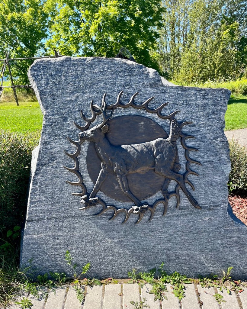
Huron-Wendat – Circle of Nations – by Artist Tyler Fauvelle
The core members of the Huron-Wendat confederacy were: Attignawantan (people of the bear), Attigneenongnahac (people of the cord), Arendahronon (people of the rock), and Tahontaenrat (people of the deer.) The Bear and the Cord nations were the largest and oldest of the confederacy, forming their alliance in the 15th century. An Iroquoian-speaking people, the Huron-Wendat farmed the land, growing mainly corn, beans, and squash. They fished using nets and weirs, and their most important game was deer. In the mid-17th century, with their population decimated by epidemics and war, they were dispersed by the Haudenosaunee (Iroquois), and most merged with other nations. In Canada, members of the Huron-Wendat First Nation live in Quebec. Others, who became the Wyandot, live in the United States.
Sculpted in clay, cast in bronze, and mounted on local granite, the Bear, Cord, Deer and Rock reliefs were created by Tyler Fauvelle, a Canadian sculptor inspired by Canada’s natural and cultural heritage. The reliefs are arranged in a circle, an important cultural symbol. The circle resembles the shape of the earth, the sun and the moon, and many cycles in the natural world. The number four appears in many aboriginal spiritual traditions, and the artist expresses the four elements in the reliefs – wind, water, earth and fire. Elements of the artwork embrace symbols from the Huron-Wendat creation stories – the full moon, the Great Turtle.
Representing People of the BearPeople of the DeerPeople of the RockPeople of the Cord
Also at the Circle of Nations were replicas of tents and tent set-ups.
Replica of Huron Wendat TentCaptain Pat checking out a tent set-up
Here are other highlights from the park:
View of town docks from the park shoreFishing at the park shoreCanadian geese grazing in the park. See St. Ann’s in the background.No matter where, Captain Pat never gets tired of viewing the water.